Yellowstone National Park – 1904 Aerial View
Yellowstone National Park – 1904 Aerial View
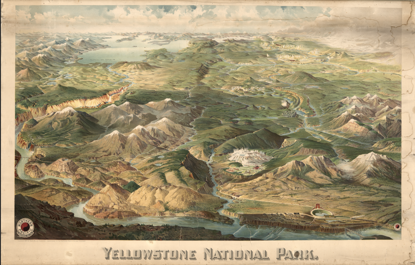
Experience Yellowstone as early 20th-century travelers first imagined it with this spectacular 1904 panoramic view by Henry Wellge. Published in Milwaukee and later associated with the Northern Pacific Railway Company, this richly colored wall map presents the park in sweeping perspective—mountain ranges, geyser basins, rivers, waterfalls, and Yellowstone Lake unfolding in dramatic, almost cinematic detail.
Historical Context Created during a pivotal era of western tourism, this map reflects the growing accessibility of Yellowstone by rail. The Northern Pacific Railway actively promoted the park as a national destination, and views like this helped shape America’s understanding of its first national park. Produced just over three decades after Yellowstone’s establishment in 1872, the image captures both its geological grandeur and its early infrastructure—hotels, roads, and visitor facilities—at the dawn of organized park travel.
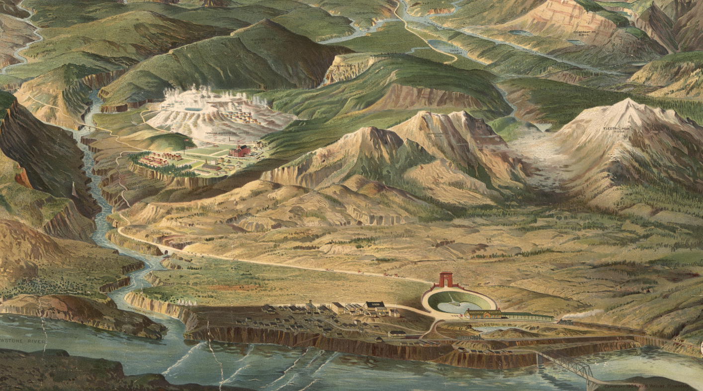
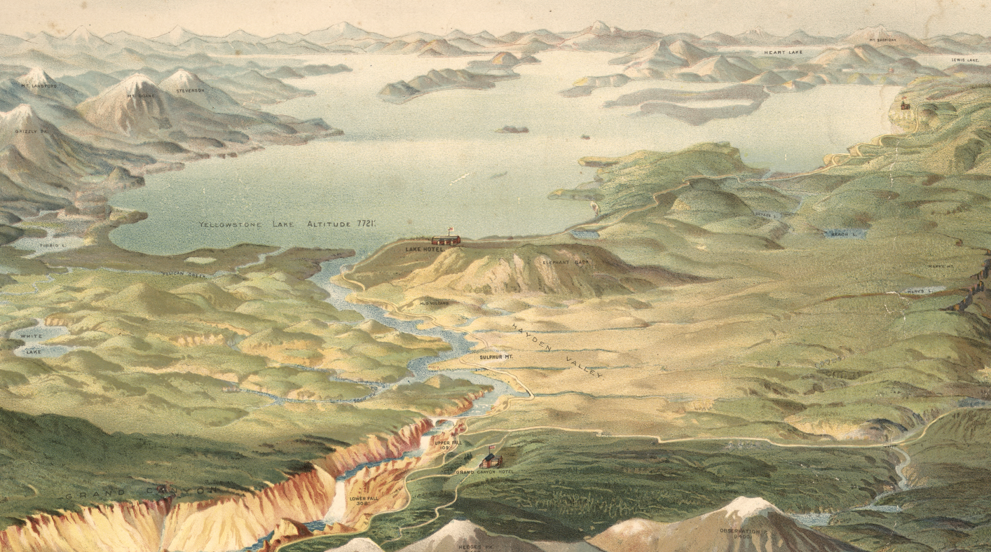
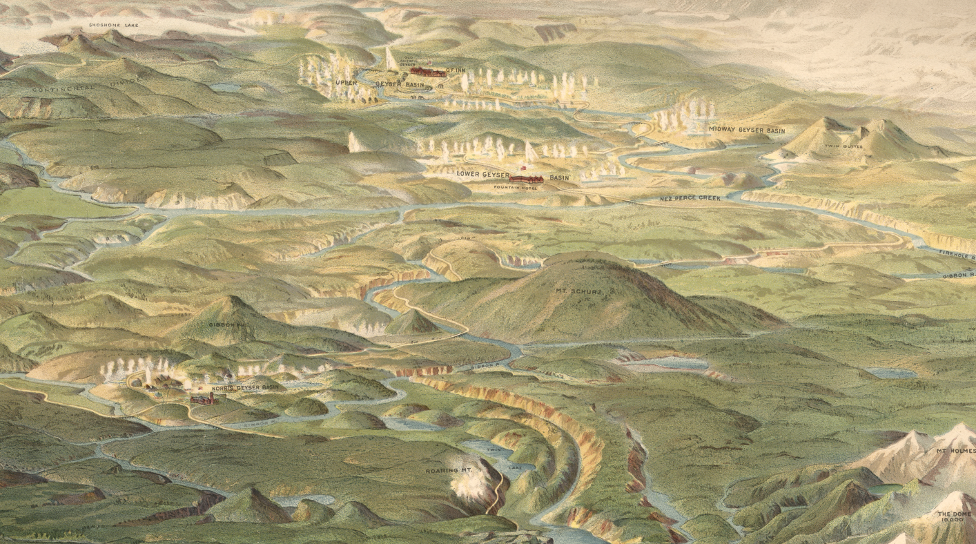
The Map’s Features This vibrant aerial perspective highlights the Grand Canyon of the Yellowstone, Yellowstone Lake stretching across the horizon, eruptive geyser basins rendered in pale mineral tones, winding river systems cutting through dramatic terrain, and early visitor developments that illustrate the park’s transformation into a managed national treasure. Spot heights are included, emphasizing the rugged topography that defines the region. There are minor staining and visible wear, and the original was mounted on cloth with wooden rods for wall display. These subtle blemishes—light toning, faint surface marks, and signs of handling—reflect its life as a functional wall map rather than a purely archival object. Rather than detracting, these authentic traces of age enhance its historic character, giving the reproduction the warmth and lived-in presence of an original turn-of-the-century display piece.
Historical Significance This map represents the golden age of railroad-sponsored American tourism. It stands at the intersection of art, cartography, and marketing—an iconic visualization of Yellowstone that helped define the public’s early mental image of the American West.
Museum-Quality Reproduction This is a high-quality reproduction of the original 1904 wall map, professionally printed on archival Hahnemühle paper using the Giclée printing process to preserve color gradation, painterly detail, and fine linework for long-term display.
Perfect For:
• National park enthusiasts
• Collectors of early 20th-century panoramic maps
• Western history and railroad history collectors
• Offices, lodges, and study spaces
• Gifts for travelers and outdoor adventurers
Specifications:
• Created/Published: 1904
• Creator: Henry Wellge
• Publisher: Henry Wellge, Milwaukee (Transferred to Northern Pacific Railway Company)
• Style: Panoramic aerial view
• Product Type: High-Quality Reproduction Print
Dimensions (Width x Height): 27.9 x 17.8
Each map is printed using the finest materials and methods. Your map will be handled with white gloves from start to finish. We use the Giclée printing method on Hahnemühle paper, which produces a clear, extremely detailed, durable map perfect for proud display in your home or office.
Choose options
