Yellowstone National Park – 1878 Preliminary Geological Map
Yellowstone National Park – 1878 Preliminary Geological Map
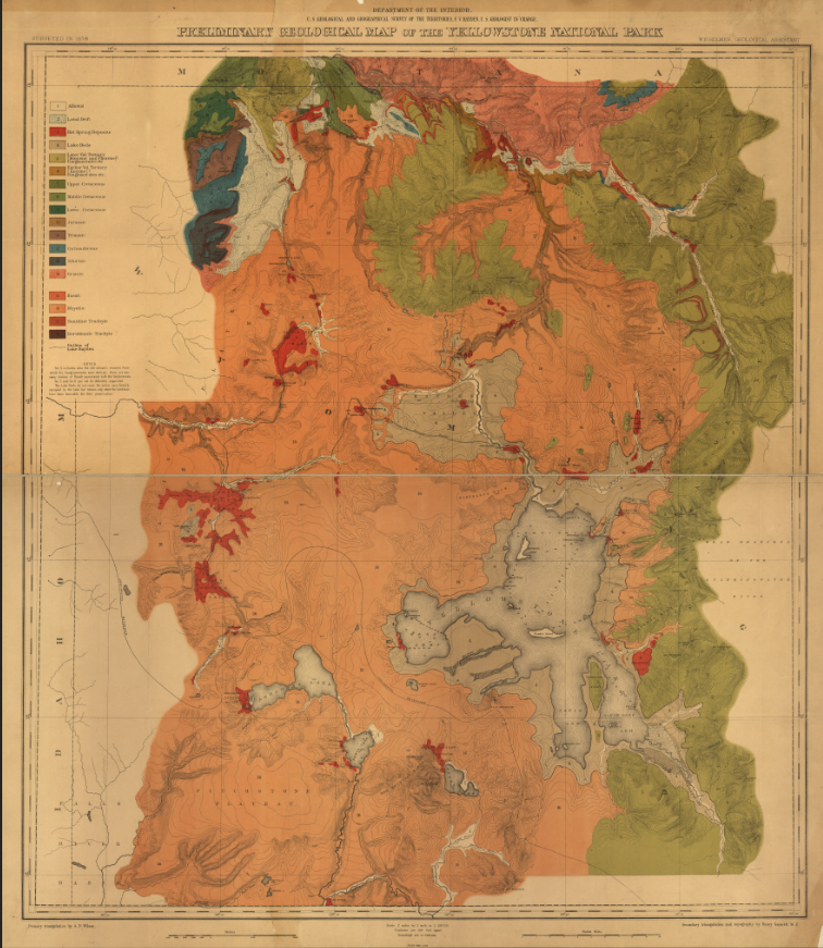
Explore one of the earliest scientific maps of America’s first national park with this 1878 Preliminary Geological Map of the Yellowstone National Park. Produced by the U.S. Geological and Geographical Survey of the Territories under the direction of Ferdinand V. Hayden, this landmark map documents the geological foundations of Yellowstone just six years after the park’s establishment in 1872. Richly color-coded to distinguish volcanic formations, sedimentary layers, and geothermal regions, the map reflects the scientific ambition that helped define Yellowstone as a national treasure.
Historical Context
Ferdinand V. Hayden’s surveys of the early 1870s played a decisive role in persuading Congress to designate Yellowstone as the world’s first national park. By 1878, federal scientists were systematically mapping the park’s geology—cataloging geyser basins, lava flows, mountain formations, and hydrothermal regions. This map captures Yellowstone not as a tourist destination, but as a frontier of American scientific discovery, when understanding its volcanic origins and geothermal features was a national priority.
The Map’s Features
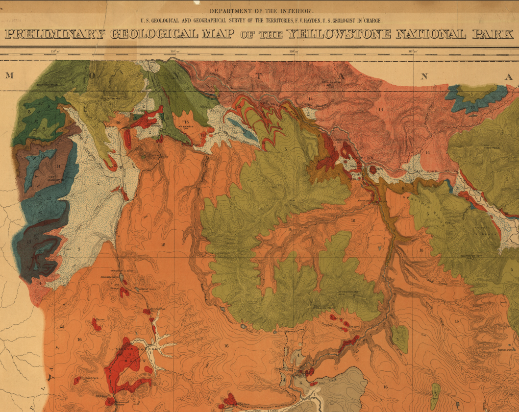
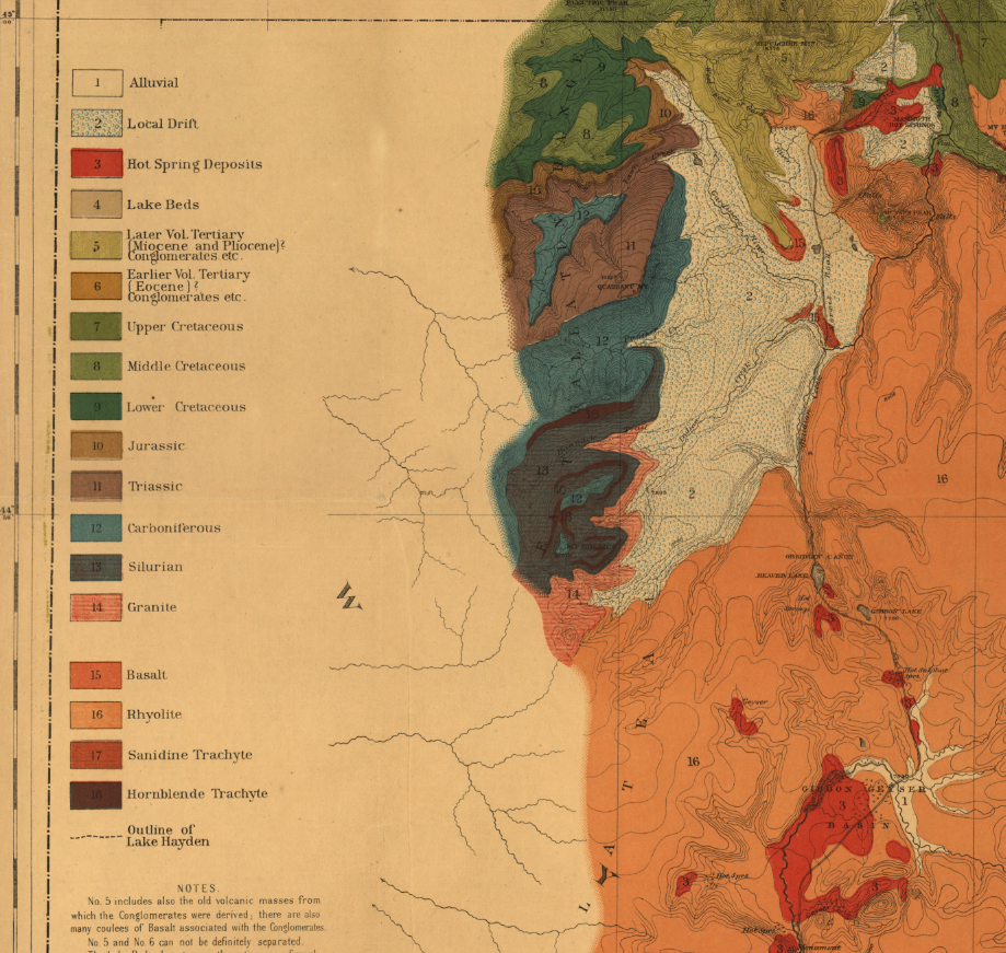
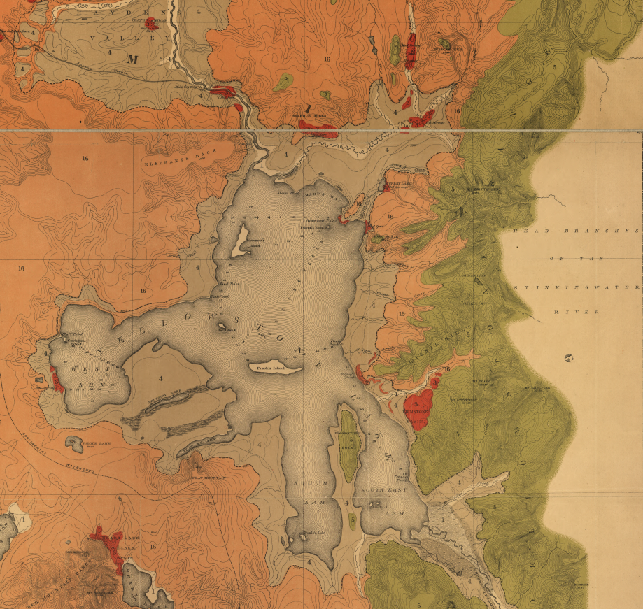
This detailed geological map presents Yellowstone in carefully differentiated color fields representing distinct rock types and formations. Mountain ranges, calderas, geyser basins, and major waterways—including Yellowstone Lake—are clearly rendered. The structured legend reflects late-19th-century scientific cartography, while the bold color contrasts highlight the volcanic nature of the landscape that makes the park unique.
Historical Significance
As one of the earliest federal geological maps of Yellowstone, this 1878 survey represents a foundational moment in American conservation and earth science. It documents the scientific work that followed the park’s creation and underscores the role of geological research in shaping public understanding of Yellowstone’s extraordinary terrain.
Museum-Quality Reproduction
This is a high-quality reproduction of the original 1878 geological survey map, professionally printed on archival Hahnemühle paper using the Giclée printing process to preserve color integrity, fine contour lines, and period detail for long-term display.
Perfect For:
• National park enthusiasts and Yellowstone visitors
• Geology and earth science professionals
• Historians of early American conservation
• Collectors of 19th-century scientific maps
• Offices, libraries, and study spaces
• Gifts celebrating America’s first national park
Specifications:
• Created/Published: 1878
• Publisher: Geological and Geographical Survey of the Territories (U.S.)
• Lead Surveyor: Ferdinand V. Hayden (1829–1887)
• Style: 19th-century scientific geological survey map
• Subject: Geological formations of Yellowstone National Park
• Product Type: High-Quality Reproduction Print
Dimensions (Width x Height): 23.4 x 27.2
Each map is printed using the finest materials and methods. Your map will be handled with white gloves from start to finish. We use the Giclée printing method on Hahnemühle paper, which produces a clear, extremely detailed, durable map perfect for proud display in your home or office.
Choose options
