

Western Front – 1918 Armistice Order of Battle Map
Western Front – 1918 Armistice Order of Battle Map
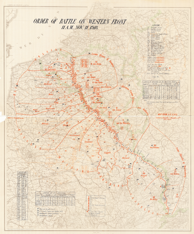
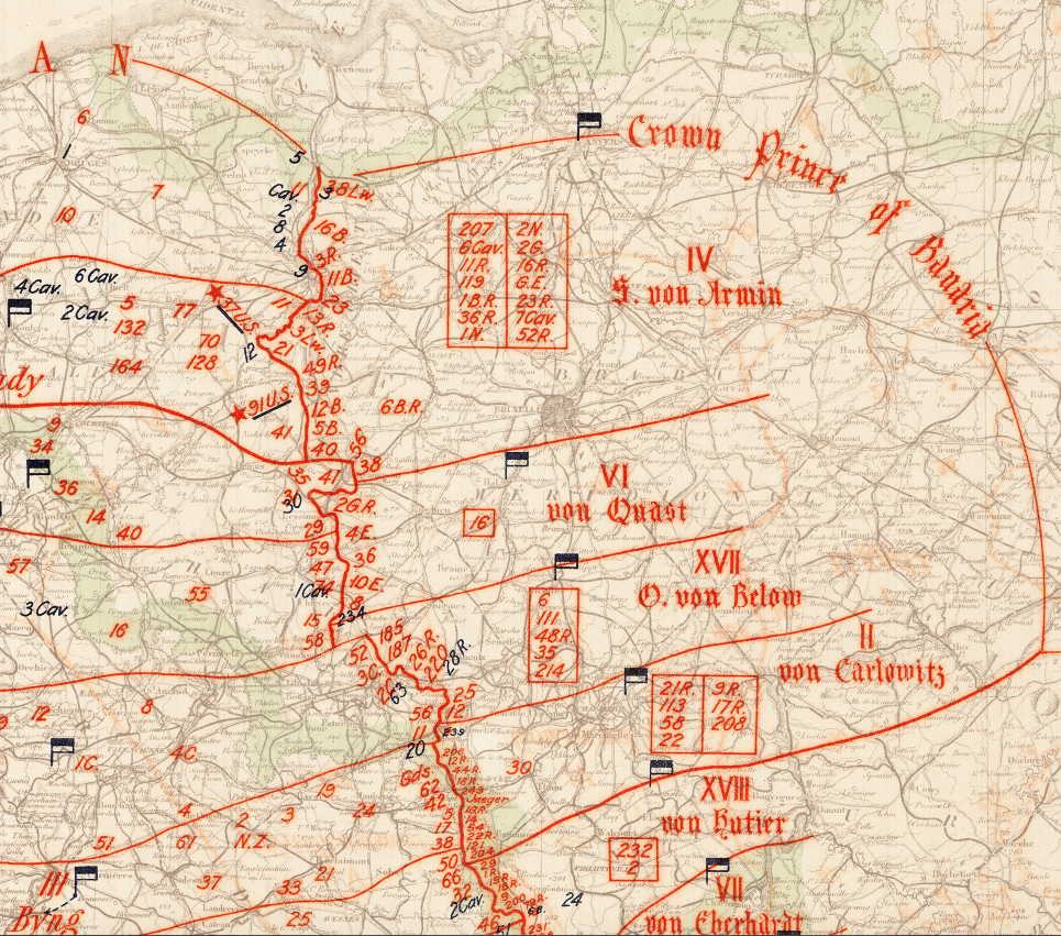
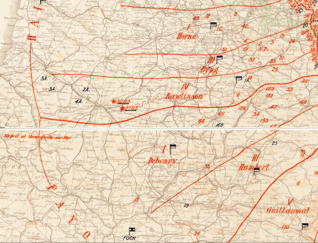
At 11:00 a.m. on November 11, 1918, the guns of the Western Front fell silent after more than four years of continuous warfare. This map captures the entire front at that exact moment — the disposition of every Allied and German formation arrayed from the North Sea to the Vosges as the Armistice took effect. It gives particular attention to the American Expeditionary Forces, annotating all thirty U.S. divisions then in France, whether holding the line or waiting in reserve. For the families of the roughly two million Americans who served in France, it is a record of precisely where their soldiers stood when the war ended.
Historical Context By the autumn of 1918, the German army was in full retreat. The Hundred Days Offensive, launched in August, had broken the Hindenburg Line and driven enemy forces back across ground they had held since 1914. American divisions carried much of the weight on the eastern end of the Allied line, where the Meuse-Argonne Offensive — the largest operation in U.S. Army history — ground forward through late September, October, and into November at a cost of more than 26,000 American dead. When German representatives signed the Armistice in a railway carriage at Compiègne in the early hours of November 11, the terms called for hostilities to cease at 11:00 a.m. This map documents the front as it stood in those final hours, freezing in place a line that had shifted decisively in the Allies' favor.
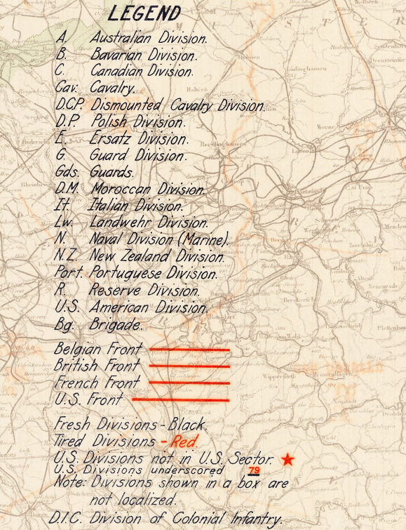
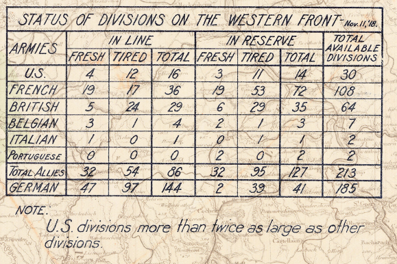
The Map's Features The map presents the full order of battle in a single view, with the front line tracing its final course in red from the Belgian coast southeast through Flanders and Picardy, past the Aisne and the Meuse, and on toward the Vosges. Individual divisions are marked by unit symbol and number, grouped under their parent armies and army groups — Belgian, British, French, and American formations on one side, and the German army groups of the Crown Prince of Bavaria and the German Crown Prince on the other. Tabulated panels record the status of divisions on the Western Front, including a dedicated table accounting for the U.S. divisions along the line and in reserve. A printed legend keys the symbology for infantry, cavalry, and reserve formations and the conventions distinguishing front-line units from those held to the rear. The concentration of American strength appears on the eastern flank toward the Pershing–Castelnau boundary, in the Meuse-Argonne region where the AEF ended the war.
Historical Significance The Armistice of November 11, 1918 ended the First World War on the Western Front and closed the bloodiest chapter of the industrial age to that point. For the United States, the war marked its emergence as a decisive military power; the divisions annotated here represent an army that had grown from a small professional force into a continental fighting formation in the space of a year and a half. Compiled in 1923, this order of battle preserves the precise arrangement of forces at the moment the fighting stopped — a reference record of who stood where when the war ended. It remains one of the clearest single-sheet accounts of the American contribution to the Allied victory.
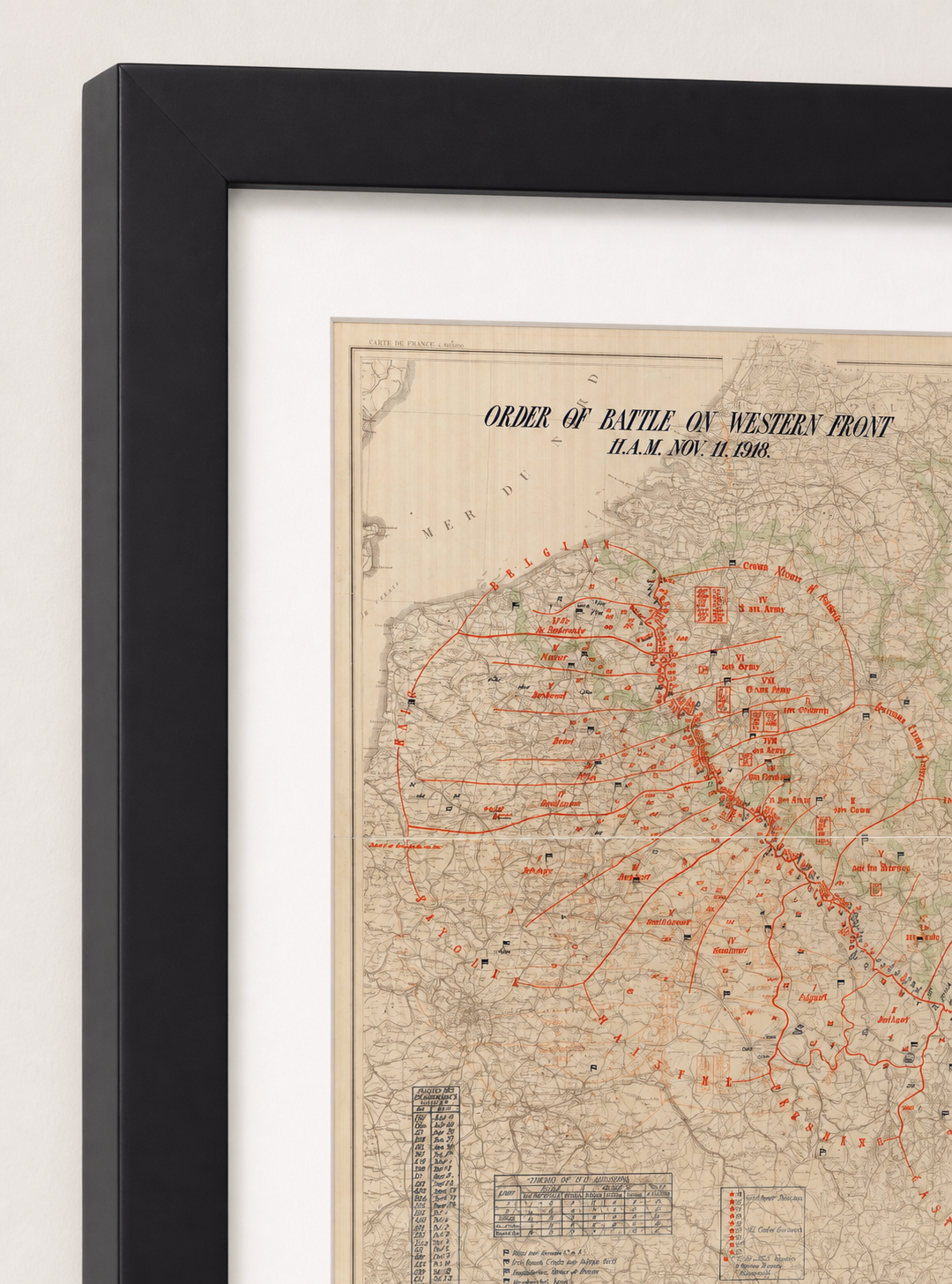
Framing Options This map is available unframed or professionally framed and ready to hang. Our framing partner uses museum-quality materials to protect and present your print for long-term display. Choose from a classic Black frame or a warm Walnut Brown frame — both available with your order. Please allow 3–4 weeks for delivery on framed orders.
Museum-Quality Reproduction This is a high-quality reproduction of the original historic map, professionally printed on premium archival paper using the Giclée printing process to preserve fine cartographic detail, line clarity, and period authenticity for long-term display.
Perfect For:
- World War I historians and collectors
- U.S. Army veterans and military families
- Descendants of American Expeditionary Forces soldiers
- Offices, studies, and libraries
- Gifts commemorating the end of the Great War
Specifications:
- Original Publication: 1923
- Scale: 1:600,000
- Style: Western Front order of battle / operational disposition map
- Battle/Conflict: World War I — Western Front
- Battle Result: Allied Victory (Armistice, November 11, 1918)
- Product Type: High-Quality Reproduction Print
Dimensions (Width x Height): 19.4 x 23.4
Each map is printed using the finest materials and methods. Your map will be handled with white gloves from start to finish. We use the Giclée printing method on premium archival paper, which produces a clear, extremely detailed, durable map perfect for proud display in your home or office.
Choose options
