



Battle of Stalingrad – September 1942 WWII German Army Battle Map
Battle of Stalingrad – September 1942 WWII German Army Battle Map
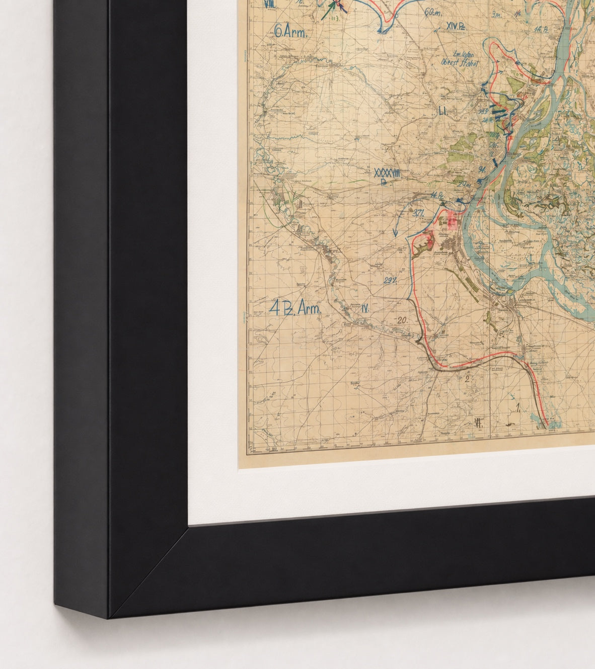
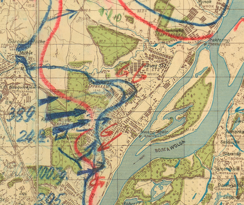
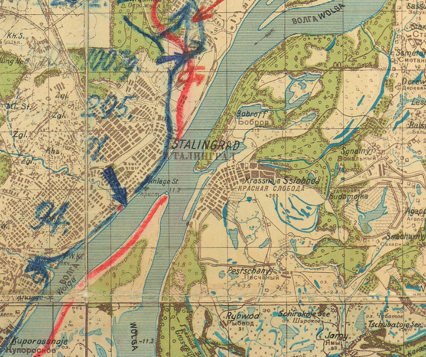
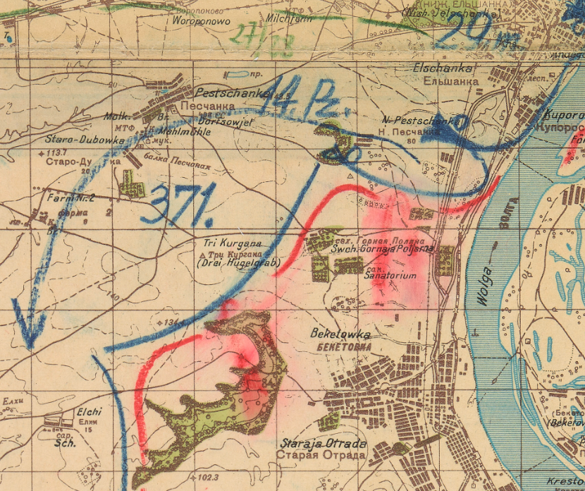
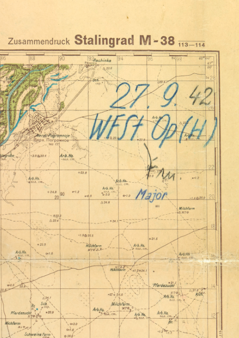
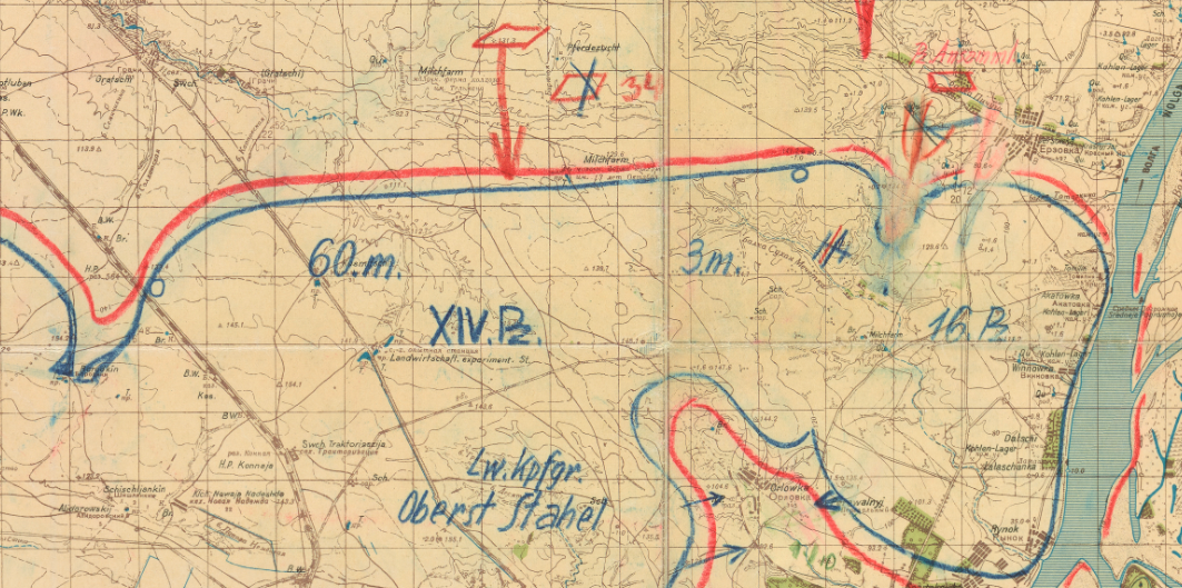
On September 27, 1942, as German infantry and tanks opened their assault on Stalingrad's factory district, an officer of the Wehrmacht Operations Staff marked that day's front lines by hand on this German Army 1:100,000 map of the city, offered here as a museum-quality reproduction. German positions are drawn in blue and Soviet positions in red. The date, the staff's abbreviation and a major's signature are written in the upper right corner. Every division fighting for the city that day is lettered where it stood.
Historical Context
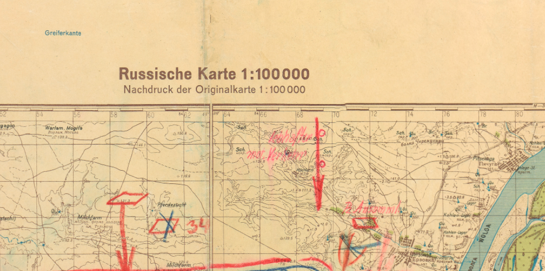
The Battle of Stalingrad was fought from August 1942 to February 2, 1943. The German Sixth Army under General Friedrich Paulus reached the Volga north of the city on August 23, and fighting inside the city began on September 13. By late September German troops held most of the center and south, while the Soviet 62nd Army under General Vasily Chuikov held the factory district and a narrow strip along the river. On September 27 Sixth Army opened a new assault toward the workers' settlements of the Red October and Barricades factories. Soviet armies were attacking from the north near Kotluban at the same time, and those attacks are marked on this map.
The Map's Features
The printed base is titled "Russische Karte 1:100 000," a German reprint of a Soviet map, with place names in Cyrillic and in German spelling; the sheet is "Zusammendruck Stalingrad M-38 113–114." Large blue lettering places 6. Arm. northwest of the city and 4. Pz. Arm. to the southwest, with the corps VIII., XIV. Pz., LI., XXXXVIII. Pz. and IV. between them. Inside the city the 389th, 24th Panzer, 100th Jäger, 295th, 71st and 94th Divisions are numbered in order from north to south, and blue arrows point into Krasnyj Oktjabr and Barrikady. North of the city the map shows the 60th and 3rd Motorized Divisions, the 16th Panzer Division and "Lw. Kpfgr. Oberst Stahel," a Luftwaffe battle group. Red arrows and German notes along the northern front record Soviet troop concentrations and ongoing attacks.
Historical Significance
This map shows Stalingrad as the German high command saw it on a day when it still expected to take the city. The fight for the factories lasted into November. On November 19, 1942 a Soviet counteroffensive struck the flanks on either side of the city, and within days Sixth Army was surrounded. It surrendered by February 2, 1943. Nearly every German division lettered on this sheet was inside the pocket when it closed.
Framing Options
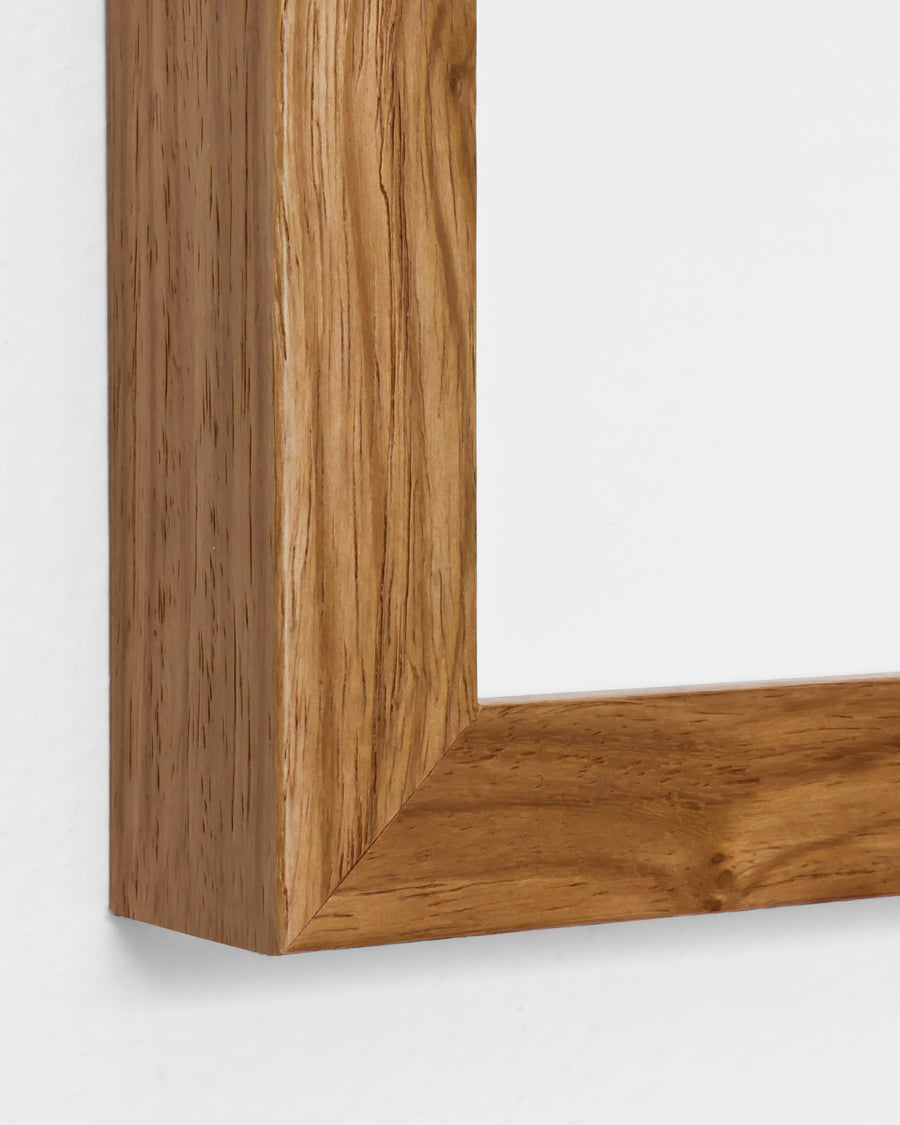
This map is available unframed or professionally framed and ready to hang. Our framing partner uses museum-quality materials to protect and present your map for long-term display. Choose from a classic Black frame or a warm Walnut Brown frame — both available with your order. Please allow 3–4 weeks for delivery on framed orders.
Museum-Quality Reproduction
This is a high-quality reproduction of the original historic map, professionally printed on premium archival paper using the Giclée printing process to preserve fine cartographic detail, line clarity, and period authenticity for long-term display.
Perfect For
- Eastern Front historians and students of the Battle of Stalingrad
- World War II collectors of German situation maps
- Veterans and serving military professionals
- Teachers and serious students of operational history
- Home offices, libraries and studies
Specifications
- Depicts: German and Soviet front lines at Stalingrad on September 27, 1942; Battle of Stalingrad fought August 1942 – February 2, 1943
- Conflict: World War II, Eastern Front
- Original Publication: September 27, 1942 (date of the hand-marked situation)
- Publisher: German Army reprint of a Soviet 1:100,000 map; situation marked by the Wehrmacht Operations Staff, Army operations section (WFSt Op (H))
- Style: German situation map, hand-marked in blue and red on a printed topographic sheet
- Original Scale: 1:100,000
- Product Type: Giclée reproduction on premium archival paper
- Printed In: Rochester Hills, Michigan
Dimensions (Width x Height): 24 x 27 inches (61 x 68.6 cm)
Each map is printed using the finest materials and methods. Your map will be handled with white gloves from start to finish. We use the Giclée printing method on premium archival paper, which produces a clear, extremely detailed, durable map perfect for proud display in your home or office.
Choose options
