St. Louis – 1876 Bird’s-Eye View Map
St. Louis– 1876 Bird’s-Eye View Map
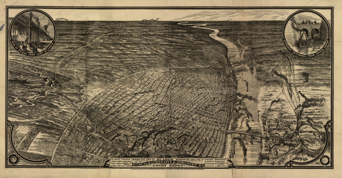
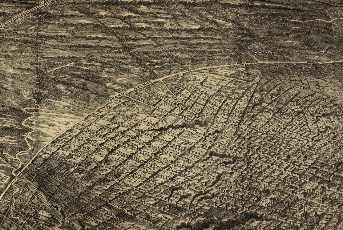
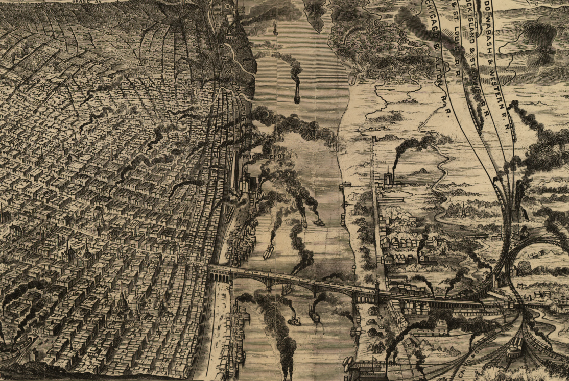
Experience St. Louis at the height of its 19th-century industrial power with this sweeping 1876 bird’s-eye view. Drawn from an elevated vantage, the map looks across the dense urban core and the Mississippi River, capturing a city defined by railroads, factories, river traffic, and rapid expansion. Smoke rising from countless chimneys, tightly packed streets, and an immense transportation network convey the scale and intensity of St. Louis as one of America’s most important cities of the era.
Historical Context In 1876, St. Louis stood as the gateway between East and West. Fueled by river commerce, rail connections, and manufacturing, the city had become a national hub linking agricultural regions, industrial centers, and frontier markets. This map was produced during a period when St. Louis was asserting itself as a dominant economic force in the post–Civil War United States.
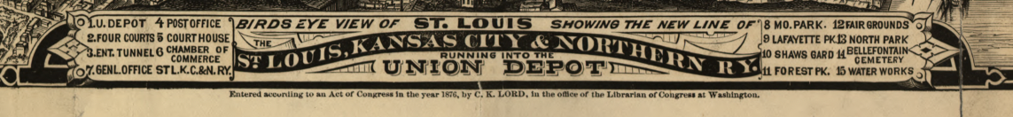
The Map’s Features This panoramic view highlights the vast urban grid stretching inland from the Mississippi River, extensive rail yards and converging rail lines, bridges and ferry crossings tying the city to the eastern bank, factories and warehouses lining the waterfront, and inset views emphasizing major infrastructure such as bridges and tunnels connected to Union Depot.
Historical Significance The map documents St. Louis at its industrial and logistical peak, offering a powerful visual record of how transportation and commerce shaped the city’s identity. It serves as an essential reference for understanding St. Louis’s role in national trade, westward expansion, and late-19th-century urban growth.
Museum-Quality Reproduction This is a high-quality reproduction of the original 1876 bird’s-eye view, professionally printed on archival Hahnemühle paper using the Giclée printing process to preserve fine linework, tonal depth, and historic detail for long-term display.
Perfect For:
• St. Louis residents and Midwest natives
• Collectors of 19th-century bird’s-eye city views
• Urban, industrial, and transportation history enthusiasts
• Offices, libraries, and study spaces
• Gifts celebrating St. Louis heritage
Specifications:
• Original Publication: 1876
• Publisher: Noted 19th-century bird’s-eye map publisher
• Style: Hand-drawn bird’s-eye panoramic city map
• Historical Context: Post–Civil War industrial expansion and river commerce
• Product Type: High-Quality Reproduction Print
Dimensions (Width x Height): 28 x 14.6
Each map is printed using the finest materials and methods. Your map will be handled with white gloves from start to finish. We use the Giclée printing method on Hahnemühle paper, which produces a clear, extremely detailed, durable map perfect for proud display in your home or office. Digital watermark does not appear on your purchased map.
Choose options
