

Paktika Province, Afghanistan 2003 Provincial Map
Paktika Province, Afghanistan – 2003 Provincial Map
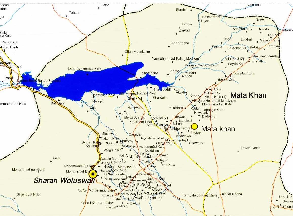
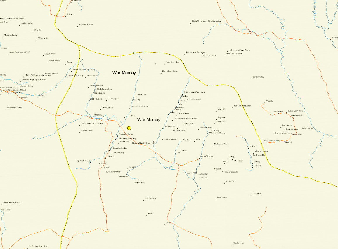
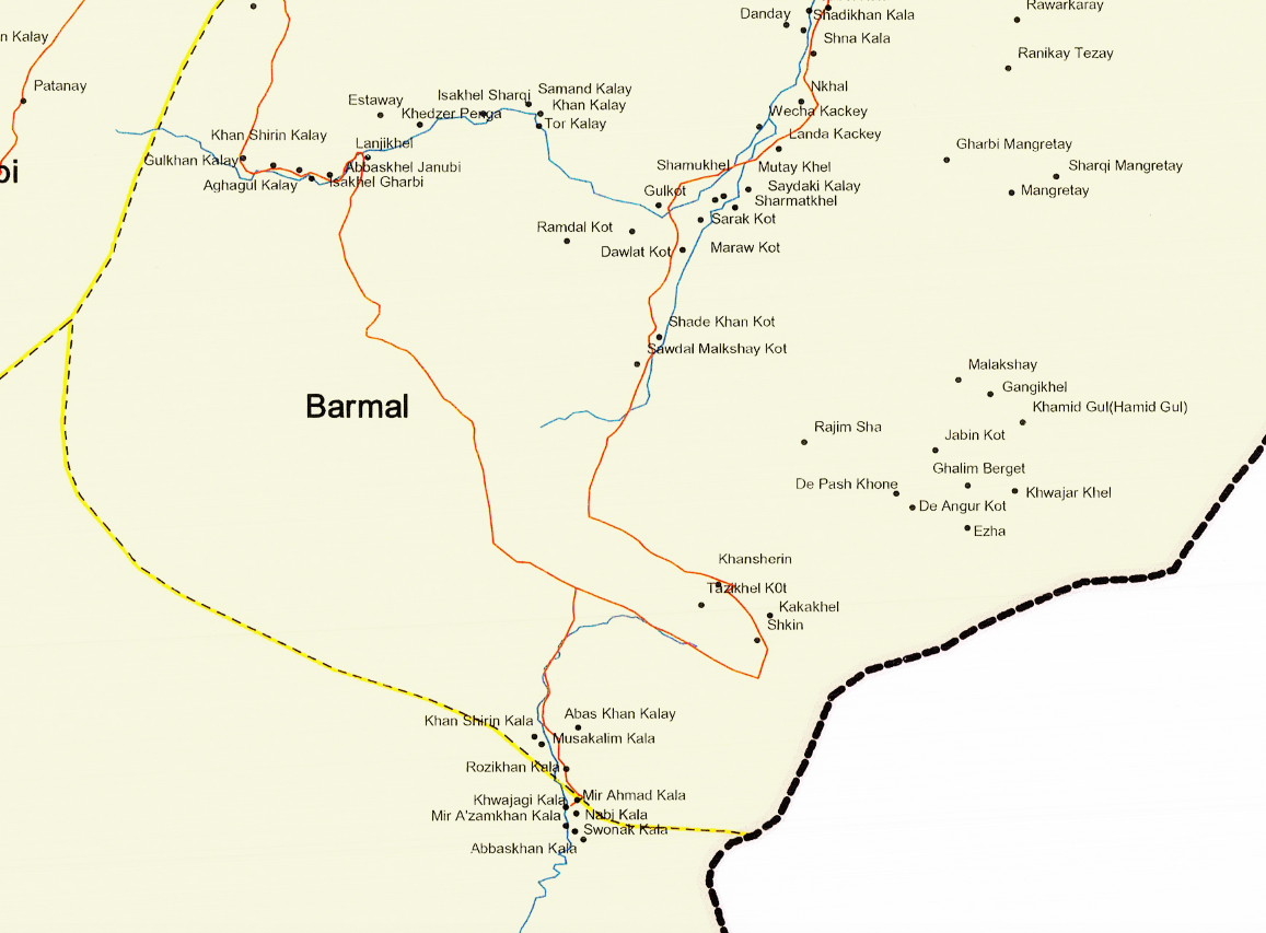
This 2003 provincial map of Paktika captures one of the most strategically important regions of eastern Afghanistan during the early years of Operation Enduring Freedom. Bordering Pakistan and located south of Khost and east of Kandahar, Paktika was a key area of cross-border movement, counterinsurgency operations, and coalition patrol activity.
Historical Context Following the U.S. invasion of Afghanistan in 2001, Paktika became a focal point for U.S. and coalition forces conducting security operations along the rugged Afghanistan–Pakistan frontier. The province’s mountainous terrain and sparse road network made it both operationally challenging and strategically vital.
The Map’s Features This detailed provincial map shows district boundaries, major and secondary roads, rivers, settlements, and key terrain features. The map provides a clear snapshot of Paktika’s infrastructure and geography as understood in 2003, offering insight into the operational landscape faced by service members deployed to the region.
Historical Significance For many veterans, Paktika represents long patrols, remote outposts, and the complexities of border-region warfare. This map preserves the geographic framework of those missions and serves as a tangible connection to that period of service.
Museum-Quality Reproduction This is a high-quality reproduction of the original 2003 map, professionally printed on archival Hahnemühle paper using the Giclée printing process to preserve its clarity, fine linework, and geographic detail for generations.
Perfect For:
• Afghanistan War veterans and military families
• Units that operated in eastern Afghanistan
• Modern military history collectors
• Offices, studies, and commemorative displays
• Gifts honoring service and sacrifice
Specifications:
• Created/Published: 2003
• Conflict: Afghanistan War
• Product Type: High-Quality Reproduction Print
Dimensions (Width x Height): 31.8 x 22.8
Each map is printed using the finest materials and methods. Your map will be handled with white gloves from start to finish. We use the Giclée printing method on Hahnemühle paper, which produces a clear, extremely detailed, durable map perfect for proud display in your home or office.
Digital watermark does not appear on your purchased map
Choose options
