New York City - 1789 Plan of the City Map
New York City - 1789 Plan of the City Map
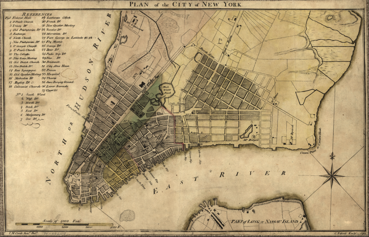
Step into the dawn of American independence with this remarkable plan of New York City from 1789—the very year George Washington was inaugurated as the first President of the United States in this city. Created by architect John McComb and engraved by Cornelius Tiebout, this hand-colored map captures the young nation's largest city at a pivotal moment in American history.
The Nation's First Capital
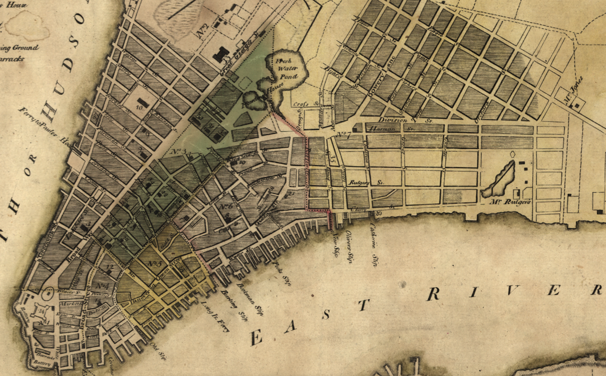
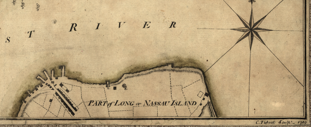
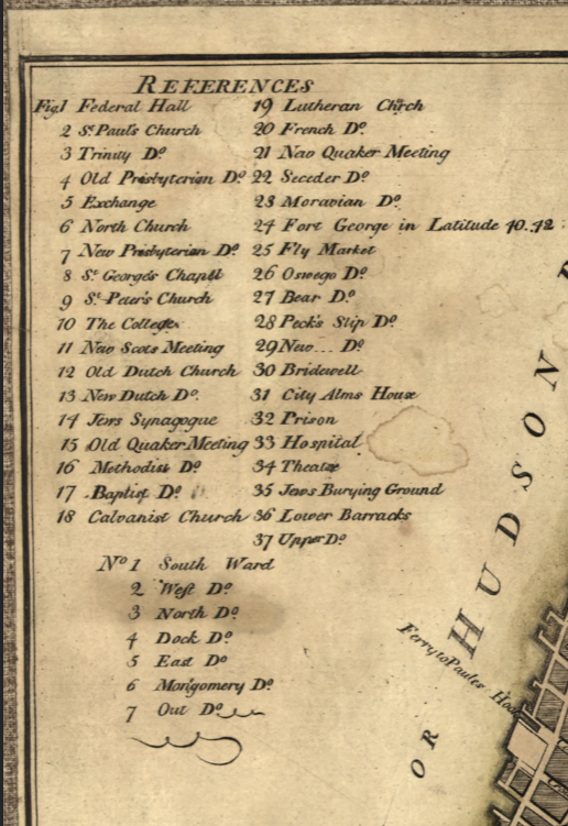
This meticulously detailed map showcases Manhattan's compact footprint in the post-Revolutionary era, when the entire city occupied only the southern tip of the island. Every street, building, and ward boundary reveals a community still recovering from British occupation while simultaneously serving as the seat of the new federal government. The map includes a comprehensive index to notable buildings, documenting landmarks like Federal Hall where Washington took the oath of office, and Trinity Church rising above the low-rise cityscape.
Historical Significance
In 1789, New York stood at the center of American political life as the nation's temporary capital. This map captures that extraordinary year when the Constitution came into effect, Congress first convened, and the machinery of the federal government began operation within these very streets. Within just a few years, the capital would move to Philadelphia and then Washington, making this snapshot of New York's brief moment as America's political heart especially significant. The ward boundaries shown reflect the city's early administrative divisions, while the indexed buildings mark the locations where American democracy took its first steps.
Museum-Quality Reproduction
This is a high-quality reproduction of the original 1789 hand-colored map, professionally printed using museum-grade methods and materials to preserve every detail of this historic cartographic treasure.
Perfect For:
- History enthusiasts and collectors of Americana
- New York natives and Manhattan residents
- Anyone passionate about early American history and the founding era
- Displaying alongside your military and historical collections
- Gift-giving for those who appreciate historical artifacts
Specifications:
- Original Publication: 1789
- Style: Street plan with ward boundaries
- Features: Hand-colored map with indexed buildings
- Product Type: High-Quality Reproduction Print
Dimensions (20 x 12.8):
Each map is printed using the finest materials and methods. Your map will be handled with white gloves from start to finish. We use the Giclee printing method on Hahnemuhle paper, which produces a clear, extremely detailed, durable map that is perfect to be proudly displayed in your home or office.
Digital watermark does not appear on your purchased map.
Choose options
