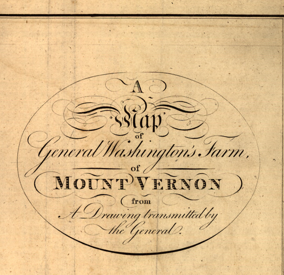
Mount Vernon, Virginia – 1801 Map of General Washington’s Farm
Mount Vernon, Virginia – 1801 Map of General Washington’s Farm
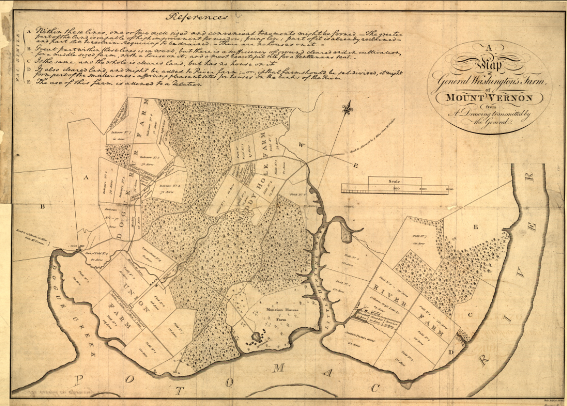
Step onto the grounds of America’s first president with this remarkable 1801 map of General George Washington’s Mount Vernon estate. Based on a drawing transmitted by Washington himself and published in London in 1801, this detailed plan illustrates the carefully organized farms, fields, woodlands, and waterways that defined the plantation along the Potomac River. More than a simple estate map, it reveals Washington’s hands-on role as an agricultural innovator and land steward.
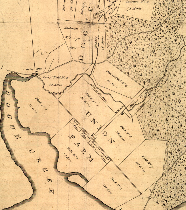
Historical Context Following the American Revolution and his presidency, George Washington devoted much of his energy to refining agricultural practices at Mount Vernon. Divided into distinct farms—such as River Farm, Dogue Run Farm, and Mansion House Farm—the estate reflected his systematic approach to crop rotation, land management, and experimentation. This 1801 publication, removed from Letters from His Excellency George Washington to Arthur Young, preserves Washington’s own vision for the property and provides rare insight into the agricultural foundation of the early Republic.
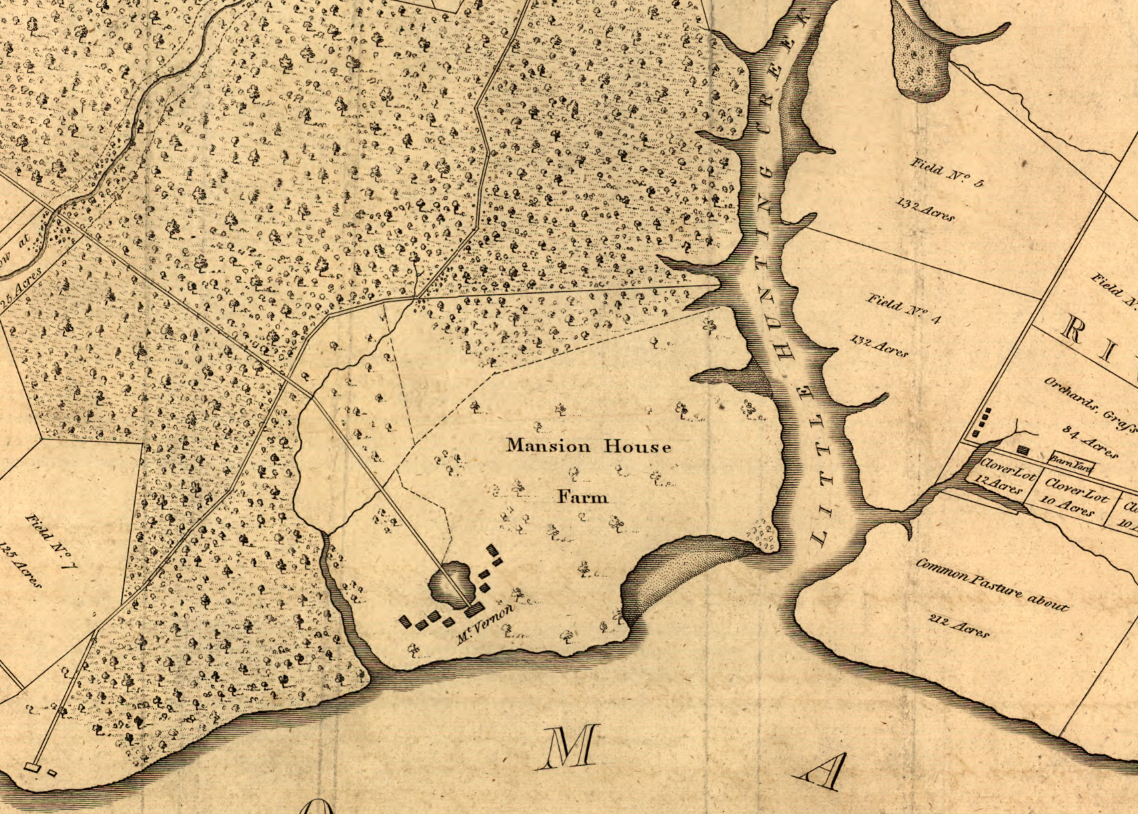
The Map’s Features The map clearly outlines the boundaries of each farm, identifying cultivated fields, wooded tracts, and waterways across the estate. The Mansion House appears prominently near the Potomac River shoreline, while roads, creeks, and field divisions illustrate the functional layout of the property. The elegant engraved title cartouche and reference notes enhance its early-19th-century character and historical authenticity.
Historical Significance Unlike later commemorative depictions, this map reflects Mount Vernon as a working agricultural enterprise under Washington’s direction. It offers a rare visual record of how the estate was structured and managed, providing insight into the economic and land-use strategies of one of America’s most influential founders.
Museum-Quality Reproduction This is a high-quality reproduction of the original 1801 map, professionally printed on archival Hahnemühle paper using the Giclée printing process to preserve fine linework, subtle aging tones, and period detail for long-term display.
Perfect For:
• Admirers of George Washington and early American history
• Collectors of Revolutionary-era and Early Republic cartography
• Students of agricultural and plantation history
• Offices, libraries, and study spaces
• Gifts honoring America’s founding legacy
Specifications:
• Created / Published: 1801
• Cartographer: George Washington (drawing transmitted by)
• Style: Early engraved estate map
• Product Type: High-Quality Reproduction Print
Dimensions (Width x Height): 29.5 x 21
Each map is printed using the finest materials and methods. Your map will be handled with white gloves from start to finish. We use the Giclée printing method on Hahnemühle paper, which produces a clear, extremely detailed, durable map perfect for proud display in your home or office.
Choose options
