



Los Angeles, California – 1871 Pictorial Bird’s Eye View Map
Los Angeles, California – 1871 Pictorial Bird’s Eye View Map
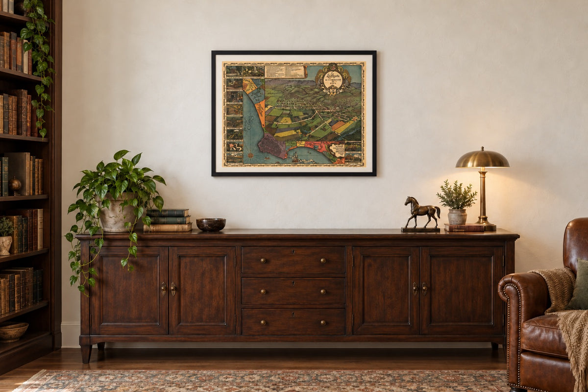
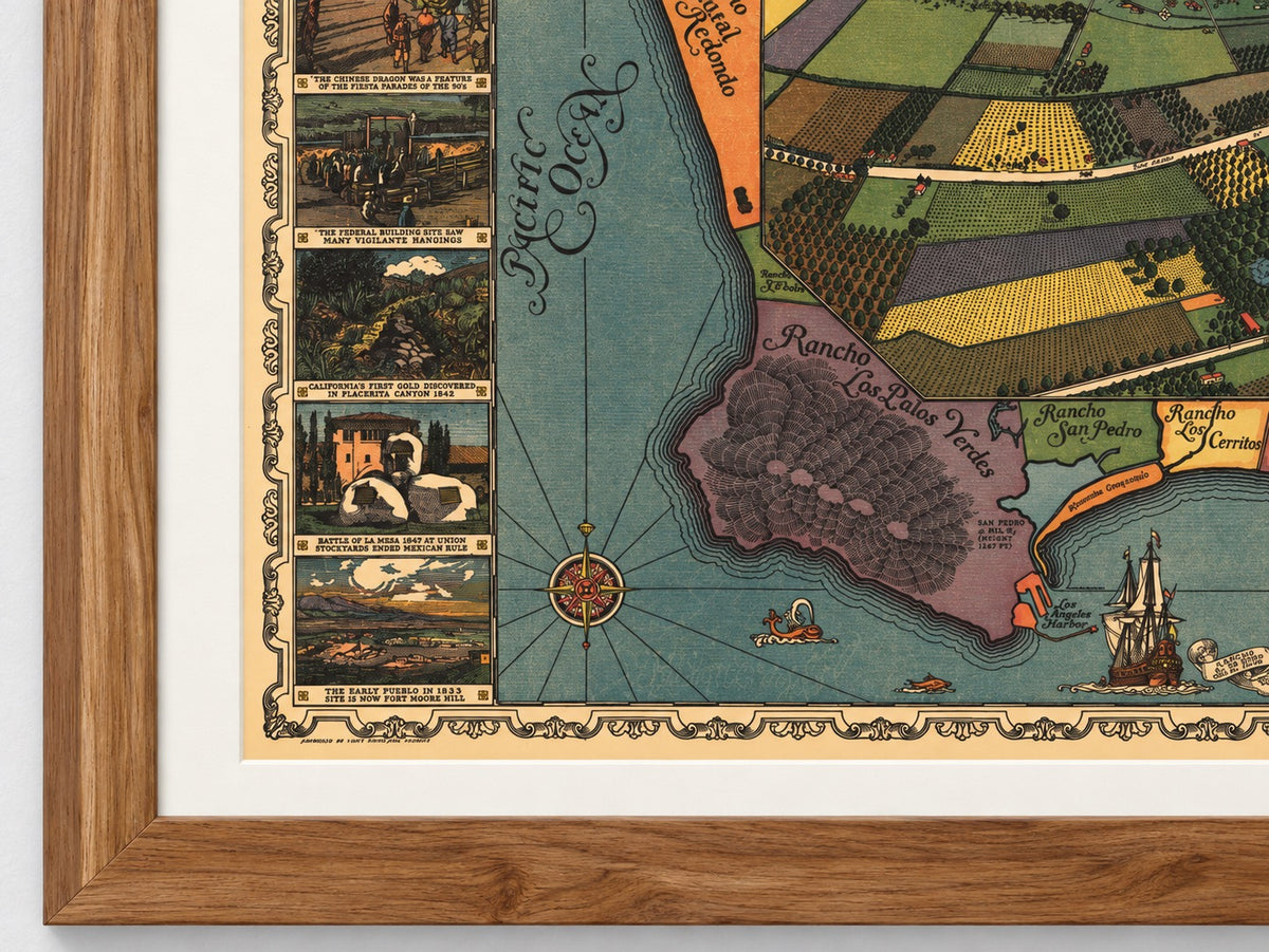
The roughly 5,700 people who lived in Los Angeles in 1871 are the subject of this pictorial bird’s-eye view map, drawn by Walter Gores and issued by the Women’s University Club of Los Angeles in 1929 to show the town as it appeared in 1871, and offered here as a museum-quality reproduction. The map rebuilds the pueblo of two generations earlier street by street and ties thirty-one of its sites to a numbered index. Around the view run the Spanish ranchos of the coast and eleven scenes from the town’s first century. The sheet states that it was approved by the Historical Society of Southern California.
Historical Context
Los Angeles was founded on September 4, 1781 as a Spanish pueblo, passed to Mexico after 1821, and came under American control after the fighting of January 1847. The 1870 census counted 5,728 residents. Water still reached fields and houses through the zanjas, open ditches fed from the Los Angeles River, and the town’s one railroad, opened in 1869, ran only to the harbor at San Pedro. On October 24, 1871 a mob killed Chinese residents in and around Calle de los Negros, and the map marks the “Site of the Chinese Massacre.” The Southern Pacific connected Los Angeles to San Francisco in 1876, and the pueblo this map shows gave way to an American city.
The Map’s Features
The title panel, held by four angels beneath the city seal, reads “Los Angeles as it appeared in 1871,” with “Founded in 1781” below. The central view looks across cultivated fields to the street grid and the hills behind it, with streets named in English and Spanish and sites marked by numbered diamonds. An index at the top identifies thirty-one of them, among them the Plaza, the Plaza Church, the Pico House, the Bella Union Hotel, Fort Hill and the zanjas, and stars those still standing in 1929. Wrapped around the left and bottom is a “Map showing original Spanish Ranchos abutting on the sea,” naming ranchos from San Vicente y Santa Monica to Las Bolsas. Eleven captioned scenes line the border, including the Battle of La Mesa in 1847, the San Gabriel Mission and the pueblo in 1853 seen from Fort Moore.
Historical Significance
This is a map of memory as much as of streets. By 1929 Los Angeles had passed a million residents and had just finished a new City Hall, which appears in one of the border scenes above a caption naming the “site of the original and the new city halls.” The women who issued the map chose to record what stood there before: the plaza, the irrigation ditches, the ranchos, and the places where the town’s violence happened alongside its civic firsts. For families with roots in early Los Angeles, it sets the names and places of their grandparents’ town on one sheet.
Museum-Quality Reproduction
This is a high-quality reproduction of the original historic map, professionally printed on premium archival paper using the Giclée printing process to preserve fine cartographic detail, line clarity, and period authenticity for long-term display.
Perfect For:
- Los Angeles residents and California natives, past and present
- Families with roots in the pueblo, the ranchos or early Los Angeles
- Collectors of pictorial maps and American city views
- Students of Spanish, Mexican and early American California
- Homes, offices and libraries with a connection to Los Angeles
Specifications:
- Depicts: Los Angeles, California, as it appeared in 1871, with the Spanish ranchos along the coast
- Original Publication: 1929
- Publisher: Women’s University Club of Los Angeles (drawn by Walter Gores; approved by the Historical Society of Southern California)
- Style: Pictorial bird’s-eye view map in color, with a numbered index, a rancho map and eleven border scenes
- Product Type: Giclée reproduction on premium archival paper
- Printed In: Rochester Hills, Michigan
Dimensions (Width x Height): 30 x 22.5 inches (76.2 x 57.2 cm)
Each map is printed using the finest materials and methods. Your map will be handled with white gloves from start to finish. We use the Giclée printing method on premium archival paper, which produces a clear, extremely detailed, durable map perfect for proud display in your home or office.
Choose options
