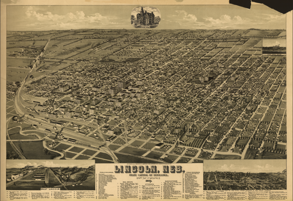
Lincoln, Nebraska – 1889 Panoramic Bird’s-Eye View of the State Capitol and University
Lincoln, Nebraska – 1889 Panoramic Bird’s-Eye View of the State Capitol and University
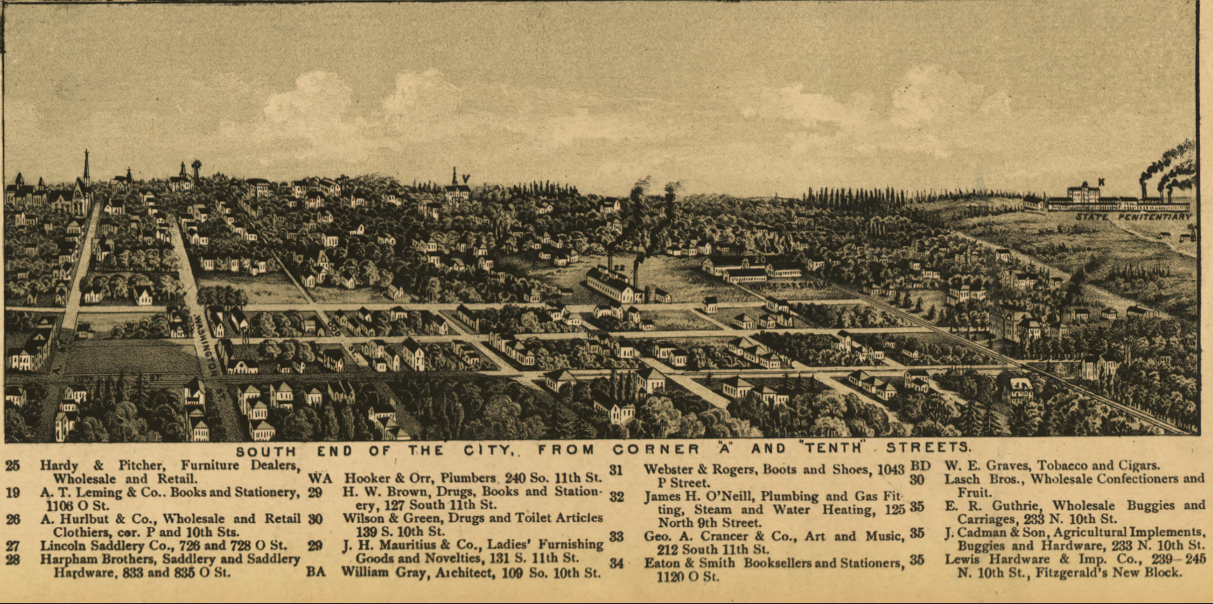
Step into late-19th-century Nebraska with this striking 1889 panoramic view of Lincoln, proudly presented as the State Capitol and home of the State University. Created by noted panoramic artist H. Wellge and published by the American Publishing Company of Milwaukee, this detailed bird’s-eye perspective captures Lincoln during a period of rapid civic growth and institutional prominence.
Historical Context By 1889, Lincoln had firmly established itself as both the political center of Nebraska and the home of the State University (now the University of Nebraska). Railroads fueled commerce, government buildings anchored civic identity, and educational institutions strengthened the city’s reputation as a regional hub of leadership and learning. This panoramic map reflects Lincoln’s confidence and expansion during a transformative era.
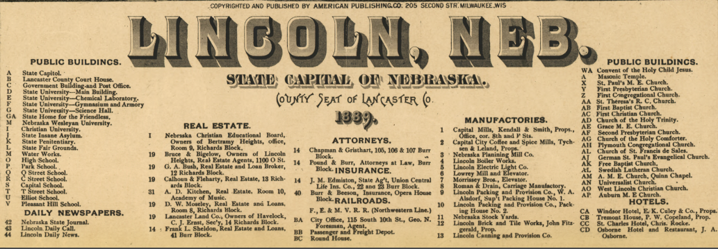
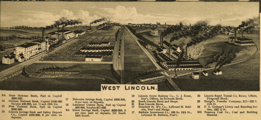
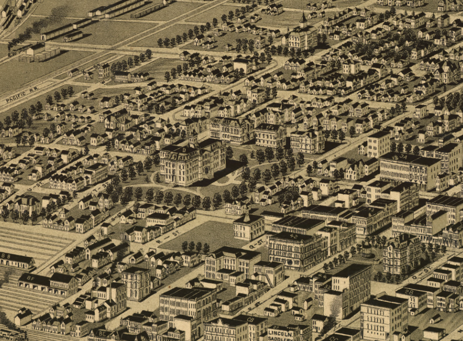
The Map’s Features. Rendered in classic 19th-century perspective style, this view illustrates Lincoln’s orderly street grid, rail yards, commercial districts, residential neighborhoods, the State Capitol, and the grounds of the "State University". Insets and illustrations highlight key landmarks, while an index identifies important points of interest throughout the city. Though not drawn to strict scale, the map provides an immersive visual survey of Lincoln’s urban landscape in 1889.
Historical Significance. Panoramic city views were both artistic achievements and civic statements, celebrating progress, education, industry, and regional pride. This 1889 Lincoln view preserves the architectural character and spatial development of Nebraska’s capital and university city at a formative moment in its history—making it both a valuable historical document and an impressive display piece.
Museum-Quality Reproduction This is a high-quality reproduction of the original 1889 panoramic map, professionally printed on archival Hahnemühle paper using the Giclée printing process to preserve fine line detail, tonal depth, and period authenticity for long-term display.
Perfect For:
• Nebraska residents and Lincoln locals
• University of Nebraska alumni and supporters
• Collectors of 19th-century panoramic city maps
• Offices, studies, and academic spaces
• Gifts celebrating Nebraska heritage
Specifications:
• Original Publication: 1889
• Mapmaker: H. Wellge
• Publisher: American Publishing Co., Milwaukee
• Style: Bird’s-eye panoramic city view
• Product Type: High-Quality Reproduction Print
Dimensions (Width x Height): 28 x 19.3
Each map is printed using the finest materials and methods. Your map will be handled with white gloves from start to finish. We use the Giclée printing method on Hahnemühle paper, which produces a clear, extremely detailed, durable map perfect for proud display in your home or office.
Choose options
