Korean War 1950 Campaign Progression Battle Map
Korean War 1950 Campaign Progression Battle Map
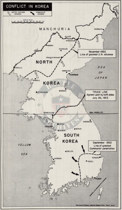
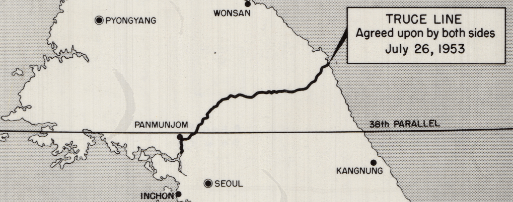
The Korean War was fought from 1950 to 1953 after North Korean forces crossed the 38th Parallel in an attempt to unify the peninsula under communist rule. United Nations forces, led primarily by the United States, intervened to defend South Korea. The conflict saw dramatic advances and reversals before stabilizing near the original dividing line.
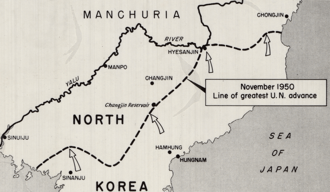
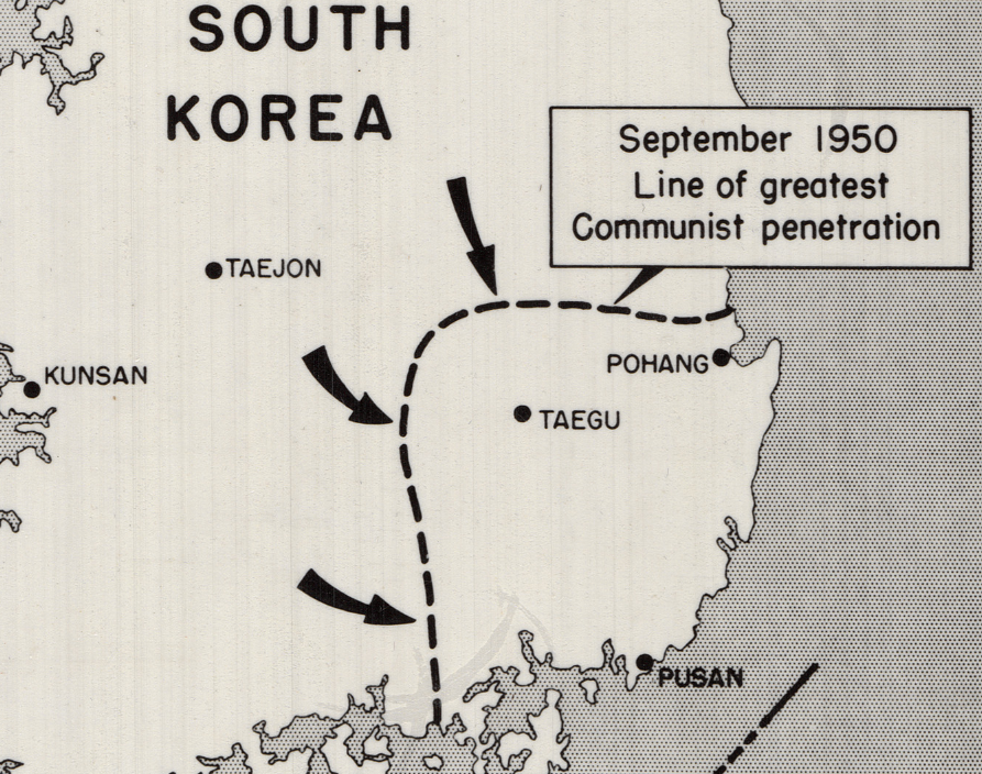
Historical Context In September 1950, communist forces had pushed deep into the southern portion of the peninsula, nearly driving United Nations troops into the sea. Following the Inchon landing and breakout from the Pusan Perimeter, UN forces rapidly advanced northward, crossing the 38th Parallel and moving deep into North Korea by November 1950.
The Map’s Features This campaign map clearly illustrates the September 1950 line of greatest communist penetration, the November 1950 line of greatest United Nations advance into North Korea, and the final truce line agreed upon in July 1953. Major cities, geographic boundaries, and the 38th Parallel are shown, providing a clear visual summary of the war’s shifting front lines.
Historical Significance The Korean War established the modern boundary between North and South Korea and marked one of the first major armed conflicts of the Cold War. This map captures the dramatic territorial swings of 1950 and the eventual stabilization that led to the armistice.
Museum-Quality Reproduction This is a high-quality reproduction of the original campaign map, professionally printed on archival Hahnemühle paper using the Giclée printing process to preserve fine cartographic detail, line clarity, and period accuracy for long-term display.
Perfect For:
• Korean War veterans and military families
• Students of Cold War military history
• Collectors of mid-20th century military cartography
• Offices, studies, and veteran memorial spaces
• Gifts honoring service on the Korean Peninsula
Specifications:
• Original Publication: Unknown
• Style: Campaign overview battle map
• Battle/Conflict: Korean War (1950 Campaign)
• Battle Result: United Nations Victory
• Product Type: High-Quality Reproduction Print
Dimensions (Width x Height): 8.4 x 14.4
Each map is printed using the finest materials and methods. Your map will be handled with white gloves from start to finish. We use the Giclée printing method on Hahnemühle paper, which produces a clear, extremely detailed, durable map perfect for proud display in your home or office.
Digital watermark does not appear on your purchased map
Choose options
