


Kandahar, Afghanistan – 2010 City Topographical Map
Kandahar, Afghanistan – 2010 City Topographical Map
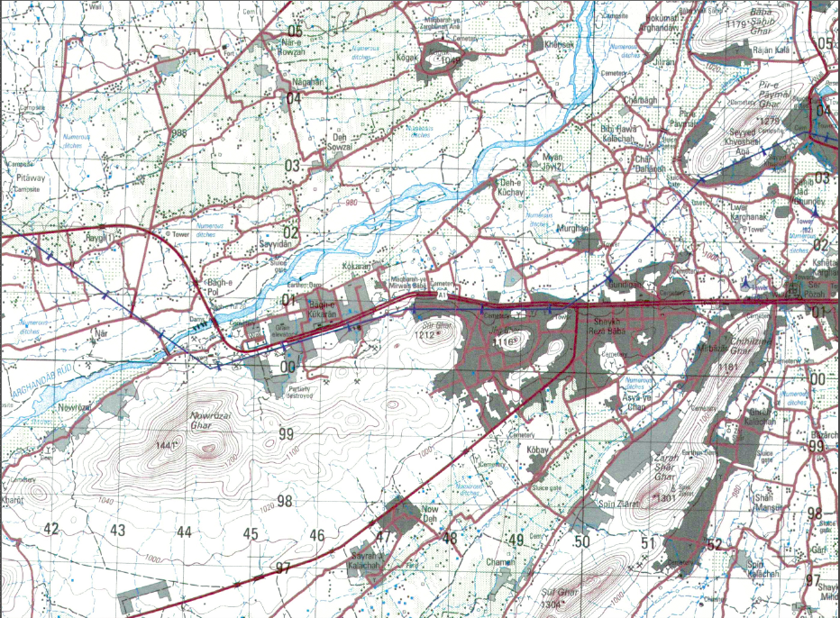
Kandahar is one of the most historically significant cities in Afghanistan, originally founded by Alexander the Great and later serving as the spiritual and political center of the Taliban regime prior to the U.S.-led invasion in 2001. For coalition forces, Kandahar became one of the most strategically critical cities of the war, shaping operations across southern Afghanistan. This detailed 2010 topographical map captures Kandahar and its surrounding terrain during a pivotal period of modern conflict.
Operational Geography Located in southern Afghanistan, Kandahar sits at the crossroads of major road networks linking Helmand, Uruzgan, Zabul, and the approaches toward Pakistan. The city’s irrigation canals, agricultural zones, desert outskirts, and dense urban districts created a complex operational environment that heavily influenced military planning and maneuver during coalition operations.
The Map’s Features This large-scale military topographical map (1:50,000) provides detailed contour lines, road networks, urban infrastructure, waterways, and surrounding terrain features. The western outskirts, transportation corridors, and expanding urban footprint are clearly defined, offering a precise geographic record of Kandahar as it existed in 2010.
Historical Significance Kandahar was central to NATO and U.S. operations throughout the Afghanistan conflict. As both a historic Afghan power center and a modern operational hub, the city became symbolic of broader efforts to stabilize southern Afghanistan. This map preserves the physical landscape that shaped those missions.
Museum-Quality Reproduction This is a high-quality reproduction of the original 2010 military topographical map, professionally printed on archival Hahnemühle paper using the Giclée printing process to preserve fine cartographic detail, line clarity, and long-term display durability.
Perfect For:
• Afghanistan War veterans and military families
• Units who served in Kandahar Province
• Collectors of modern military cartography
• Offices, studies, and veteran memorial spaces
• Gifts honoring service in Operation Enduring Freedom
Specifications:
• Original Publication: 2010
• Scale: 1:50,000
• Style: Military topographical city map
• Conflict: War in Afghanistan
• Product Type: High-Quality Reproduction Print
Dimensions (Width x Height): 22.3 x 30.2
Each map is printed using the finest materials and methods. Your map will be handled with white gloves from start to finish. We use the Giclée printing method on Hahnemühle paper, which produces a clear, extremely detailed, durable map perfect for proud display in your home or office.
Digital watermark does not appear on your purchased map
Choose options
