
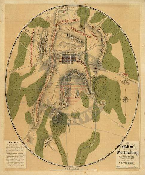

Gettysburg, Pennsylvania – July 1–3, 1863 Battle Map
Gettysburg, Pennsylvania – July 1–3, 1863 Battle Map
The Battle of Gettysburg was the largest and most consequential engagement of the American Civil War, fought over three days — July 1 through 3, 1863 — outside the small Pennsylvania town that neither side had chosen as a deliberate objective. General Robert E. Lee led the Army of Northern Virginia, approximately 75,000 strong, on his second attempt to carry the war onto Northern soil. Opposing them was the Army of the Potomac under General George Meade, who had assumed command just three days before the battle opened. With combined casualties estimated between 45,000 and 51,000 men, Gettysburg remains the bloodiest battle ever fought on American soil.
Historical Context Lee's Army of Northern Virginia had crossed into Pennsylvania in late June 1863, threatening Harrisburg and moving within striking distance of Philadelphia and Washington. The collision at Gettysburg began almost by accident on July 1 when Confederate infantry probing westward encountered Union cavalry under General John Buford on McPherson's Ridge. What opened as a skirmish escalated into a full engagement as both armies rushed reinforcements to the field. By the evening of July 3, Lee's assault had spent itself against the Federal center on Cemetery Ridge — the moment history remembers as the High Water Mark of the Confederacy, the closest point at which the South could claim to have come to winning the war outright. Lee withdrew into Virginia on July 4, never to mount a major offensive again.
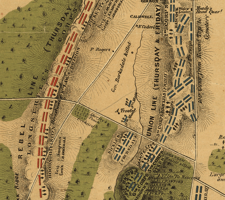
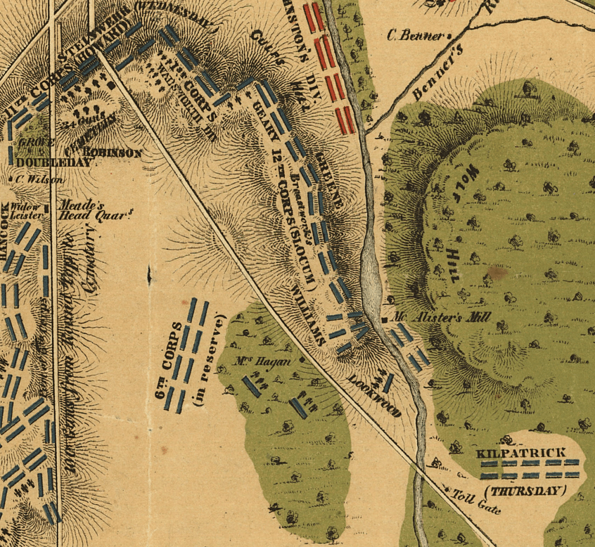
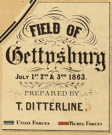
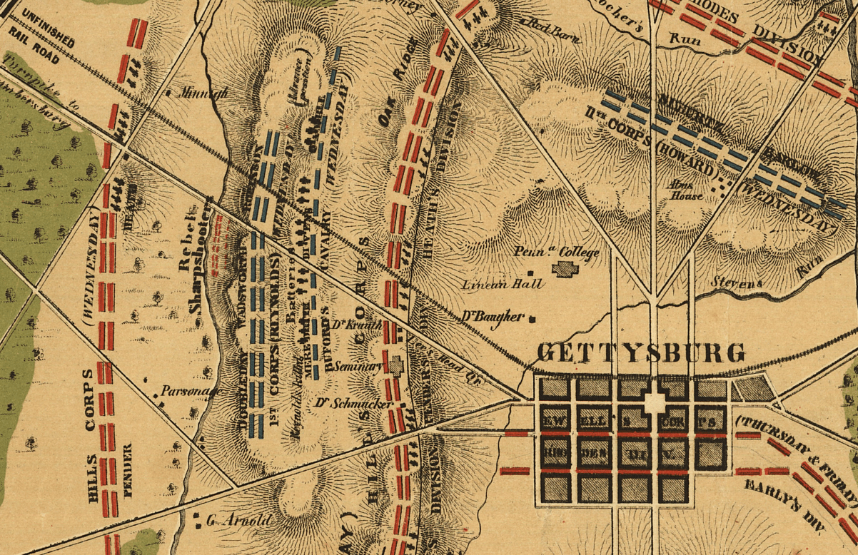
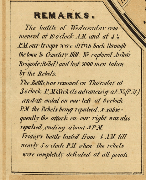
The Map's Features Drawn from the Union perspective and published in 1863, this color battle map presents all three days of fighting across a single composition, offering a comprehensive operational view that single-day maps cannot provide. Confederate formations are labeled throughout as Rebel units, reflecting the contemporary Union viewpoint under which the map was produced. Uniquely, unit positions are identified by day of the week — Wednesday, Thursday, Friday — rather than calendar dates, a cartographic choice that grounds the viewer in the real-time rhythm of the engagement. Color coding distinguishes Union and Confederate positions across the terrain, which is rendered to show the ridgelines, fields, and woodlands that shaped the tactical decisions of both armies. Annotations mark the locations where senior officers were killed in action, adding a layer of human specificity rarely found in operational cartography of this era.
Historical Significance Gettysburg effectively ended the Confederacy's strategic capacity to win the war on Northern terms. The defeat cost Lee's army an irreplaceable 28,000 casualties — veterans and officers he could not replace — and foreclosed any realistic prospect of European diplomatic recognition, which had depended in part on Confederate battlefield success. The three-day battle produced more American dead, wounded, and missing than any engagement before or since, and the ground on which it was fought became consecrated national territory within months, when Lincoln delivered the Gettysburg Address at the dedication of the Soldiers' National Cemetery in November 1863. A map capturing all three days in a single frame is a document of an entire turning point, not just a moment within it.
Framing Options This map is available unframed or professionally framed and ready to hang. Our framing partner uses museum-quality materials to protect and present your print for long-term display. Choose from a classic Black frame or a warm Walnut Brown frame — both available with your order. Please allow 3–4 weeks for delivery on framed orders.
Museum-Quality Reproduction This is a high-quality reproduction of the original historic map, professionally printed on archival Hahnemühle paper using the Giclée printing process to preserve fine cartographic detail, line clarity, and period authenticity for long-term display.
Perfect For:
- Civil War historians and collectors seeking a comprehensive single-map view of the full three-day battle
- Descendants of Union or Confederate veterans who fought at Gettysburg
- Students and educators of American military history and Civil War strategy
- Offices, studies, libraries, and heritage displays
- Gifts honoring Civil War history or Pennsylvania heritage
Specifications:
- Original Publication: 1863
- Cartographer: T. Ditterline
- Style: Color operational battle map — three-day composite
- Battle/Conflict: Battle of Gettysburg (American Civil War)
- Battle Result: Union Victory (July 1–3, 1863)
- Product Type: High-Quality Reproduction Print
Dimensions (Width x Height): 16.4 x 19.9
Each map is printed using the finest materials and methods. Your map will be handled with white gloves from start to finish. We use the Giclée printing method on Hahnemühle paper, which produces a clear, extremely detailed, durable map perfect for proud display in your home or office.
For the full account of the second day, read our Field Notes article: The Ground That Could Not Be Given: Gettysburg, July 2, 1863
Choose options
