Florida – Bird’s Eye View of the Peninsula and Gulf Coast
Florida – Bird’s Eye View of the Peninsula and Gulf Coast
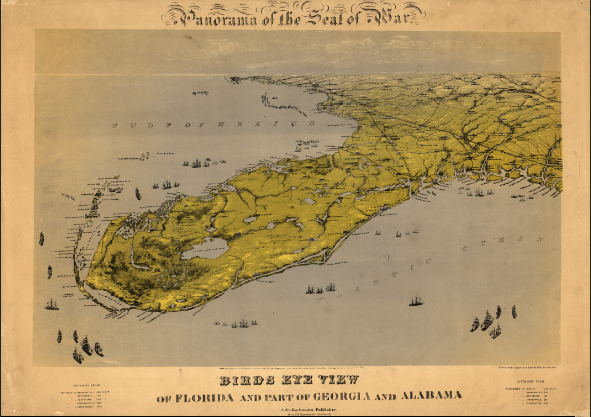
Experience Florida as it was envisioned in the 19th century with this sweeping bird’s-eye view map depicting the Florida peninsula alongside portions of Georgia and Alabama. Rendered from an elevated panoramic perspective, this map captures Florida’s coastline, interior waterways, emerging settlements, and maritime approaches at a time when the state was still largely undeveloped and defined by its geography rather than its cities.
Historical Context
Created during an era when Florida was viewed as both a frontier and a strategic maritime region, this map reflects how Americans understood the state before large-scale drainage projects, rail expansion, and urban growth reshaped the landscape. Rivers, bays, coastal inlets, and shipping routes are emphasized, underscoring Florida’s importance to trade, navigation, and military movement in the Gulf of Mexico and Atlantic Ocean.
The Map’s Features
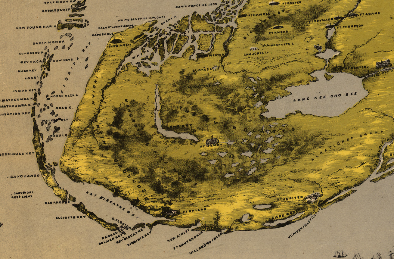
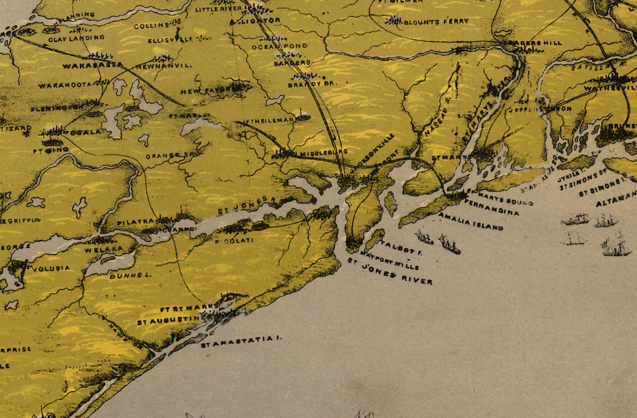
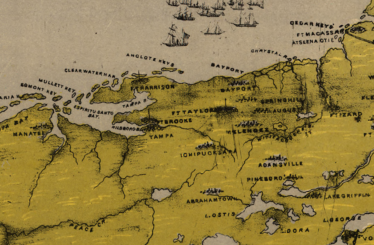
This panoramic composition presents Florida from a bird’s-eye perspective, highlighting the peninsula’s shape, elevation changes, rivers, lakes, and coastal contours. Sailing ships populate surrounding waters, while inland details illustrate sparse settlements, transportation routes, and natural terrain. The wide geographic scope gives viewers a rare sense of scale and spatial context unmatched by conventional flat maps.
Historical Significance
Rather than focusing on a single city, this map offers a powerful geographic portrait of Florida itself—ideal for those with personal, professional, or military connections to the state. It serves as a visual reminder of how dramatically Florida has changed, preserving a moment when the land, water, and coastline defined life far more than roads or skylines.
Museum-Quality Reproduction
This is a high-quality reproduction of the original historical map, professionally printed using museum-grade methods to preserve its color, detail, and panoramic clarity. Each print is produced on archival Hahnemühle paper using the Giclée printing process, ensuring exceptional durability and a refined finish suitable for long-term display.
Perfect For:
• Florida residents and lifelong natives
• Veterans and service members with Florida deployments or training
• Geographic and cartography enthusiasts
• Coastal and maritime history collectors
• Offices, libraries, and study spaces
• Gifts for anyone with a deep connection to Florida
Specifications:
• Style: 19th-century panoramic bird’s-eye geographic map
• Region Shown: Florida with portions of Georgia and Alabama
• Product Type: High-Quality Reproduction Print
Dimensions (Width x Height): 28 x 19.9
Each map is printed using the finest materials and methods. Your map will be handled with white gloves from start to finish. We use the Giclée printing method on Hahnemühle paper, which produces a clear, extremely detailed, durable map perfect for proud display in your home or office.
Subtle variations in lettering and alignment reflect the original hand-drawn and period printing methods, preserving the authentic character of the source map.
Digital watermark does not appear on your purchased map.
Choose options
