Detroit, Michigan – 1889 Bird’s Eye View Map
Detroit, Michigan – 1889 Bird’s Eye View Map
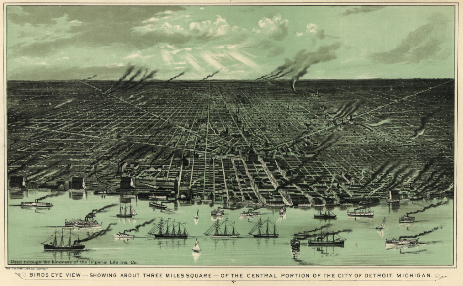
Experience Detroit at the height of its late-19th-century industrial rise with this striking 1889 bird’s eye view of the city along the Detroit River. Drawn from an elevated vantage point, this panoramic map captures a dense, expanding urban grid, busy waterfront docks, rail corridors, factories, and ship traffic that together illustrate Detroit’s emergence as one of America’s most important manufacturing and transportation centers.
Historical Context
By the late 1880s, Detroit had transformed from a regional trading hub into a booming industrial city powered by railroads, shipping, and manufacturing. Positioned on the Great Lakes between the American Midwest and Canada, Detroit’s riverfront became a critical artery for commerce, raw materials, and finished goods. This map reflects the city just before the automobile industry would redefine its global identity, capturing Detroit in a pivotal moment of growth, ambition, and industrial confidence.
The Map’s Features
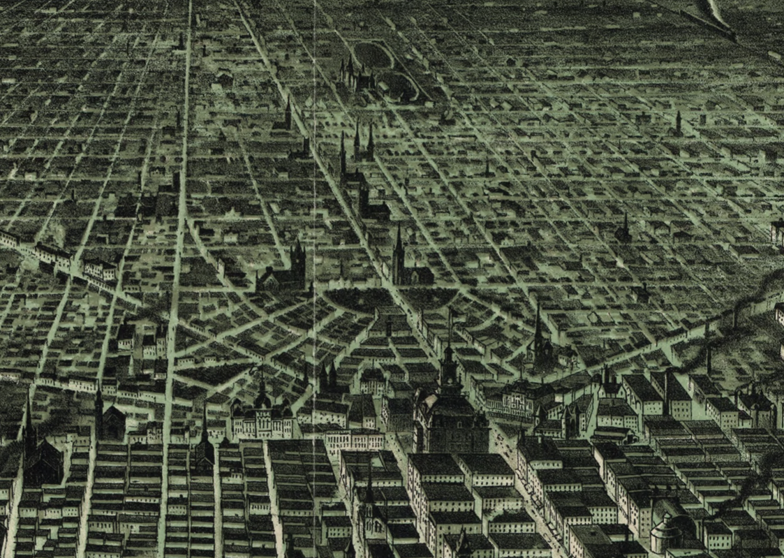
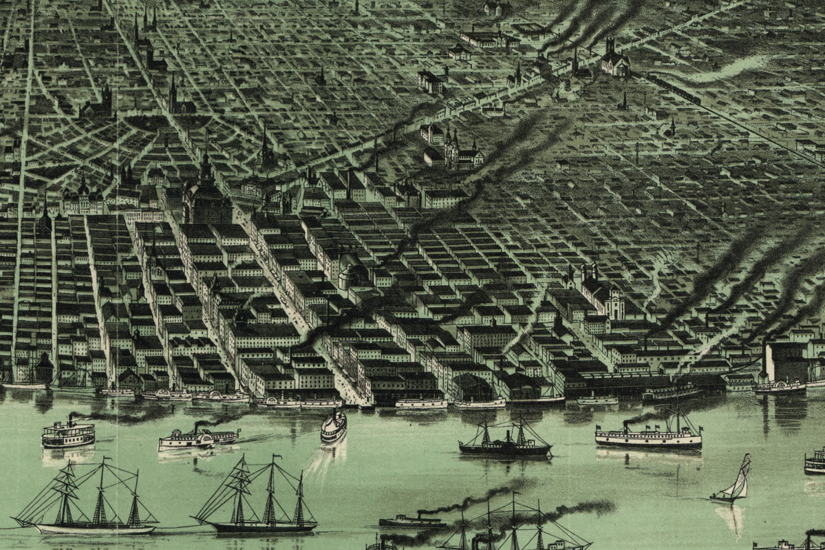
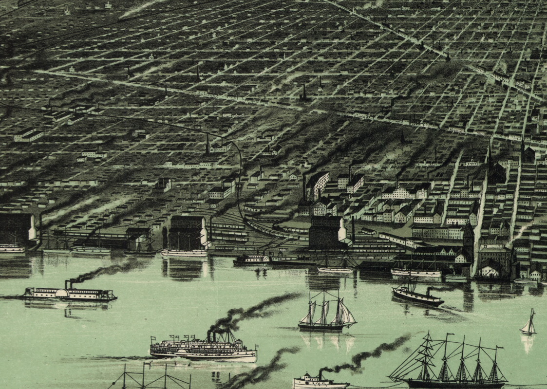
This detailed bird’s eye view presents the city with remarkable clarity, showing the rectilinear street grid, industrial districts marked by smokestacks, rail yards and depots, waterfront warehouses, and heavy river traffic. The Detroit River is rendered as a central lifeline, crowded with steamships and sailing vessels, emphasizing the city’s role as a major port. The perspective highlights both residential neighborhoods and industrial zones, offering a comprehensive snapshot of Detroit’s late-19th-century urban form.
Historical Significance
This 1889 view preserves Detroit at a formative stage—industrialized but not yet dominated by the automobile age. It documents the physical foundations that would support Detroit’s explosive 20th-century growth and serves as a powerful visual record of the city’s working-class roots, manufacturing heritage, and strategic geographic importance. For residents, historians, and collectors, it offers a tangible connection to Detroit’s identity as an engine of American industry.
Museum-Quality Reproduction
This is a high-quality reproduction of the original 1889 bird’s eye view, professionally printed using museum-grade methods and materials to preserve every line, structure, and atmospheric detail. Each map is produced on archival Hahnemühle paper using the Giclée printing process, ensuring exceptional clarity, durability, and a refined finish suitable for display in any setting.
Perfect For:
• Detroit residents and those with roots in the Motor City
• History enthusiasts interested in industrial and urban growth
• Collectors of bird’s eye view and 19th-century city maps
• Offices, libraries, and study spaces
• Gifts for Detroit natives and Great Lakes historians
Specifications:
• Original Publication: 1889
• Style: Bird’s eye panoramic city view
• Product Type: High-Quality Reproduction Print
Dimensions (Width x Height): 27.3 x 16.9
Each map is printed using the finest materials and methods. Your map will be handled with white gloves from start to finish. We use the Giclée printing method on Hahnemühle paper, which produces a clear, extremely detailed, durable map that is perfect to be proudly displayed in your home or office. Digital watermark does not appear on your purchased map.
Choose options
