Detroit, Michigan – 1835 City Plan Map
Detroit, Michigan – 1835 City Plan Map
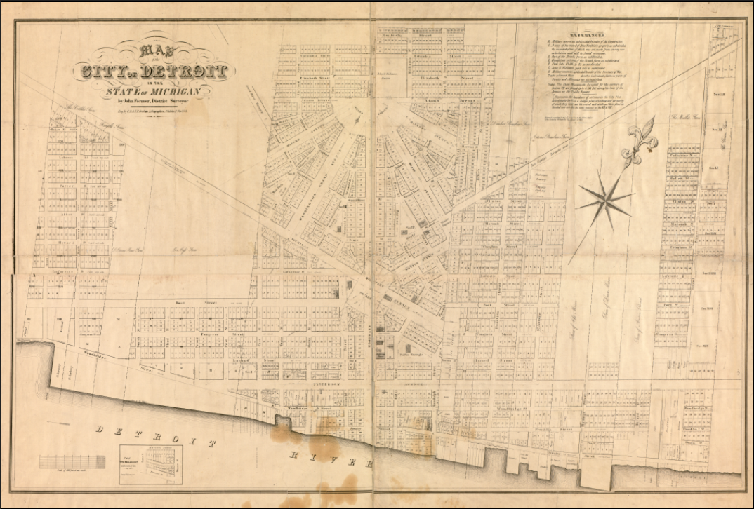
Step into early Detroit with this detailed 1835 city plan, capturing the city during its formative years as a growing Great Lakes settlement. This historic map presents Detroit’s distinctive radial street design radiating from central points, reflecting early urban planning influences and the city’s strategic importance along the Detroit River. Long before its rise as an industrial powerhouse, Detroit is shown here as an ambitious frontier city organizing itself for expansion, commerce, and civic life.
Historical Context
In 1835, Detroit stood at a pivotal moment in its development. Michigan had just achieved statehood, and Detroit was transitioning from a fortified trading post into a structured American city. The radial avenues and orderly blocks shown on this map echo Pierre L’Enfant–style planning principles, emphasizing movement, visibility, and civic order. This was Detroit before railroads, factories, and automobiles—defined instead by land speculation, river trade, and its role as a gateway between the eastern United States and the expanding Midwest.
The Map’s Features
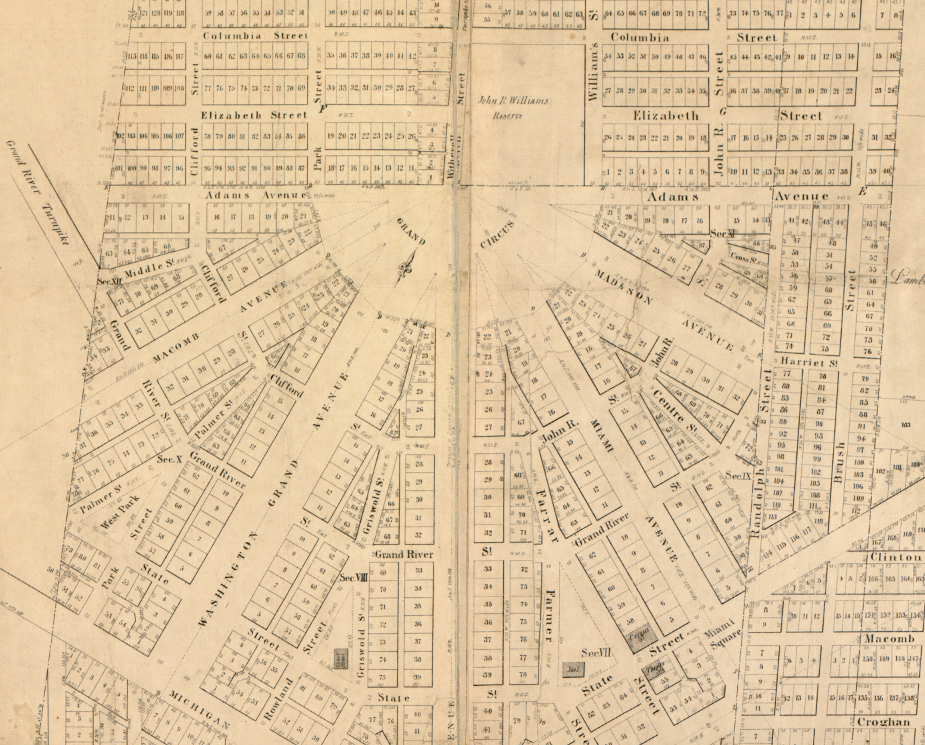
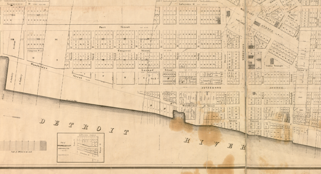
This city plan clearly illustrates Detroit’s early street layout, property lots, ward divisions, and waterfront alignment along the Detroit River. The radial avenues converge toward central hubs, while rectangular blocks fill the surrounding grid, offering a rare look at how early planners envisioned Detroit’s growth. The riverfront is prominently featured, underscoring its importance to transportation, trade, and daily life in the city’s earliest decades.
Historical Significance
As one of the earliest comprehensive maps of Detroit, this 1835 plan preserves the blueprint of a city on the brink of transformation. It documents the foundations upon which modern Detroit was built and serves as a tangible connection to the city’s territorial-era ambitions, long before industrialization reshaped its identity. For historians, collectors, and Detroit natives, this map represents the city’s origin story in visual form.
Museum-Quality Reproduction
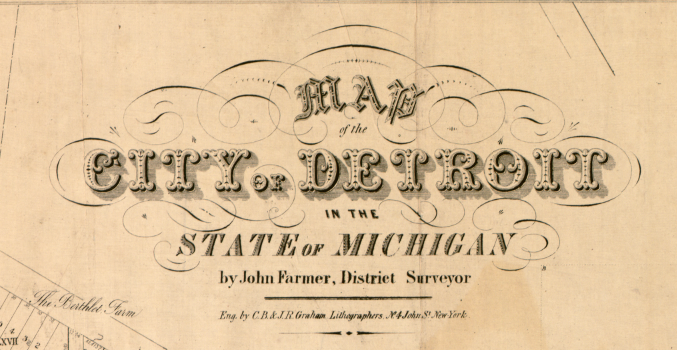
This is a high-quality reproduction of the original 1835 city plan, professionally printed using museum-grade methods and materials to preserve every line, label, and cartographic detail. Each piece is produced on archival Hahnemühle paper using the Giclée printing process, ensuring exceptional clarity, durability, and a refined finish suitable for display in any setting.
Perfect For:
• Detroit residents and those with deep roots in the city
• History enthusiasts interested in early American urban planning
• Collectors of pre-industrial city maps and Great Lakes history
• Offices, libraries, and study spaces
• Gifts for Michigan natives and historical map collectors
Specifications:
• Original Publication: 1835
• Style: Early American city plan map
• Product Type: High-Quality Reproduction Print
Dimensions (Width x Height): 27 x 18.3
Each map is printed using the finest materials and methods. Your map will be handled with white gloves from start to finish. We use the Giclée printing method on Hahnemühle paper, which produces a clear, extremely detailed, durable map that is perfect to be proudly displayed in your home or office. Digital watermark does not appear on your purchased map.
Choose options
