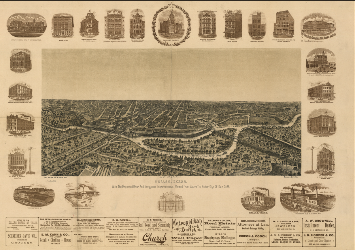
Dallas, Texas – Panoramic Bird’s-Eye View City Map
Dallas, Texas – Panoramic Bird’s-Eye View City Map
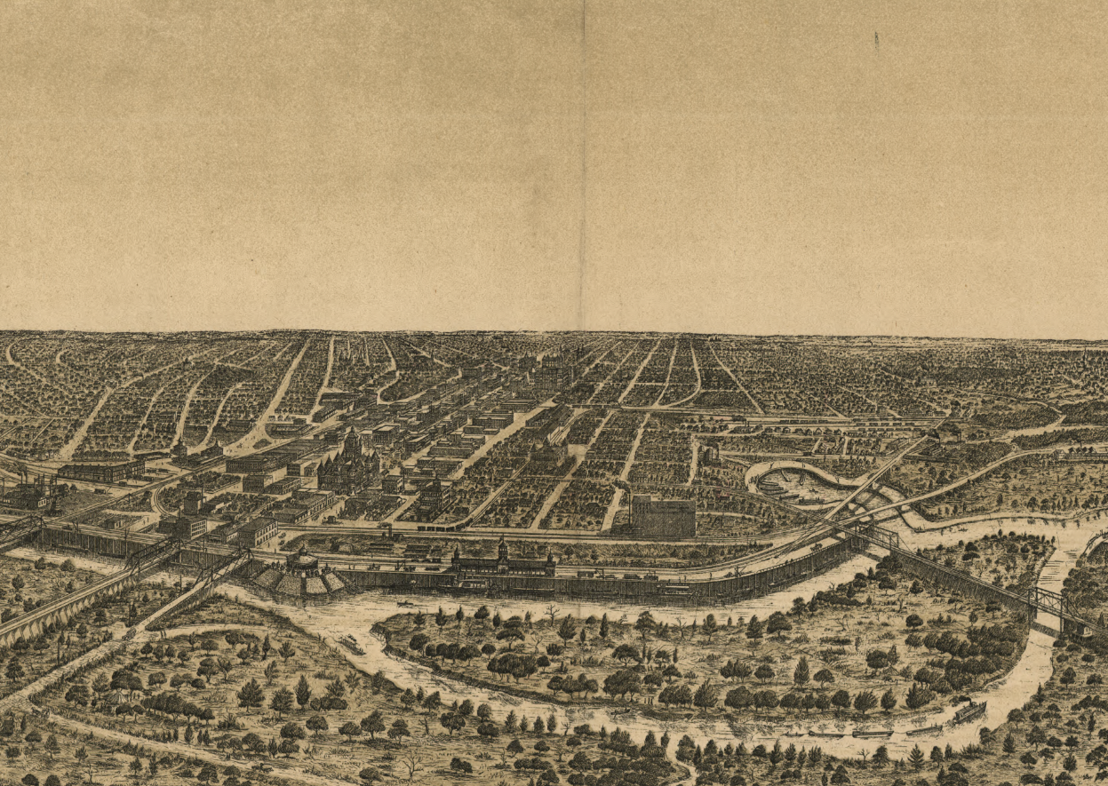
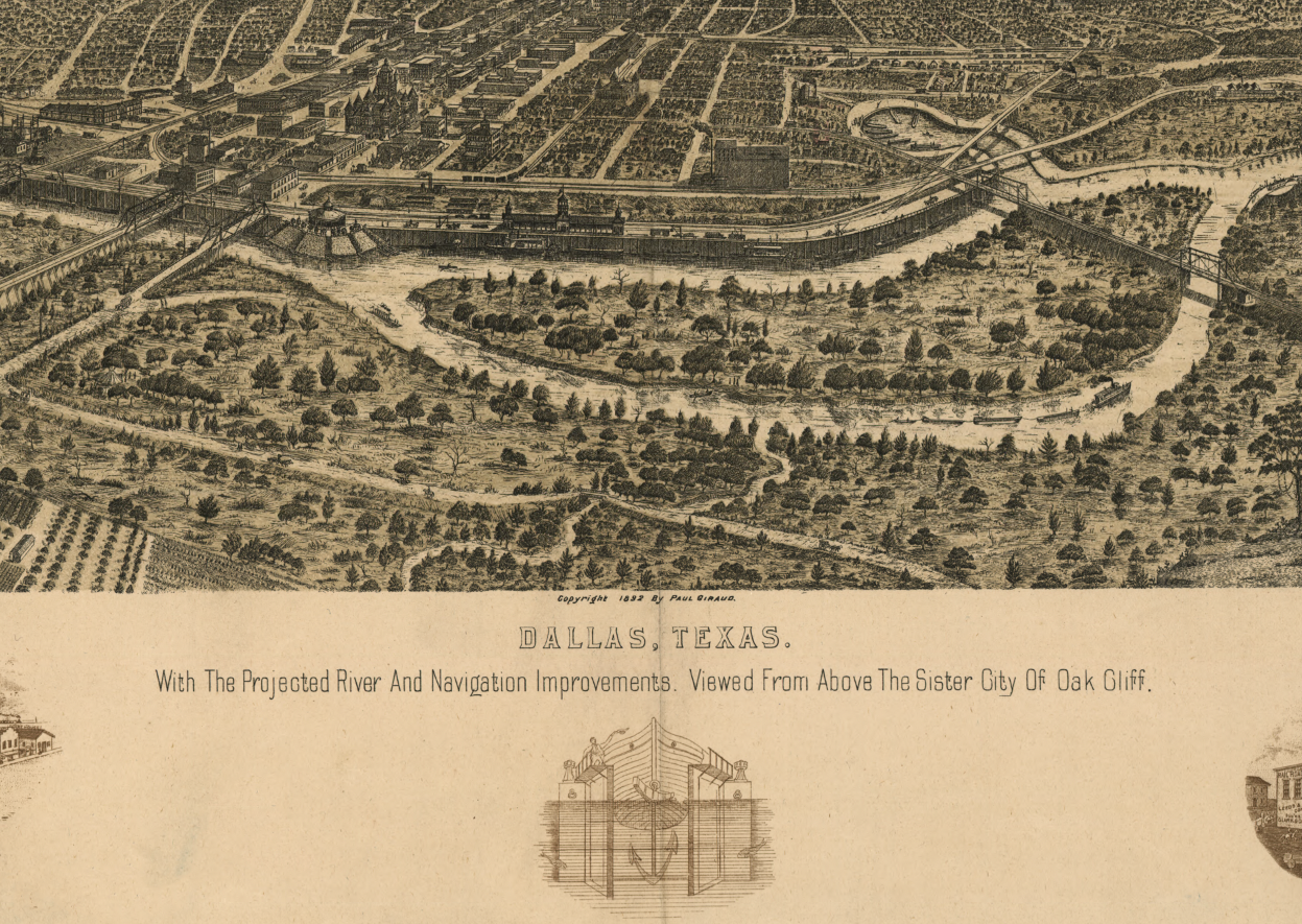
Experience Dallas at the height of its late-19th-century ambition with this expansive panoramic bird’s-eye view of the city. Drawn from an elevated vantage point above Oak Cliff, this richly detailed map presents Dallas as a rapidly modernizing urban center, with rail lines, bridges, river improvements, and a dense street grid stretching across the Trinity River basin. Surrounding vignette illustrations highlight prominent buildings, businesses, and civic institutions, reinforcing the city’s confidence and momentum during a pivotal era of growth.
Historical Context
Created during a period when Dallas was emerging as one of the most important commercial hubs in Texas, this map reflects the city’s transformation from regional crossroads to metropolitan powerhouse. Railroads converging on the city fueled trade, manufacturing, and population growth, while proposed river and navigation improvements signaled aspirations for expanded commerce and infrastructure. The view captures Dallas just as it was positioning itself as a dominant economic force in North Texas and beyond.
The Map’s Features
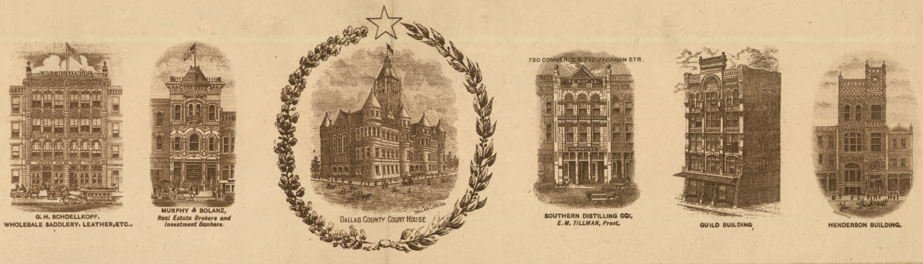
This bird’s-eye view illustrates Dallas’s urban fabric in remarkable detail, showing street layouts, rail corridors, bridges, neighborhoods, and industrial areas, all rendered in a sweeping panoramic perspective. Decorative border illustrations depict notable hotels, office buildings, factories, and public structures, offering a visual catalog of the institutions that defined Dallas’s identity at the time. The combination of cartography and illustration makes this both a geographic reference and a celebratory city portrait.
Historical Significance
Panoramic city maps like this were statements of pride and progress, often commissioned to promote growth and investment. This example preserves a moment when Dallas was actively shaping its future, documenting how infrastructure, commerce, and urban planning came together to define the modern city. For residents, historians, and collectors, it provides a powerful visual connection to Dallas’s formative years.
Museum-Quality Reproduction
This is a high-quality reproduction of the original panoramic map, professionally printed using museum-grade methods and materials to preserve every fine line and illustration. Each map is produced on archival paper using the Giclée printing process, ensuring exceptional clarity, durability, and a refined finish suitable for display in any home or office.
Perfect For:
• Dallas residents and lifelong locals
• Texas history enthusiasts
• Collectors of panoramic and bird’s-eye view maps
• Offices, libraries, and study spaces
• Meaningful gifts with strong local connection
Specifications:
• Created/Publication: 1891
• Style: Panoramic bird’s-eye view city map
• Product Type: High-quality reproduction print
Dimensions (Width x Height): 28.8 x 20.4
Each map is printed using the finest materials and methods. Your map will be handled with white gloves from start to finish. We use the Giclée printing method on archival paper, producing a clear, extremely detailed, durable map perfect for proud display in your home or office. Digital watermark does not appear on your purchased map.
Choose options
