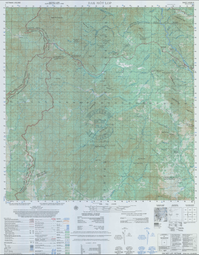


Dak To, Vietnam (Western Hills) – 1965 Military Topographical Map
Dak To, Vietnam (Western Hills) – 1965 Military Topographical Map
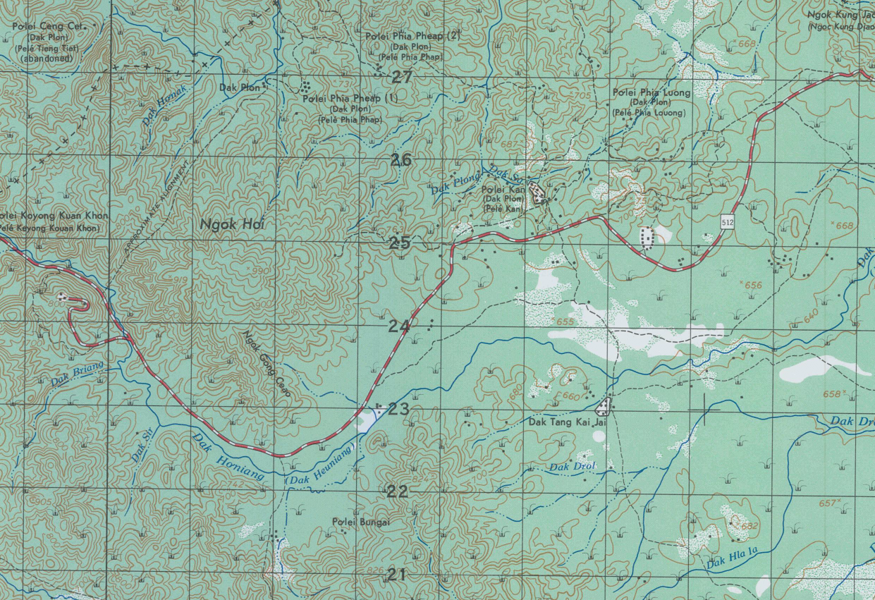
In November 1967, the Central Highlands of Vietnam became the site of some of the most brutal close-quarters combat of the entire war. The Battle of Dak To — fought across a series of densely jungled ridgelines and steep hillsides in Kontum Province — pitted elements of the U.S. Army's 173rd Airborne Brigade and 4th Infantry Division against entrenched North Vietnamese Army regulars in a grinding campaign of attrition that cost both sides dearly. This 1965 military topographical map documents the rugged western hill terrain of the Dak To operational area, including Hills 875 and 882 — the numbered elevations that became synonymous with sacrifice, courage, and the brutal calculus of highland warfare.
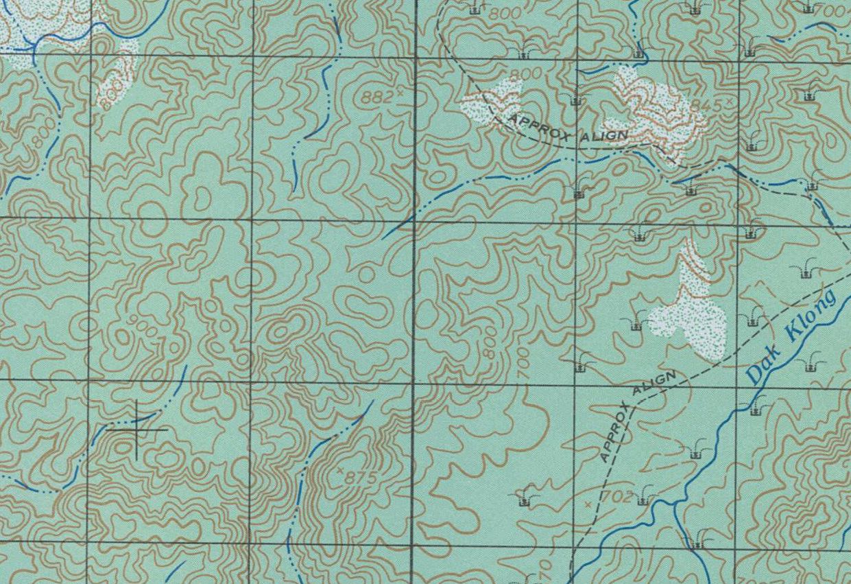
Historical Context The Battle of Dak To unfolded across three phases in the fall of 1967 as NVA forces from the 1st NVA Division sought to draw American units into the remote highlands and inflict maximum casualties. The hill fights of Phase III — concentrated in the densely forested terrain depicted on this map — reached their savage apex at Hill 875. On November 19, 1967, the 2nd Battalion, 503rd Infantry of the 173rd Airborne Brigade launched an assault up Hill 875's jungle slopes into a prepared NVA defensive network of fortified bunkers, spider holes, and interlocking fields of fire. The battalion was nearly destroyed in the fighting that followed, suffering catastrophic casualties before reinforcements arrived. After four days of continuous combat, American forces reached the crest on November 23 — Thanksgiving Day — and found the hill abandoned. The battle for Dak To's western hills remains one of the most costly engagements in the history of the 173rd Airborne Brigade.
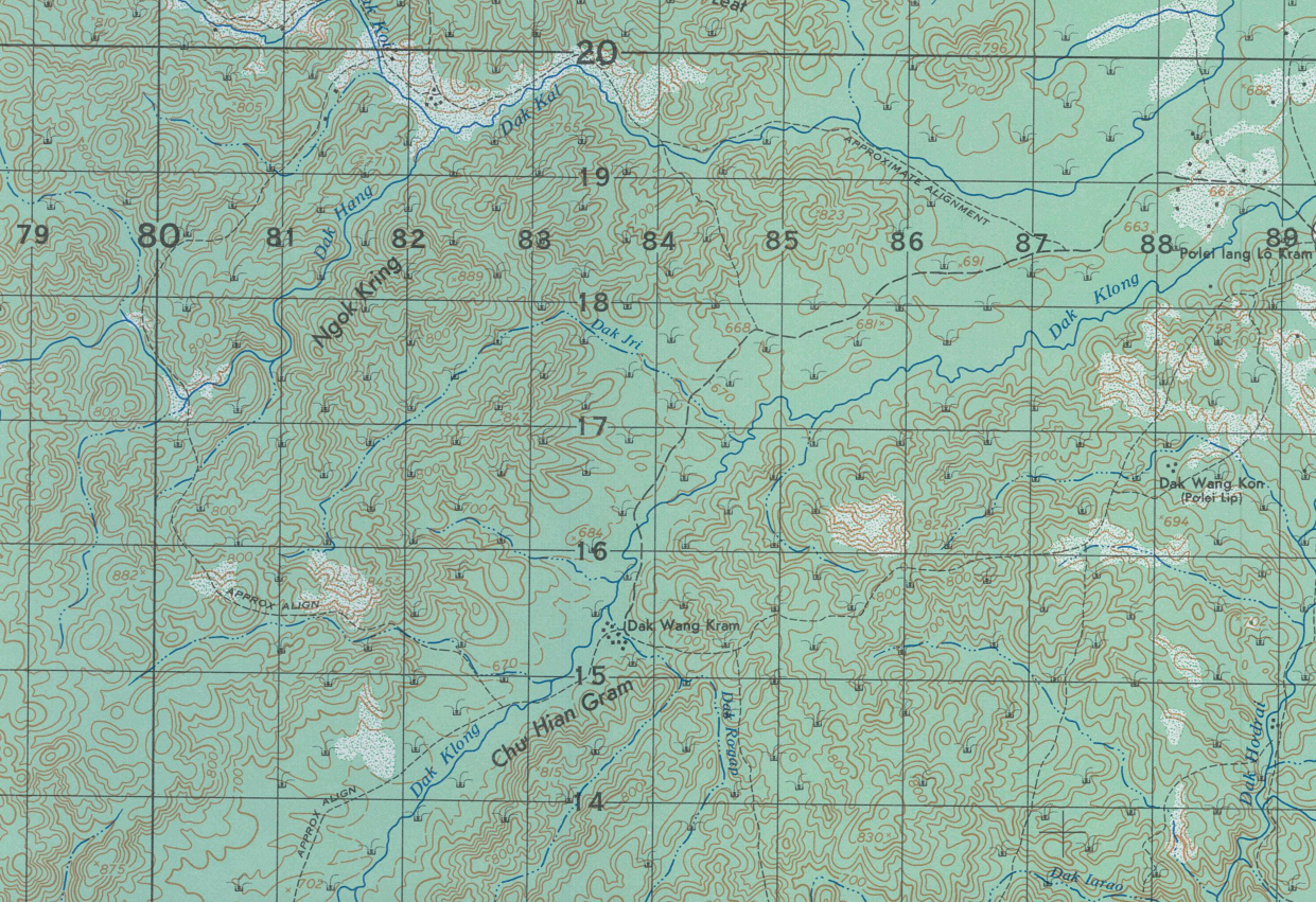
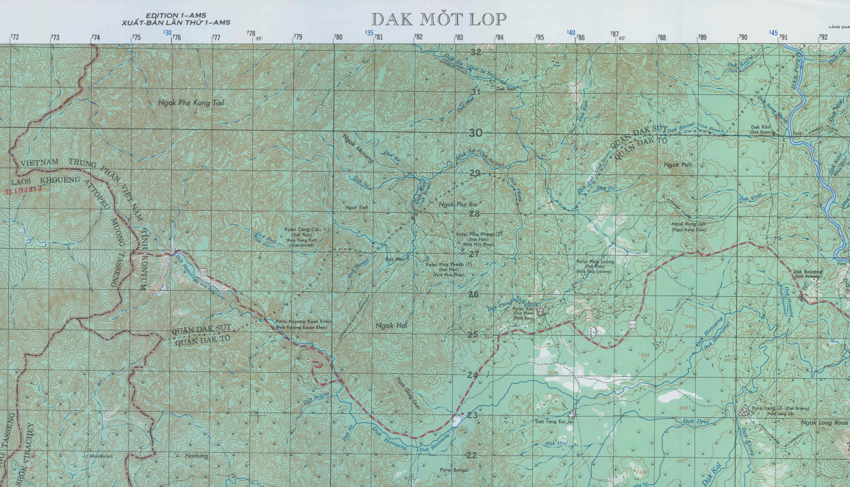
The Map's Features This detailed military topographical map presents the western hill terrain of the Dak To operational area at a scale of 1:50,000, with precision elevation contour lines documenting the steep ridgelines, ravines, and jungle-covered hillsides that defined the tactical environment of the 1967 hill fights. Hills 875 and 882 — the numbered elevations central to Phase III combat operations — are identifiable within the map's coverage area. River systems, trail networks, and the dense topographical complexity of Kontum Province's highland interior are rendered with the cartographic detail used by U.S. and ARVN commanders to plan and execute operations in this demanding terrain. The map's grid system and marginal data reflect standard military mapping conventions of the Vietnam-era series produced for operational use in the Central Highlands.
Historical Significance The Battle of Dak To and the hill fights of November 1967 occupy a defining place in the institutional memory of the U.S. Army's airborne forces. For the 173rd Airborne Brigade — the first conventional Army unit committed to ground combat in Vietnam — Dak To represented the costliest engagement of the war, and Hill 875 became a name carried by the brigade for generations. A topographical map of this terrain is not an abstraction; it is the precise document that commanders, forward observers, and fire support coordinators used to navigate, call fires, and plan assaults across these same ridgelines. For veterans of the 173rd Airborne, the 4th Infantry Division, or any unit that fought in Kontum Province, this map is a direct cartographic record of the ground where their brothers fought and fell.
Framing Options This map is available unframed or professionally framed and ready to hang. Choose from a classic Black Frame or a warm Walnut Brown Frame, each matted with 4-ply white archival mat board and finished with non-glare acrylic glazing for a clean, museum-style presentation. Framed orders are professionally assembled and shipped directly to your door. Please allow 3–4 weeks for delivery on framed orders.
Museum-Quality Reproduction This is a high-quality reproduction of the original 1965 military topographical map, professionally printed on archival Hahnemühle paper using the Giclée printing process to preserve fine cartographic detail, line clarity, and period authenticity for long-term display.
Perfect For:
- Vietnam War veterans and military families with service connections to the Central Highlands
- Veterans and families of the 173rd Airborne Brigade and 4th Infantry Division
- Military history collectors specializing in Vietnam-era operations
- Home offices, libraries, and veteran memorial displays
- Gifts honoring those who served in Kontum Province and the Dak To campaign
Specifications:
- Original Publication: 1965
- Scale: 1:50,000
- Style: Military topographical operational map
- Conflict: Vietnam War — Battle of Dak To (1967)
- Product Type: High-Quality Reproduction Print
Dimensions (Width x Height): 22.4 x 28.9
Each map is printed using the finest materials and methods. Your map will be handled with white gloves from start to finish. We use the Giclée printing method on Hahnemühle paper, which produces a clear, extremely detailed, durable map perfect for proud display in your home or office.
Choose options
