Da Nang Air Base, Vietnam – 1969 Topographical Map
Da Nang Air Base, Vietnam – 1969 Topographical Map
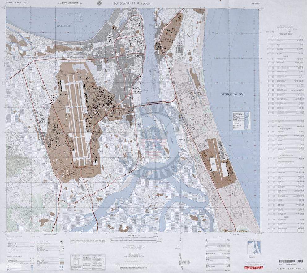
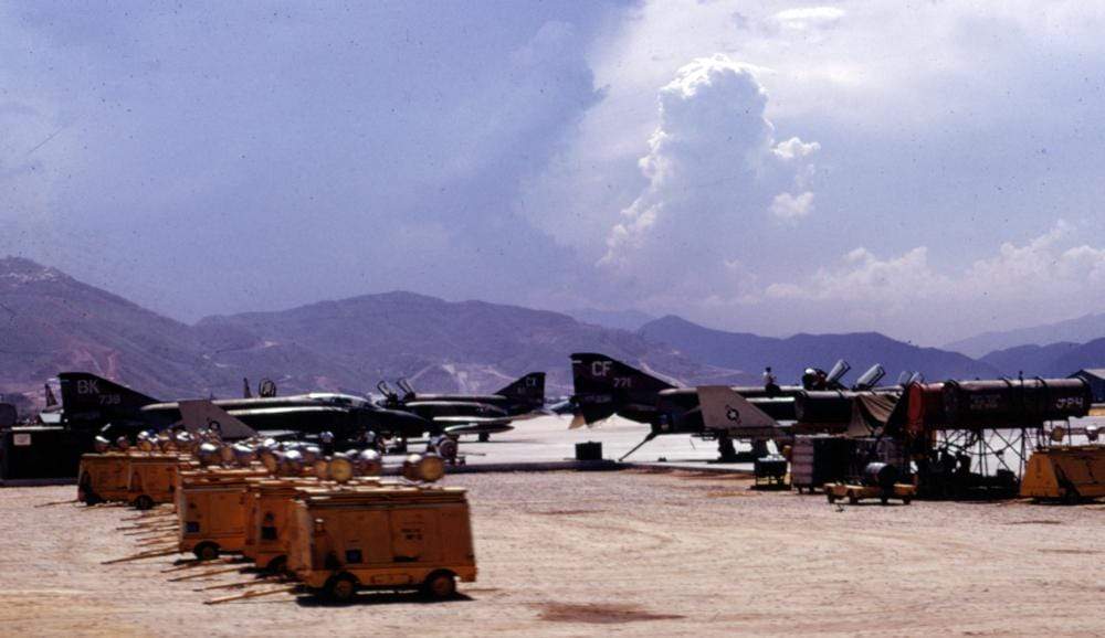
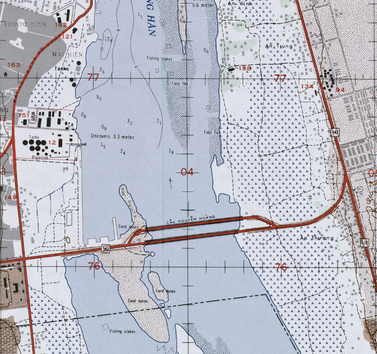
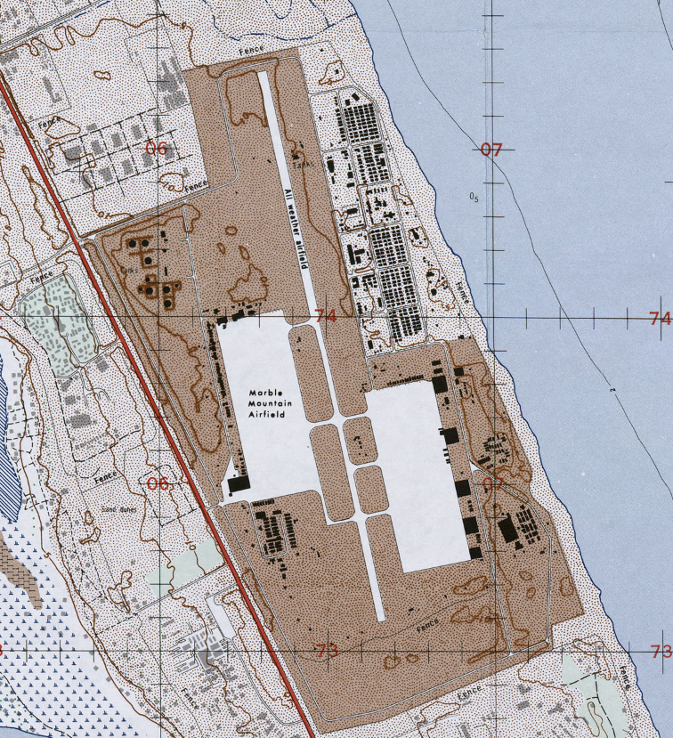
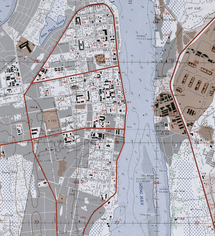
Da Nang Air Base was one of the largest and most strategically significant air installations supporting the war in Vietnam. Army, Air Force, and Marine aviation units were all stationed at Da Nang, with American forces beginning to arrive as early as 1962. For many U.S. servicemen, Da Nang was their first step onto Vietnamese soil. This detailed 1969 topographical map captures the air base and surrounding terrain at the height of the conflict.
Historical Context By 1969, Da Nang served as a critical hub for air operations in I Corps Tactical Zone. From fighter and bomber missions to transport, reconnaissance, and medical evacuation flights, the base was central to American and allied strategy in northern South Vietnam. Its location along the South China Sea and near key contested regions made it indispensable to both offensive and defensive operations.
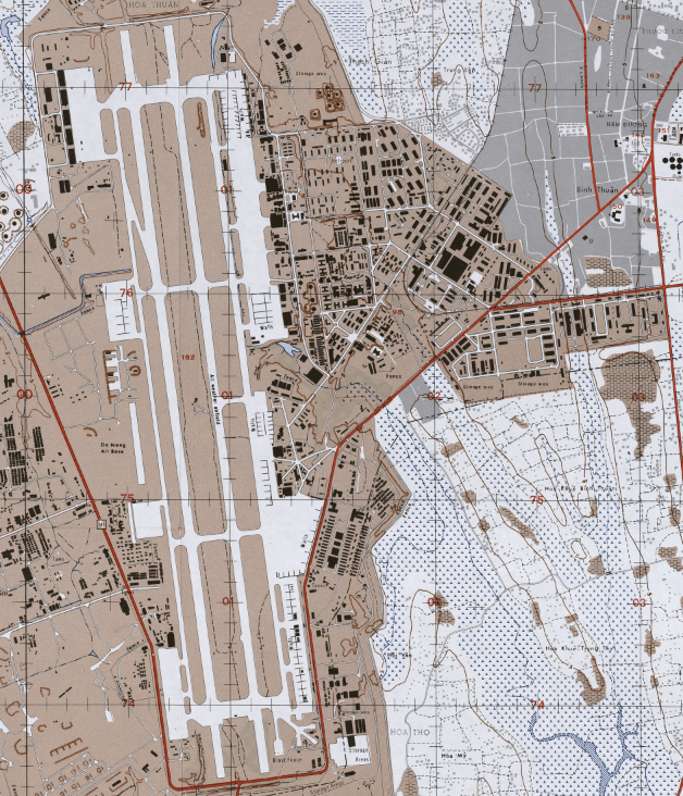
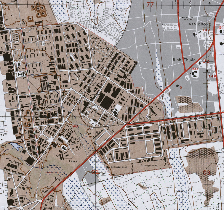
The Map’s Features This large-scale topographical map (1:12,500) shows runway configurations, base infrastructure, surrounding road networks, waterways, elevation contours, and coastal features in precise military detail. The layout of the airfield complex, nearby installations, and natural terrain provides a clear operational snapshot of the base during the Vietnam War era.
Historical Significance As one of the primary air power centers in Southeast Asia, Da Nang played a vital role in sustaining U.S. and allied operations. This map documents the physical footprint of that effort, preserving a detailed record of the infrastructure that supported thousands of air missions during the conflict.
Museum-Quality Reproduction This is a high-quality reproduction of the original 1969 topographical map, professionally printed on archival Hahnemühle paper using the Giclée printing process to preserve fine cartographic detail, line clarity, and period accuracy for long-term display.
Perfect For:
• Vietnam War veterans and military families
• Aviation and military history enthusiasts
• Collectors of Cold War–era military cartography
• Offices, studies, and veteran memorial spaces
• Gifts honoring service in Southeast Asia
Specifications:
• Original Publication: 1969
• Scale: 1:12,500
• Style: Military topographical installation map
• Battle/Conflict: Vietnam War
• Product Type: High-Quality Reproduction Print
Dimensions (Width x Height): 23.4 x 20.7
Each map is printed using the finest materials and methods. Your map will be handled with white gloves from start to finish. We use the Giclée printing method on Hahnemühle paper, which produces a clear, extremely detailed, durable map perfect for proud display in your home or office.
Digital watermark does not appear on your purchased map
Choose options
