




Charleston Harbor, South Carolina – Civil War Era Defensive Battle Map
Charleston Harbor, South Carolina – Civil War Era Defensive Battle Map
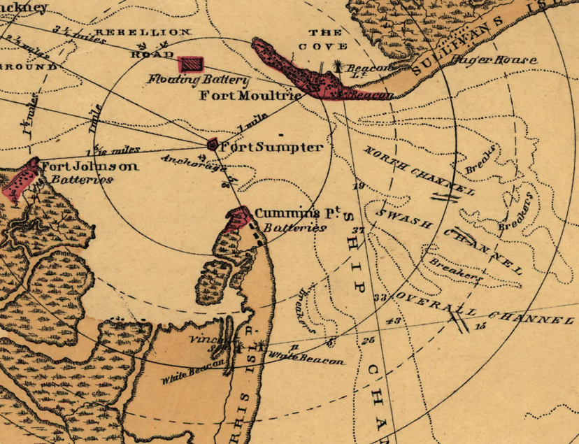
Charleston Harbor was the strategic and symbolic heart of the Confederate war effort — the port city where secession was born, where the first shots of the Civil War were fired, and where Union naval and land forces spent years attempting to reduce one of the most heavily fortified harbor complexes in North America. This Civil War-era sketch of Charleston Harbor, drawn by M.A. Williams, Civil Engineer, and published by L. Prang & Co. of Boston, documents the defensive architecture of the harbor with precision — charting the positions, layouts, and effective ranges of the fortifications that guarded Charleston's approaches, centered on the iconic star-shaped fortress at the harbor's throat: Fort Sumter.
Historical Context When Confederate artillery opened fire on the Union garrison at Fort Sumter on April 12, 1861, the shots that echoed across Charleston Harbor signaled the beginning of four years of devastating war. The harbor's defensive network — anchored by Fort Sumter on its man-made island, Fort Moultrie on Sullivan's Island, and Castle Pinckney in the inner harbor — was designed to make Charleston impregnable from naval assault. Union forces would spend the better part of three years testing that proposition. A sustained ironclad naval attack in April 1863 was repulsed in under two hours. A combined siege and bombardment campaign beginning in August 1863 reduced Fort Sumter to rubble but failed to dislodge its garrison. Charleston did not fall until February 1865, when Sherman's inland advance rendered the harbor defenses irrelevant and Confederate forces evacuated the city.
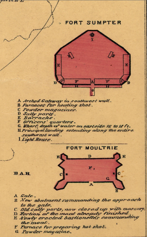
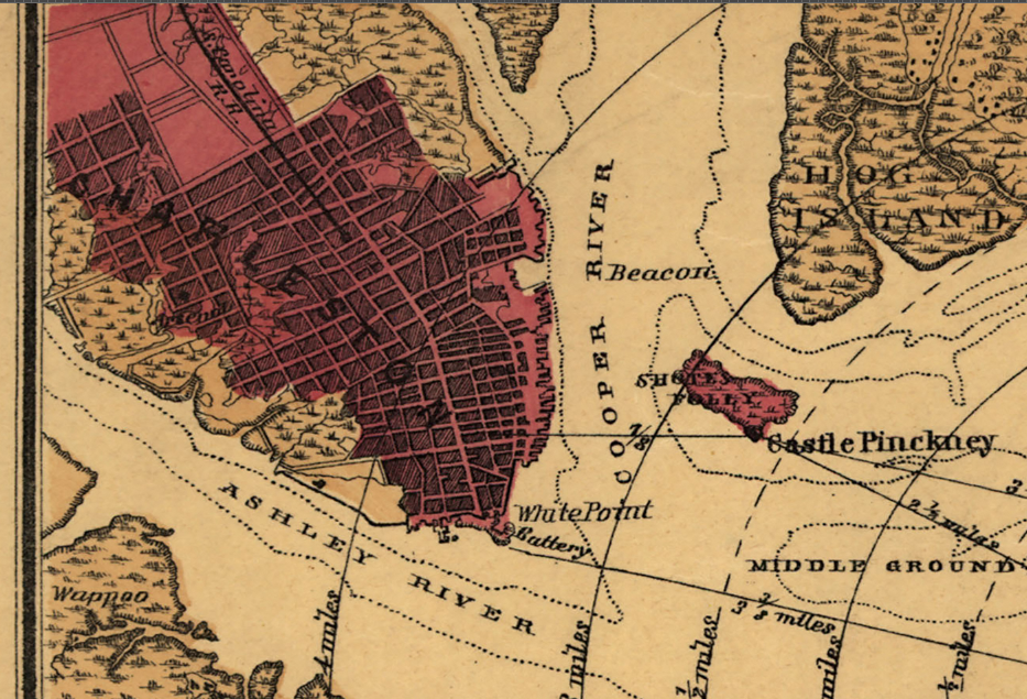
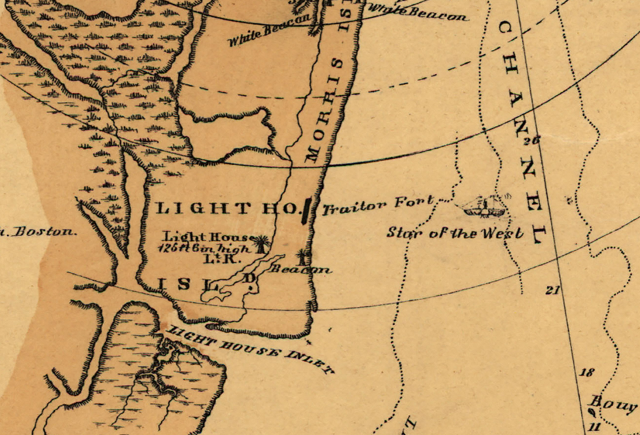
The Map's Features This detailed harbor sketch presents the full defensive geography of Charleston from an operational perspective, with concentric range circles radiating outward from Fort Sumter to document the fort's fields of fire across the harbor approaches. The positions of Fort Moultrie, Castle Pinckney, and the surrounding batteries are marked across James Island, Sullivan's Island, and the inner harbor. Three inset diagrams — each individually keyed — provide detailed architectural floor plans of Castle Pinckney, Fort Sumter, and Fort Moultrie, annotating key structural features including arched gateways, barracks, powder magazines, and positions for hoisting shot. The surrounding waterways, shoals, channels, and barrier islands that shaped every naval approach to the city are rendered with cartographic precision by M.A. Williams, Civil Engineer.
Historical Significance No harbor in the Civil War carried greater symbolic weight than Charleston. Fort Sumter — battered to ruins by Union bombardment yet never taken by assault — became one of the war's most powerful symbols of Confederate defiance and, ultimately, of Union perseverance. A harbor defense map of this caliber, documenting the overlapping fields of fire and fortification layouts that frustrated Union naval operations for nearly four years, is an essential artifact for understanding why Charleston proved so difficult to reduce. It is a primary-source document of the fortified geography that shaped some of the war's most consequential strategic decisions.
Framing Options This map is available unframed or professionally framed and ready to hang. Choose from a classic Black Frame or a warm Walnut Brown Frame, each matted with 4-ply white archival mat board and finished with non-glare acrylic glazing for a clean, museum-style presentation. Framed orders are professionally assembled and shipped directly to your door. Please allow 3–4 weeks for delivery on framed orders.
Museum-Quality Reproduction This is a high-quality reproduction of the original Civil War-era harbor defense map, professionally printed on archival Hahnemühle paper using the Giclée printing process to preserve fine cartographic detail, line clarity, and period authenticity for long-term display.
Perfect For:
- Civil War historians and collectors with an interest in coastal and harbor operations
- Descendants of Union and Confederate soldiers who served in the Charleston theater
- Students of American military engineering and fortification history
- Home offices, libraries, and heritage display settings
- Gifts honoring those with a connection to South Carolina and the Civil War
Specifications:
- Original Publication: Unknown
- Publisher: L. Prang & Co., Boston; drawn by M.A. Williams, Civil Engineer
- Style: Harbor defensive operational map with fortification insets
- Battle/Conflict: Defense of Charleston Harbor (American Civil War)
- Battle Result: Confederate Defense (1861–1865)
- Product Type: High-Quality Reproduction Print
Dimensions (Width x Height): 22.2 x 20.1
Each map is printed using the finest materials and methods. Your map will be handled with white gloves from start to finish. We use the Giclée printing method on Hahnemühle paper, which produces a clear, extremely detailed, durable map perfect for proud display in your home or office.
Choose options
