


Bastogne, Belgium – December 26, 1944 Tactical Situation Battle Map
Bastogne, Belgium – December 26, 1944 Tactical Situation Battle Map
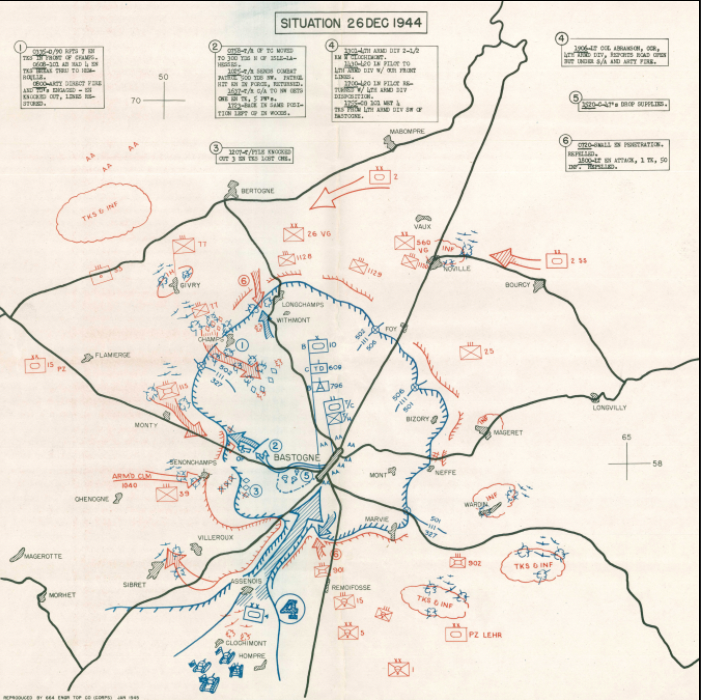
On December 26, 1944, the encircled American garrison at Bastogne, Belgium stood at the center of one of the most dramatic reversals of fortune in World War II. For nine days, the 101st Airborne Division and attached armored and artillery units had held the critical road junction against relentless German armored and infantry assault during the opening of Hitler's Ardennes Offensive. This operational situation map—reproduced by the 8th Engineer Topographic Company in January 1945—captures the battlefield as it appeared on the precise day General George S. Patton's Third Army broke the siege and changed the course of the Battle of the Bulge.
Historical Context The German High Command's Operation Wacht am Rhein, launched December 16, 1944, sought to split Allied lines, seize the port of Antwerp, and force a negotiated settlement in the West. Bastogne, a nexus of seven major roads through the Ardennes, was a strategic imperative for both sides—without it, the German armored spearheads could not sustain their advance. When Brigadier General Anthony McAuliffe famously responded "NUTS!" to the German surrender ultimatum on December 22nd, he committed his outnumbered, under-supplied defenders to holding against overwhelming pressure. December 26, 1944 represents the operational turning point: elements of the 4th Armored Division, driving north from Assenois through a narrow corridor, pierced the German encirclement and restored supply lines to the beleaguered garrison—marking the beginning of the end for the German offensive.
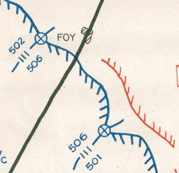
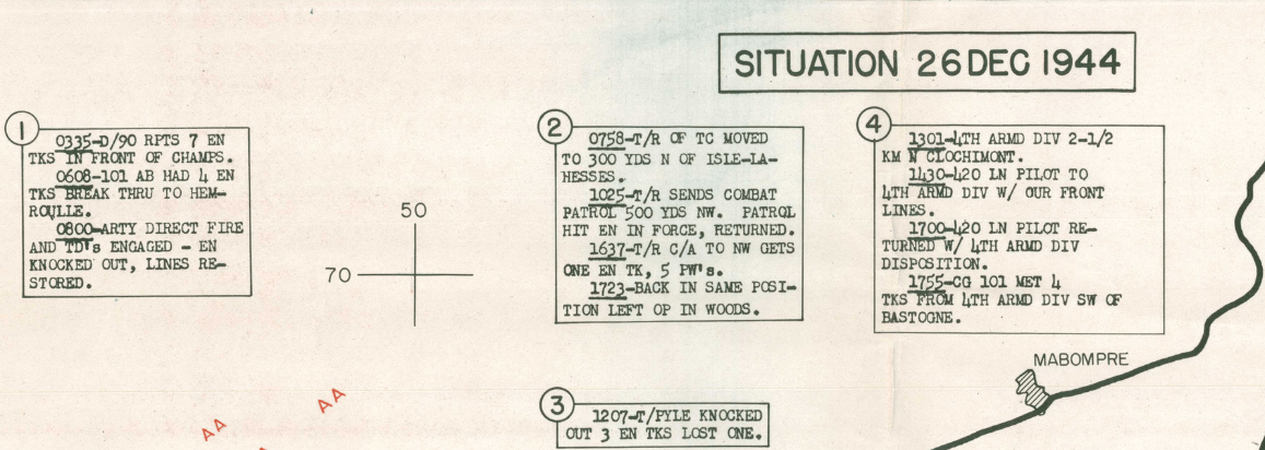
The Map's Features This operational situation map employs the standard U.S. Army Corps cartographic convention of the period, with blue symbols denoting American unit positions and red markings indicating German formations and axes of advance. Bastogne occupies the center of the composition, ringed by the defensive perimeter of the 101st Airborne and supporting armor. The map's numbered tactical annotations—six in total—document time-stamped operational events as they unfolded across the battlefield that day, including German combat actions, American defensive adjustments, aerial resupply drops, and the critical armored penetration from the south. Identified German formations include Panzer Lehr in the southern sector, along with multiple tank and infantry concentrations pressing the perimeter from Flamierge in the west, Noville in the north, and Wardin in the east. Red arrows indicate the vectors of German pressure; the breakthrough corridor at Assenois is rendered with unmistakable tactical clarity.
Historical Significance The relief of Bastogne on December 26, 1944 effectively shattered the strategic coherence of the German Ardennes Offensive. Though fierce fighting would continue into January 1945, the Wehrmacht's window to exploit the breakthrough had closed. Bastogne became synonymous with American resolve under siege—a testament to the defensive tenacity of airborne infantry and the aggressive armored relief operation that Patton executed in record time. This map preserves that precise operational moment, offering a primary-source perspective on the tactical geometry of a battle that has endured as one of the defining engagements of the Western Front.
Museum-Quality Reproduction This is a high-quality reproduction of the original historic map, professionally printed on archival Hahnemühle paper using the Giclée printing process to preserve fine cartographic detail, line clarity, and period authenticity for long-term display.
Perfect For:
- World War II historians and Battle of the Bulge researchers
- Veterans of the European Theater and their families
- Collectors of operational military cartography
- Offices, studies, and library display spaces
- Gifts honoring the sacrifice of the 101st Airborne Division
Specifications:
- Original Publication: January 1945
- Publisher: 8th Engineer Topographic Company, 12th Corps, U.S. Army
- Style: Operational tactical situation map
- Battle/Conflict: Siege of Bastogne, Battle of the Bulge (World War II)
- Battle Result: Allied Victory
- Product Type: High-Quality Reproduction Print
Dimensions (Width x Height): 18.1 x 18.1
Each map is printed using the finest materials and methods. Your map will be handled with white gloves from start to finish. We use the Giclée printing method on Hahnemühle paper, which produces a clear, extremely detailed, durable map perfect for proud display in your home or office.
Choose options
