Baltimore, Maryland – Bird’s-Eye View of the Heart of Baltimore Map
Baltimore, Maryland – Bird’s-Eye View of the Heart of Baltimore Map
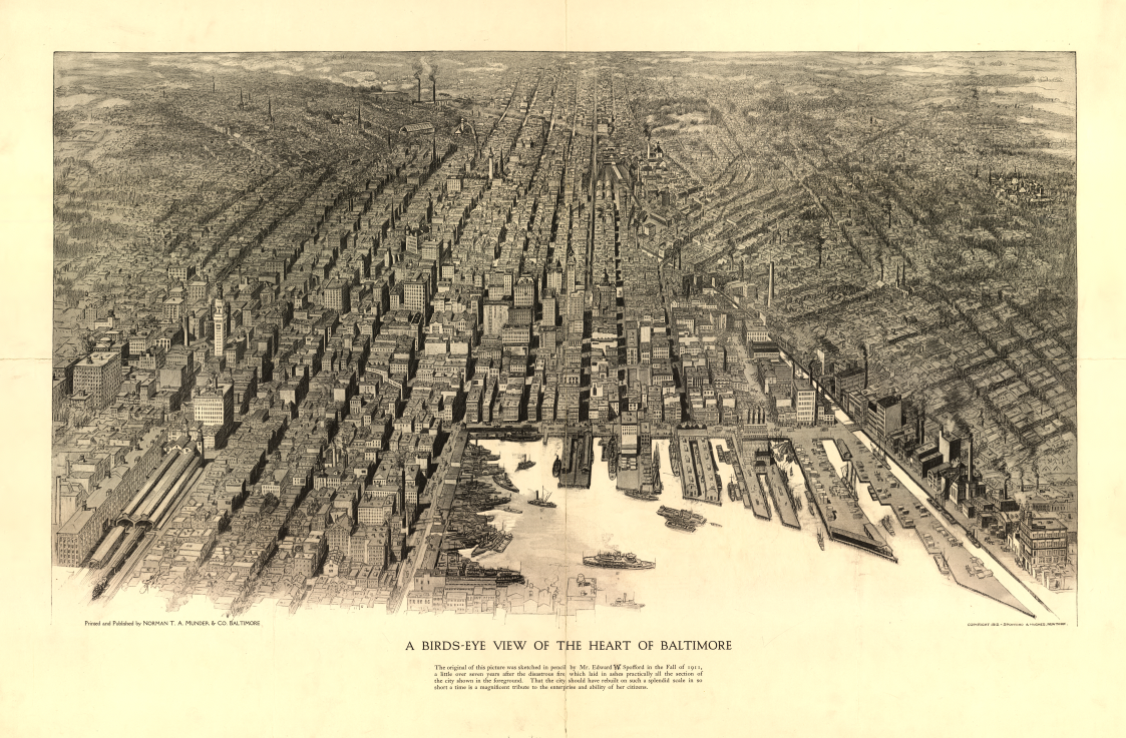
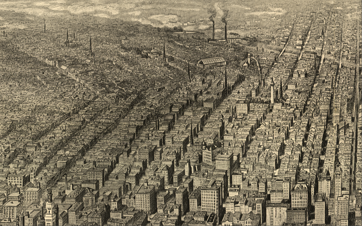
This striking bird’s-eye view captures the dense urban core of Baltimore at the height of its industrial and commercial maturity. Drawn from an elevated perspective over the harbor, the map presents a tightly packed cityscape of warehouses, factories, rail terminals, and wharves radiating inland from the waterfront. The composition emphasizes Baltimore’s identity as a working port city, where maritime trade, rail transport, and manufacturing converged at the heart of the city.
Historical Context This panoramic view reflects Baltimore during a period when American cities were defined by industrial scale and infrastructure. The harbor is crowded with piers and vessels, while the surrounding grid of streets and multistory buildings illustrates a fully developed urban center shaped by commerce and transportation rather than early settlement patterns.
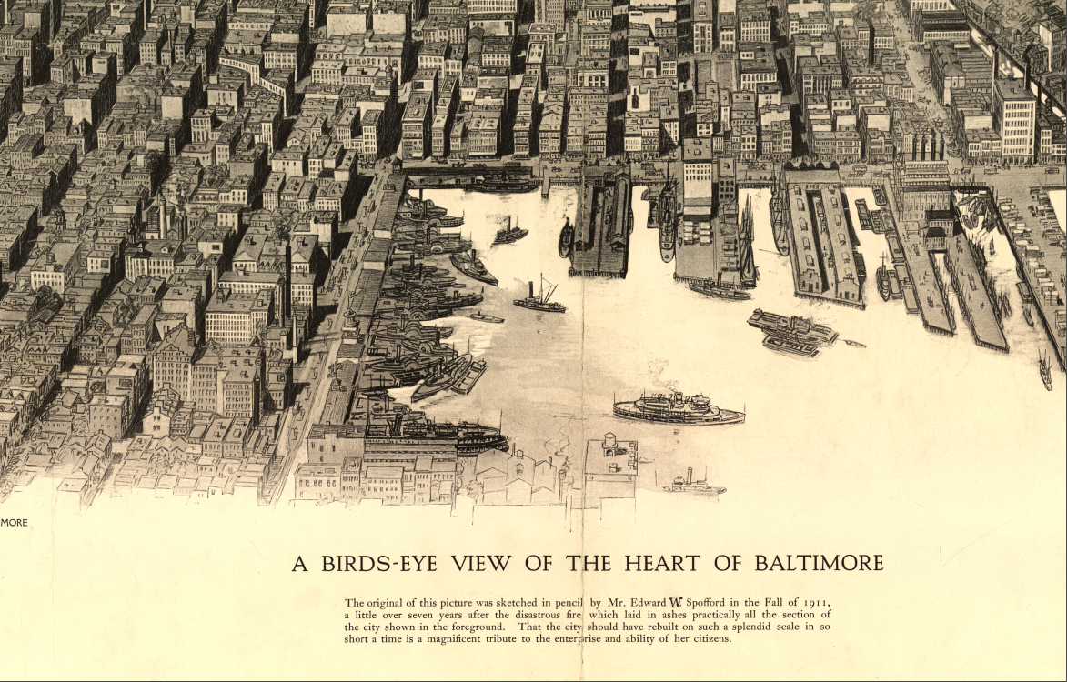
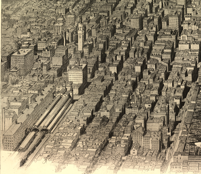
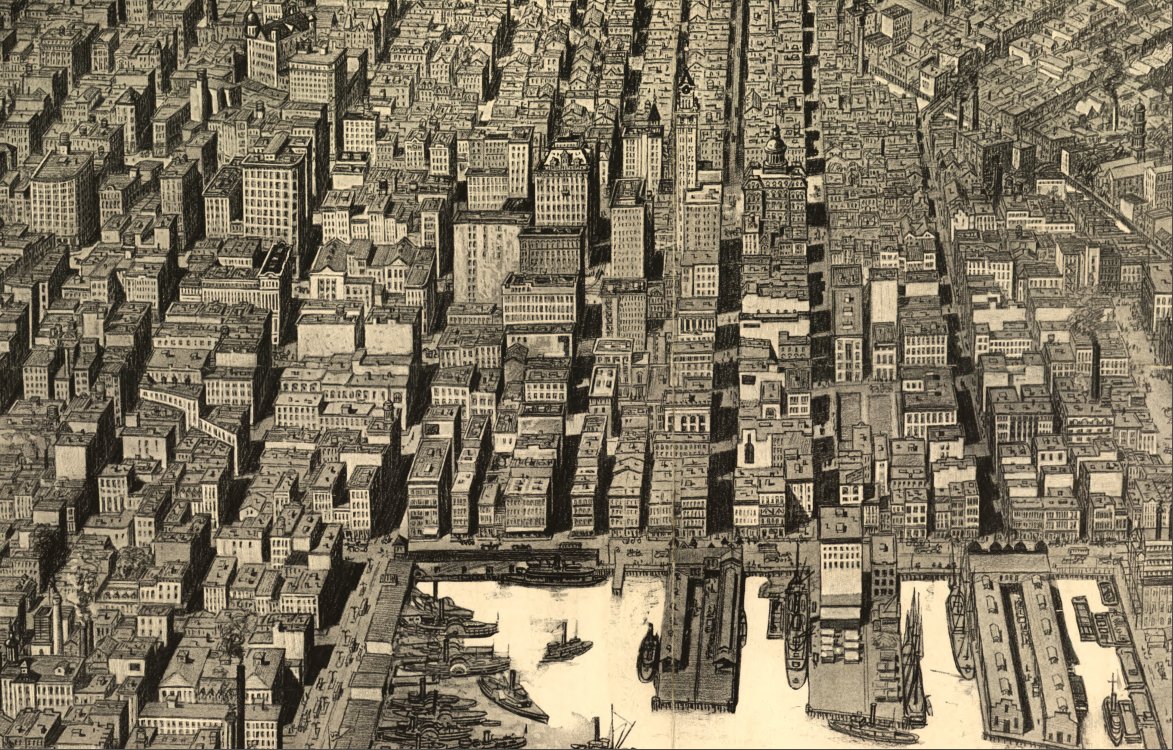
The Map’s Features The view highlights the inner harbor lined with docks and shipping slips, rail yards feeding directly into waterfront terminals, dense blocks of commercial and industrial buildings, and residential neighborhoods extending outward toward the horizon. The perspective compresses the city’s vertical and horizontal growth into a single, dramatic visual narrative of urban intensity.
Historical Significance This map serves as a visual record of Baltimore’s economic engine at work, documenting how the city functioned at its core. It offers historians and collectors insight into the physical scale, density, and infrastructure that defined Baltimore as one of the nation’s most important Atlantic ports.
Museum-Quality Reproduction This is a high-quality reproduction of the original bird’s-eye view, professionally printed on archival Hahnemühle paper using the Giclée printing process to preserve fine linework, tonal depth, and period detail for long-term display.
Perfect For:
• Baltimore residents and local-history enthusiasts
• Collectors of industrial-era city views
• Maritime and urban history researchers
• Offices, libraries, and study spaces
• Gifts celebrating Baltimore’s port heritage
Specifications:
• Original Publication: 1912
• Publisher: Norman T.A. Munder & Co., Baltimore
• Style: Bird’s-eye panoramic city view
• Historical Context: Industrial-era Baltimore and harbor-centric development
• Product Type: High-Quality Reproduction Print
Dimensions (Width x Height): 30 x 19.8
Each map is printed using the finest materials and methods. Your map will be handled with white gloves from start to finish. We use the Giclée printing method on Hahnemühle paper, which produces a clear, extremely detailed, durable map perfect for proud display in your home or office.
Digital watermark does not appear on your purchased map.
Choose options
