Baltimore, Maryland – 1822 Plan of the City of Baltimore Map
Baltimore, Maryland – 1822 Plan of the City of Baltimore Map
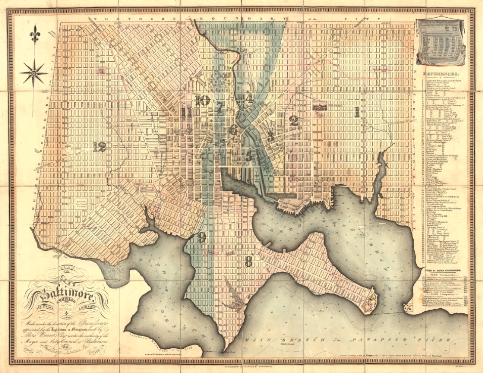
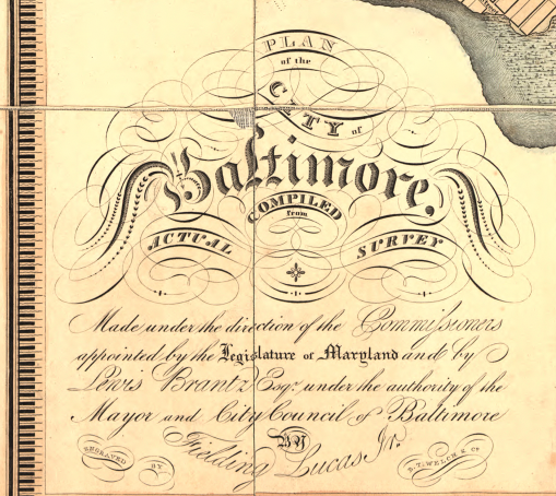
Step into early-19th-century Baltimore with this detailed 1822 city plan published by cartographer and publisher Fielding Lucas Jr. The map captures Baltimore as a growing Chesapeake port city, with the harbor and shoreline carefully drawn and the city divided into wards—an administrative snapshot of how Baltimore was organized and understood at the time.
Historical Context Published in 1822, this map reflects Baltimore in the post–War of 1812 era, as the city expanded commercially and geographically along the Patapsco waterfront. The ward divisions shown here highlight a city formalizing its governance and infrastructure during a period of rapid urban growth.
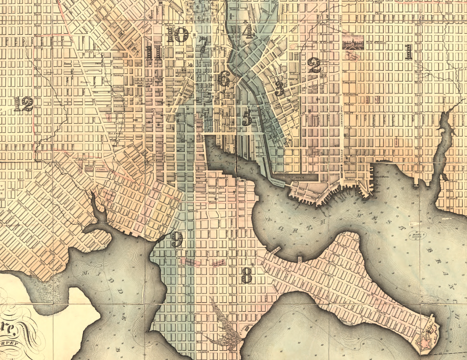
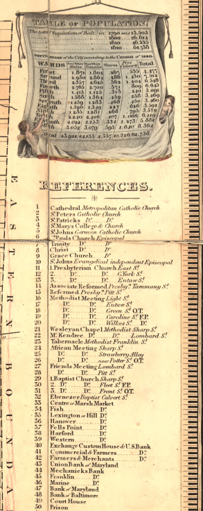
The Map’s Features This hand-colored plan shows Baltimore’s ward boundaries, a street grid spreading inland from the harbor, and water-depth soundings that emphasize the city’s maritime character. It also includes an index of points of interest and a population table, making it both a practical reference map and a civic record of the city’s layout and landmarks.
Historical Significance As an officially entered and published 1822 plan, this map preserves Baltimore’s early civic footprint—how the city was divided, navigated, and connected to the water that powered its economy. It offers a clear view of Baltimore before later industrialization and modern development reshaped the city.
Museum-Quality Reproduction This is a high-quality reproduction of the original 1822 map, professionally printed on archival Hahnemühle paper using the Giclée printing process to preserve crisp linework, hand coloring, and fine period detail for long-term display.
Perfect For:
• Baltimore residents and Maryland history enthusiasts
• Collectors of early American city plans
• Genealogists and local-history researchers
• Offices, libraries, and study spaces
• Gifts celebrating Baltimore heritage
Specifications:
• Original Publication: 1822
• Publisher: Fielding Lucas Jr., Baltimore
• Engraver: B.T. Welch & Co.
• Style: Hand-colored city plan with ward divisions and harbor soundings
• Historical Context: Post–War of 1812 Baltimore and early urban growth
• Product Type: High-Quality Reproduction Print
Dimensions (Width x Height): 29.6 x 23
Each map is printed using the finest materials and methods. Your map will be handled with white gloves from start to finish. We use the Giclée printing method on Hahnemühle paper, which produces a clear, extremely detailed, durable map perfect for proud display in your home or office.
Digital watermark does not appear on your purchased map.
Choose options
