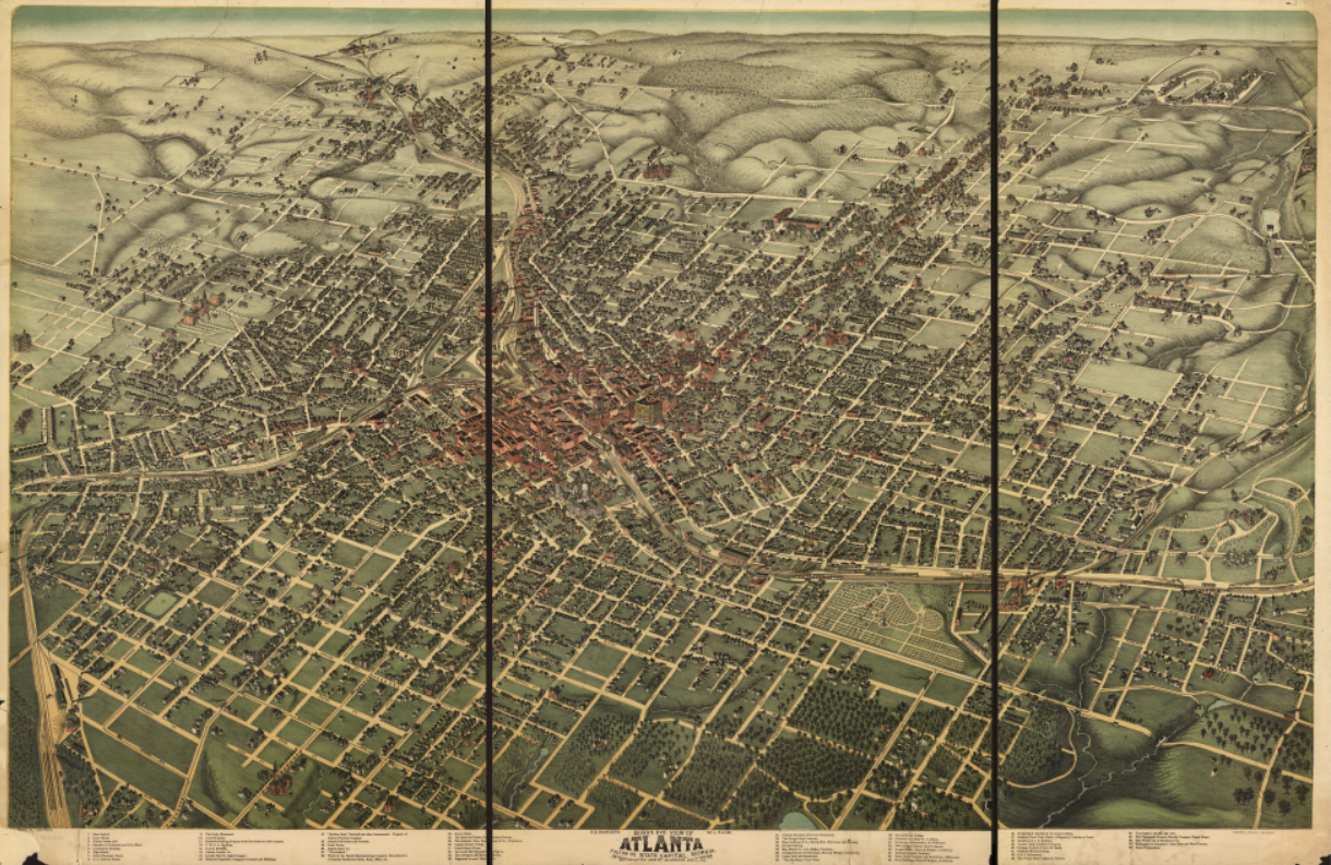
Atlanta, Georgia – 1892 City Map
Atlanta, Georgia – 1892 City Map
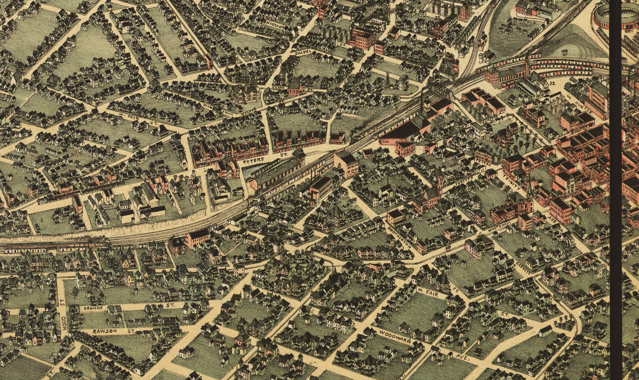
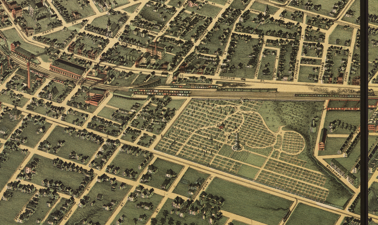
Step into Atlanta at the height of its late-19th-century transformation with this detailed 1892 city map capturing the city as it emerged as the commercial and transportation capital of the New South. Produced during a period of rapid growth, this map presents Atlanta as a fully formed urban center—its street grid, rail infrastructure, and neighborhoods clearly defined as the city moved beyond its postwar rebuilding years into sustained expansion.
Historical Context
By 1892, Atlanta had firmly reestablished itself after the devastation of the Civil War and Reconstruction. Railroads once again converged at the city’s core, fueling commerce, migration, and industrial growth. The population surged, new neighborhoods took shape, and Atlanta’s role as a regional hub for business, education, and transportation became unmistakable. This map reflects the moment when Atlanta was no longer simply rebuilding, but confidently asserting its future as a modern Southern city.
The Map’s Features
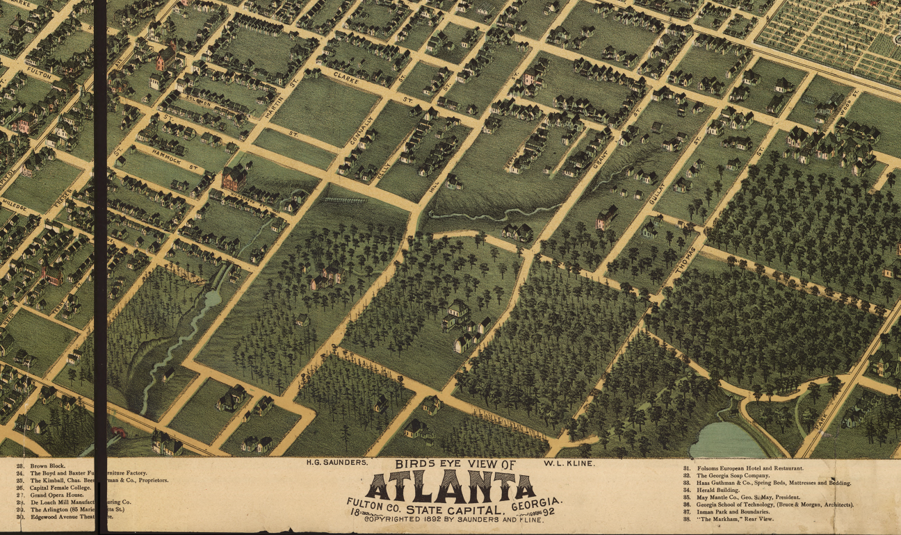
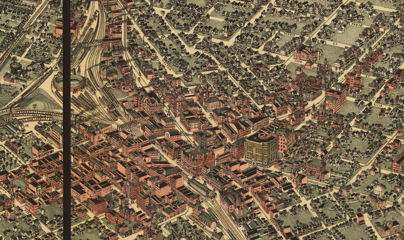
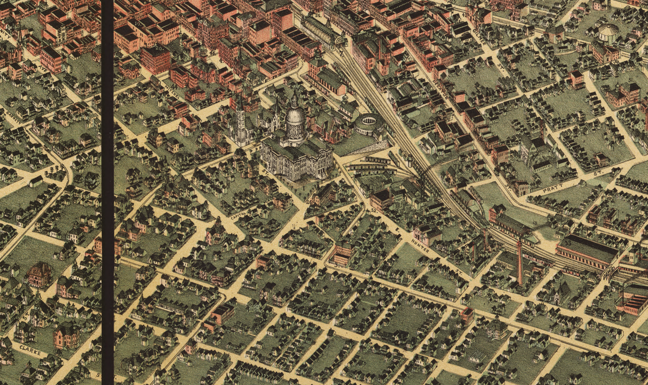
This richly detailed city map presents Atlanta with clarity and balance, showing an organized street network radiating from the city center, major rail lines and depots that defined Atlanta’s economic lifeblood, emerging residential and commercial districts, and the spatial layout that shaped everyday life for residents at the close of the 19th century. The careful labeling and dense urban detail make the map immediately recognizable to anyone familiar with Atlanta’s historic core.
Historical Significance
Maps from this period capture Atlanta at a pivotal crossroads—past the trauma of war, but still early in its rise as a major American city. This 1892 map preserves that transition, illustrating how infrastructure, planning, and commerce combined to create the Atlanta many residents still identify with today. For collectors and locals alike, it offers a tangible connection to the era when Atlanta defined itself as the capital of the modern South.
Museum-Quality Reproduction
This is a high-quality reproduction of the original 1892 city map, professionally printed using museum-grade methods and materials to preserve every detail of this historic urban document. Each piece is produced on archival Hahnemühle paper using the Giclée printing process, ensuring exceptional clarity, durability, and a refined finish suitable for display in any setting.
Perfect For:
• Atlanta residents and longtime locals
• City history and urban development enthusiasts
• Offices, libraries, and study spaces
• Housewarming and relocation gifts
• Collectors of historic American city maps
• Anyone with a personal connection to Atlanta
Specifications:
• Original Publication: 1892
• Style: Late 19th-century American city map
• Product Type: High-Quality Reproduction Print
• Dimensions (Width x Height): 26 x 17.1
Each map is printed using the finest materials and methods. Your map will be handled with white gloves from start to finish. We use the Giclée printing method on Hahnemühle paper, which produces a clear, extremely detailed, durable map perfect for proud display in your home or office.
Digital watermark does not appear on your purchased map.
Choose options
