Atlanta, Georgia – 1871 City Map
Atlanta, Georgia – 1871 City Map
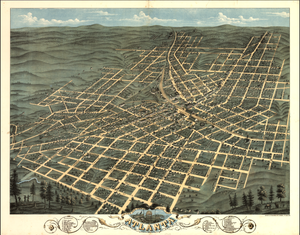
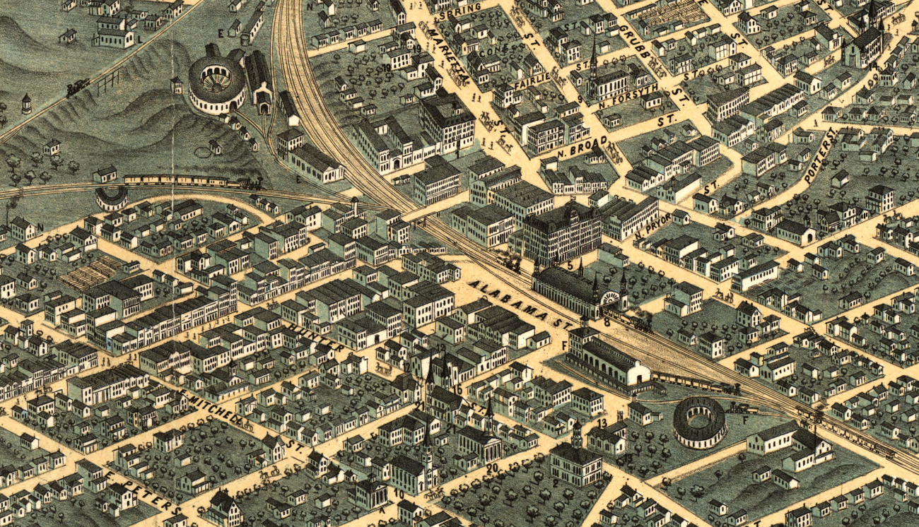
Witness Atlanta in the immediate aftermath of the Civil War with this detailed 1871 city map capturing the city during its critical period of rebuilding and renewal. Created just six years after Atlanta’s near-total destruction, this map documents a city in transition—where rail lines, streets, and neighborhoods were being reestablished as Atlanta began its transformation into the commercial heart of the New South.
Historical Context
In 1871, Atlanta was emerging from one of the most dramatic chapters in its history. Burned during Sherman’s 1864 campaign, the city rebuilt with remarkable speed. Railroads once again converged at its center, businesses reopened, and new construction spread outward from the downtown core. This period marked Atlanta’s determination to reinvent itself, laying the foundation for the explosive growth that would follow in the late 19th century.
The Map’s Features
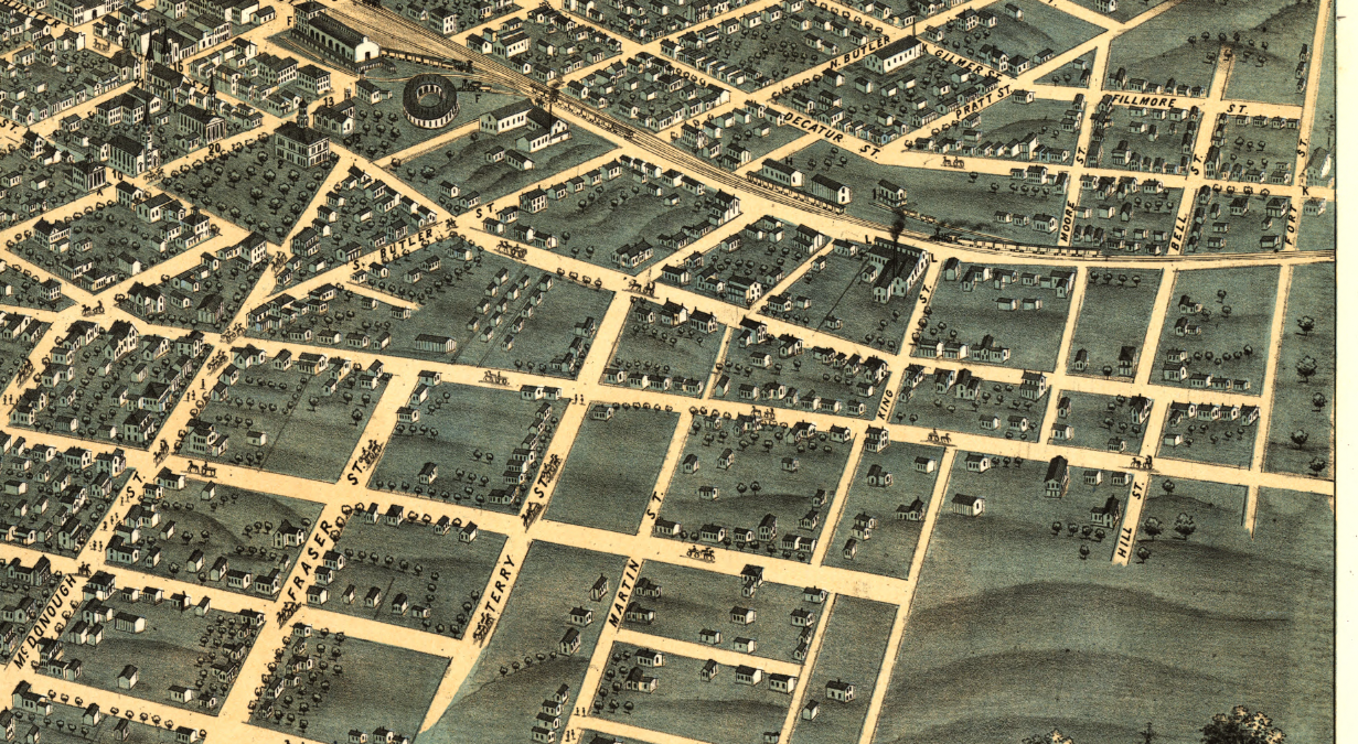
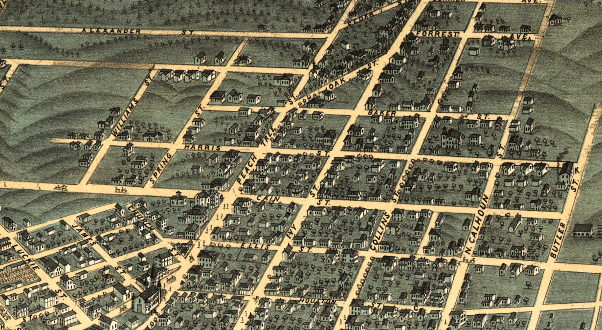
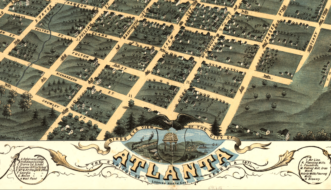
This postwar city map presents Atlanta with clarity and structure, showing the reestablished street grid, rail corridors that drove economic recovery, and the early formation of residential and commercial districts. The layout reflects a city actively reorganizing itself—balancing inherited infrastructure with new development as Atlanta pushed forward from devastation toward opportunity.
Historical Significance
Maps from this era are rare windows into Atlanta’s rebirth. This 1871 map preserves the moment when the city shifted from recovery to renewal, capturing the physical framework that enabled Atlanta’s rise as a regional powerhouse. For residents, historians, and collectors, it represents the resilience and ambition that continue to define Atlanta’s identity today.
Museum-Quality Reproduction
This is a high-quality reproduction of the original 1871 city map, professionally printed using museum-grade methods and materials to preserve every detail of this historic urban document. Each piece is produced on archival Hahnemühle paper using the Giclée printing process, ensuring exceptional clarity, durability, and a refined finish suitable for display in any setting.
Perfect For:
• Atlanta residents and history-minded locals
• Collectors of Reconstruction-era city maps
• Offices, libraries, and study spaces
• Gifts celebrating resilience and civic pride
• Urban history and planning enthusiasts
Specifications:
• Original Publication: 1871
• Style: Post–Civil War American city map
• Product Type: High-Quality Reproduction Print
• Dimensions (Width x Height): 28 x 22
Each map is printed using the finest materials and methods. Your map will be handled with white gloves from start to finish. We use the Giclée printing method on Hahnemühle paper, which produces a clear, extremely detailed, durable map perfect for proud display in your home or office.
Digital watermark does not appear on your purchased map.
Choose options
