

Army Air Forces Western and Southern Europe Attacks – Strategic Bombing Overview Map
Army Air Forces Western and Southern Europe Attacks – Strategic Bombing Overview Map
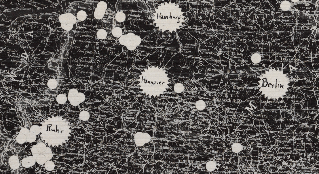
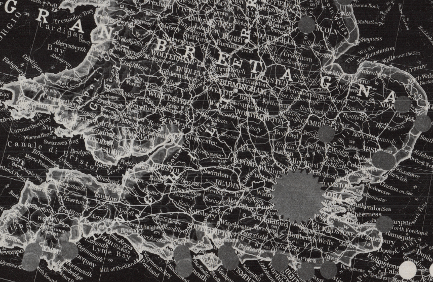
This striking Italian-produced map visualizes the scale and distribution of Allied strategic bombing across Western and Southern Europe during World War II. Featuring English annotations layered over a dense European basemap, it resembles a heat map illustrating the frequency and volume of bombing by the U.S. Army Air Forces and Royal Air Force. The map also marks German bombing activity over England, offering a rare dual-perspective overview of the air war in Europe.
Historical Context
By 1943–1945, the Allied strategic bombing campaign had expanded into a sustained effort targeting industrial centers, transportation networks, oil facilities, and military infrastructure across occupied Europe and Germany itself. From the Ruhr and Hamburg to northern Italy and southern France, air power was used to cripple production, disrupt troop movements, and weaken German defensive capacity ahead of ground offensives. Simultaneously, earlier German bombing campaigns against Britain are reflected here, underscoring the reciprocal nature of the air war.
The Map’s Features
The map covers Western, Southern, and parts of Eastern Europe, including England, France, the Low Countries, Germany, northern Italy, and the Balkans. Large white circular markings indicate concentrated bombing activity, creating a powerful visual representation of intensity and geographic distribution. Major industrial regions such as the Ruhr, Berlin, Hamburg, and northern Italian targets stand out prominently. The layered annotations and contrasting black-and-white design give the map a dramatic, analytical appearance.
Historical Significance
Strategic bombing played a central role in the Allied victory in Europe. By systematically degrading German industrial output and transportation capacity, the campaign limited the Wehrmacht’s ability to reinforce fronts and sustain prolonged resistance. This map serves as a broad operational overview of that sustained air offensive, capturing the immense geographic scope of the European air war.
Museum-Quality Reproduction
This is a high-quality reproduction of the original World War II strategic bombing overview map, professionally printed on archival Hahnemühle paper using the Giclée printing process to preserve contrast, clarity, and intricate geographic detail.
Perfect For:
• World War II aviation and air campaign enthusiasts
• Military historians and researchers
• Veterans and active-duty service members
• Strategic studies professionals
• Offices, studies, and history-focused spaces
Specifications:
• Campaign: European Strategic Air Campaign
• Theater: Western and Southern Europe
• Created/Published: Unknown
• Product Type: High-Quality Reproduction Print
• Battle Result: Allied Victory
Dimensions (Width x Height): 23 x 17.4
Each map is printed using the finest materials and methods. Your map will be handled with white gloves from start to finish. We use the Giclée printing method on Hahnemühle paper, producing a clear, extremely detailed, durable map perfect for proud display in your home or office.
Choose options
