

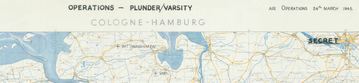
Army Air Forces Attacks on 24 March 1945 – Rhine Crossing Support Map
Army Air Forces Attacks on 24 March 1945 – Rhine Crossing Support Map
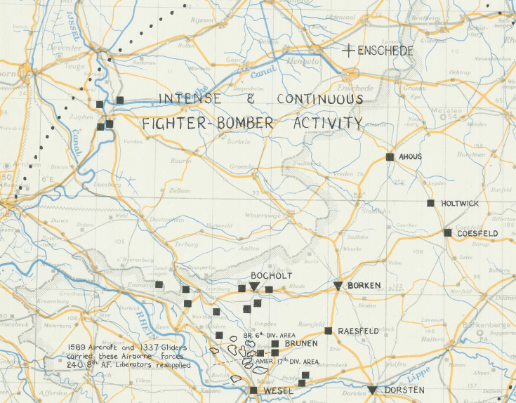
On 24 March 1945, Allied air power played a decisive role in supporting Operations Varsity and Plunder—the airborne assault and river crossing that forced the Rhine River and opened the final drive into Germany. This map documents the concentrated Allied air attacks conducted that day in direct support of the ground offensive.
Historical Context
Operation Plunder marked the large-scale Allied crossing of the Rhine, while Operation Varsity involved one of the largest single-day airborne drops of the war. To ensure the success of the crossing, Allied air forces targeted transportation networks, troop concentrations, and defensive positions east of the Rhine. By disrupting German reinforcement routes, air power helped secure the bridgeheads and accelerate the collapse of organized resistance in western Germany.
The Map’s Features
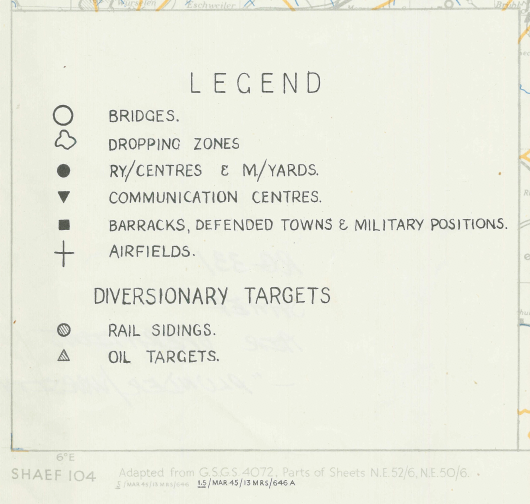
This operational map highlights Allied air strikes on 24 March 1945, with the majority of attacks focused east of the Rhine River. The 1:500,000 scale provides a detailed view of key rail lines, road networks, and strategic targets in the Cologne–Hamburg region. Originally marked “SECRET,” the map reflects the coordinated integration of air and ground operations during one of the final major offensives of the European campaign.
Historical Significance
The successful Rhine crossing signaled the beginning of the end for Nazi Germany. With air superiority firmly established, Allied forces were able to isolate German units, prevent counterattacks, and push rapidly into the heart of the Reich. The operations supported by the strikes shown on this map contributed directly to Germany’s surrender just weeks later in May 1945.
Museum-Quality Reproduction
This is a high-quality reproduction of the original 1945 operational air map, professionally printed on archival Hahnemühle paper using the Giclée printing process to preserve clarity, precision linework, and authentic historical detail.
Perfect For:
• World War II aviation and airborne operations enthusiasts
• Military historians and researchers
• Veterans and active-duty service members
• Strategic studies professionals
• Offices, studies, and history-focused spaces
Specifications:
• Campaign: Western European Campaign – Rhine Crossing
• Date: 24 March 1945
• Created/Published: 1945
• Scale: 1:500,000
• Product Type: High-Quality Reproduction Print
• Battle Result: Allied Victory
Dimensions (Width x Height): 14.8 x 20
Each map is printed using the finest materials and methods. Your map will be handled with white gloves from start to finish. We use the Giclée printing method on Hahnemühle paper, producing a clear, extremely detailed, durable map perfect for proud display in your home or office.
Digital watermark does not appear on your purchased map.
Choose options
