

Army Air Forces Attacks of 25+ Tons in February 1945 – Tactical Air Campaign Map
Army Air Forces Attacks of 25+ Tons in February 1945 – Tactical Air Campaign Map
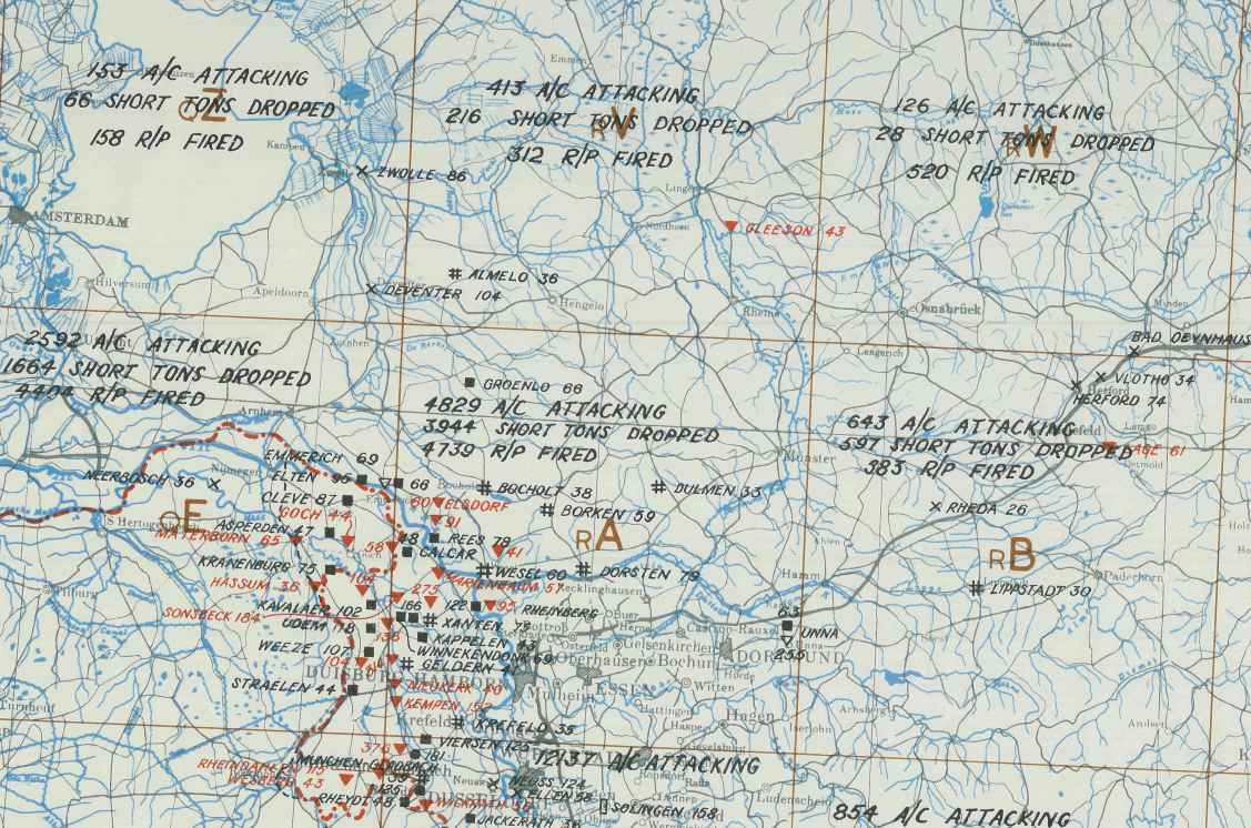
In February 1945, Allied tactical air forces intensified operations across Western Europe in direct support of advancing ground armies. This map, titled “Attacks of 25 Tons and Over by Allied Tactical Air Forces During February 1945,”documents significant strike concentrations across Germany and occupied territories during the final months of the war.
Historical Context
By February 1945, Allied forces were pressing toward the Rhine while Soviet forces advanced from the east. Tactical air power focused on rail junctions, troop concentrations, bridges, supply depots, and transportation networks to isolate German forces and disrupt reinforcement efforts. These coordinated strikes played a critical role in weakening enemy defenses ahead of the final Allied offensives into the heart of Germany.
The Map’s Features
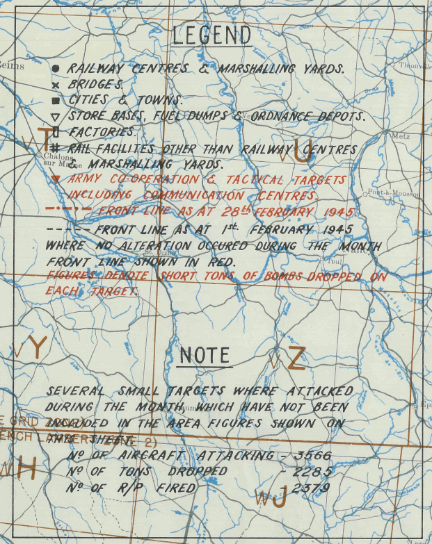
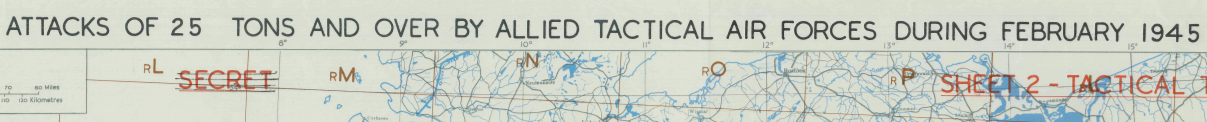
This detailed operational map records bombing attacks of 25 tons or more, stretching as far northwest as Amsterdam and as far southeast as the Nuremberg–Munich region. The 1:1,250,000 scale provides a broad operational overview while clearly marking key transportation and industrial nodes targeted by Allied tactical aircraft. Originally classified “SECRET,” the map reflects the systematic coordination of air-ground operations in the closing phase of the European war.
Historical Significance
The sustained tactical air campaign of early 1945 accelerated the collapse of German defensive capability. By severing rail lines and disrupting logistics, Allied air forces ensured that ground advances faced increasingly fragmented resistance, contributing directly to final victory in May 1945.
Museum-Quality Reproduction
This is a high-quality reproduction of the original 1945 tactical operations map, professionally printed on archival Hahnemühle paper using the Giclée printing process to preserve clarity, fine linework, and historical character.
Perfect For:
• World War II aviation and tactical air power enthusiasts
• Military historians and researchers
• Veterans and active-duty service members
• Strategic studies professionals
• Offices, studies, and history-focused spaces
Specifications:
• Campaign: Western European Tactical Air Campaign
• Date: February 1945
• Created/Published: 1945
• Scale: 1:1,250,000
• Product Type: High-Quality Reproduction Print
• Battle Result: Allied Victory
Dimensions (Width x Height): 27.3 x 19.8
Each map is printed using the finest materials and methods. Your map will be handled with white gloves from start to finish. We use the Giclée printing method on Hahnemühle paper, producing a clear, extremely detailed, durable map perfect for proud display in your home or office.
Digital watermark does not appear on your purchased map.
Choose options
