

Ardennes Counteroffensive (Battle of the Bulge) with Topography Battle Map
Ardennes Counteroffensive (Battle of the Bulge) – Topographic Battle Map
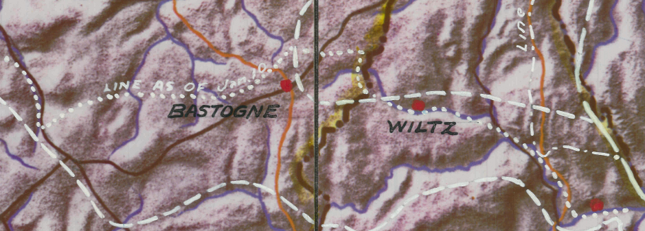
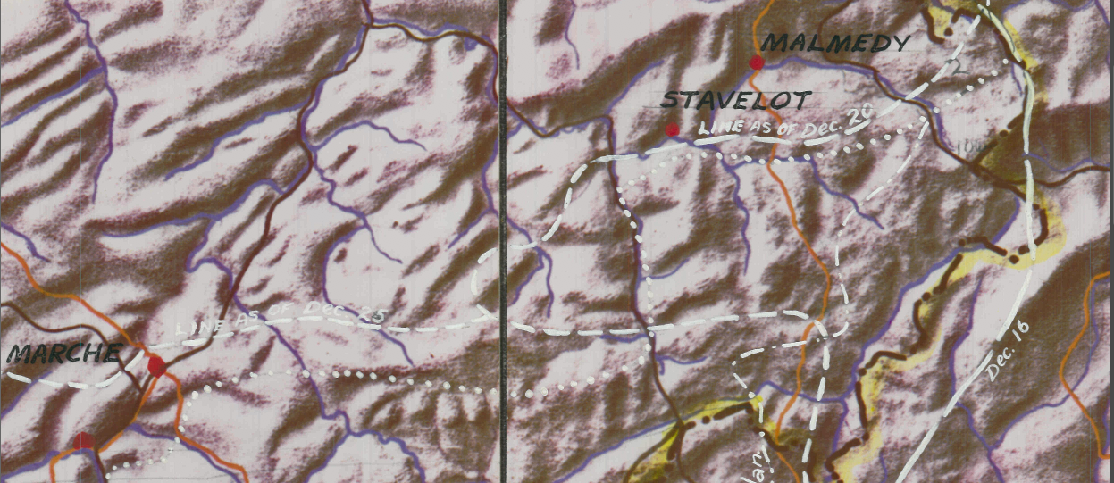
The Ardennes Counteroffensive, fought from December 1944 to January 1945, was Germany’s final major offensive in the West during World War II. Known as the Battle of the Bulge, the operation aimed to drive through the Ardennes, cross the Meuse River, seize Antwerp, and split Allied forces. Early German gains created a deep salient in Allied lines, but determined resistance and rapid counterattacks ultimately halted the advance. By late January 1945, German forces had been pushed back to their original positions.
Historical Context
Launched on 16 December 1944 under the codename “Wacht am Rhein,” the offensive sought to fracture the Allied coalition and force a negotiated settlement in the West. Instead, the battle became one of the largest and bloodiest engagements fought by American forces in World War II. The failure of the offensive accelerated Germany’s collapse in the months that followed.
The Map’s Features
This highly detailed topographic map emphasizes the rugged terrain of the Ardennes—dense forests, river valleys, ridgelines, and limited road networks that shaped the course of the battle. Elevation contours and terrain features provide critical insight into why certain advances stalled and how defensive positions were established. The map offers a geographic understanding of the battlefield beyond simple front-line markings.
Historical Significance
Terrain played a decisive role in the Ardennes campaign. Winter weather, narrow roads, and heavily forested high ground influenced movement, supply, and combat effectiveness. This map highlights the environmental realities that commanders on both sides had to navigate during one of the war’s most dramatic offensives.
Museum-Quality Reproduction
This is a high-quality reproduction of the original wartime map, professionally printed on archival Hahnemühle paper using the Giclée printing process to preserve fine detail and historical clarity for long-term display.
Perfect For:
• World War II history enthusiasts
• Military terrain and operations collectors
• Veterans and active-duty service members
• Offices, studies, and history-focused spaces
• Gifts honoring the European Theater
Specifications:
• Battle: Ardennes Counteroffensive (Battle of the Bulge)
• Date of Engagement: December 1944 – January 1945
• Battle Result: Allied Victory
• Created/Published: Unknown (most likely 1945)
• Product Type: High-Quality Reproduction Print
Dimensions (Width x Height): 17.1 x 14.2
Each map is printed using the finest materials and methods. Your map will be handled with white gloves from start to finish. We use the Giclée printing method on Hahnemühle paper, producing a clear, extremely detailed, durable map perfect for proud display in your home or office.
Choose options
