Ann Arbor, Michigan – 1880 Panoramic View Featuring the University of Michigan
Ann Arbor, Michigan – 1880 Panoramic View Featuring the University of Michigan
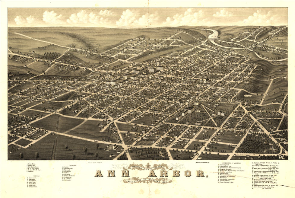
Step back into late 19th-century Michigan with this beautifully detailed 1880 bird’s-eye view of Ann Arbor. Created by A. Ruger and J. J. Stoner and published in Madison, Wisconsin, this panoramic map captures Ann Arbor at a time of rapid growth, academic prestige, and expanding civic identity.
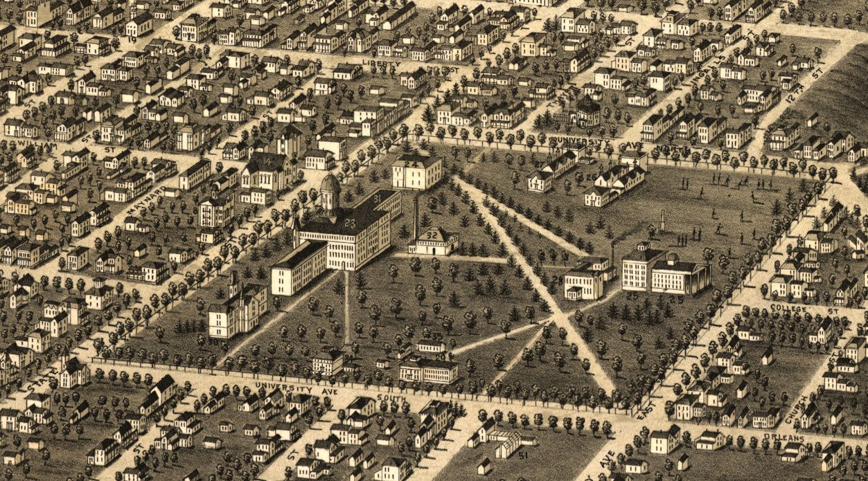
Historical Context By 1880, Ann Arbor was already firmly established as the home of the University of Michigan, which had become one of the nation’s leading institutions of higher education. The city’s grid of streets, residential neighborhoods, rail connections, and university buildings reflect a thriving Midwestern community shaped by education, commerce, and regional development.
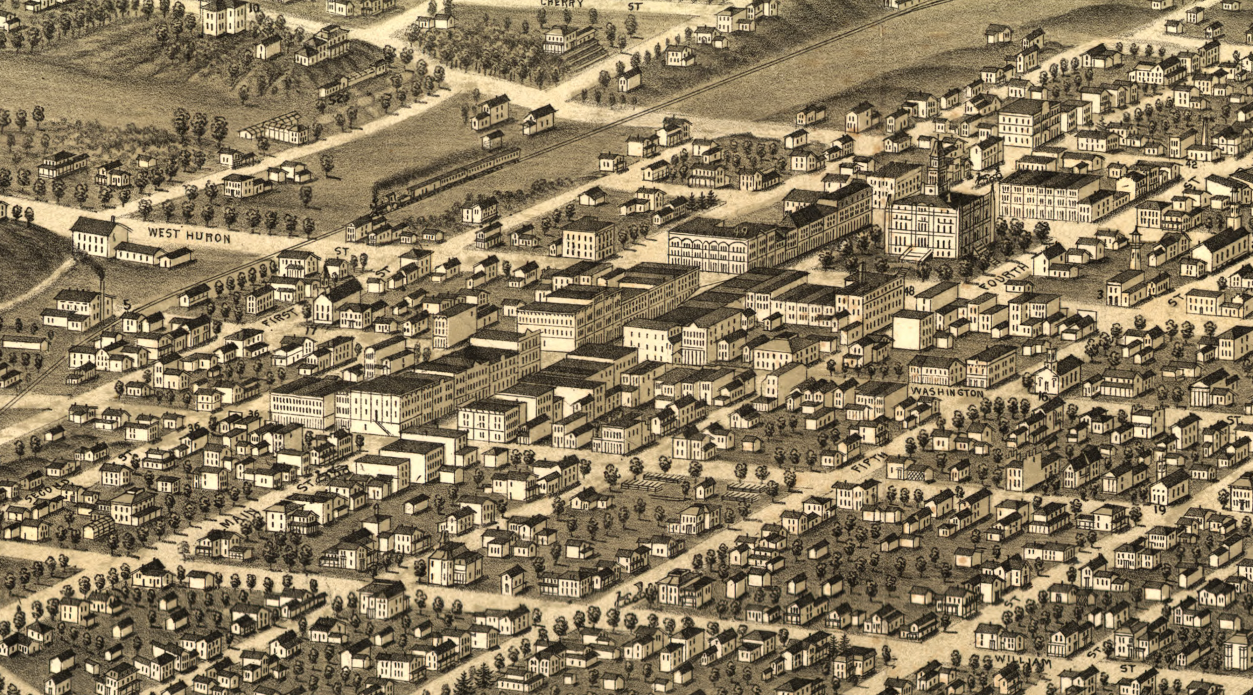
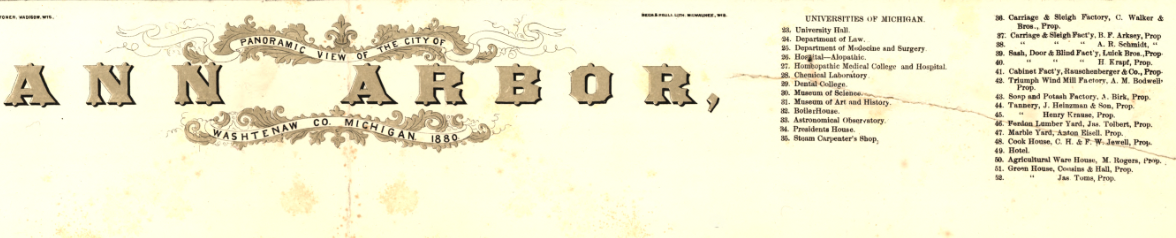
The Map’s Features This panoramic “bird’s-eye” view presents Ann Arbor in sweeping perspective, showing streets, homes, churches, commercial blocks, rail lines, and prominent university buildings. Though not drawn to scale, the map is indexed for points of interest, allowing viewers to identify key landmarks and institutions. The elevated vantage point provides a vivid, almost cinematic look at the city as it appeared in 1880.
Historical Significance Panoramic city views were both works of art and civic statements—celebrating prosperity, infrastructure, and ambition. This 1880 view preserves a visual record of Ann Arbor during a transformative era, making it both a historical document and a striking decorative piece.
Museum-Quality Reproduction This is a high-quality reproduction of the original 1880 panoramic map, professionally printed on archival Hahnemühle paper using the Giclée printing process to preserve fine line work, tonal depth, and period character for long-term display.
Perfect For:
• University of Michigan alumni and faculty
• Ann Arbor residents and Michigan natives
• Collectors of 19th-century panoramic maps
• Offices, studies, and academic spaces
• Unique gifts celebrating local heritage
Specifications:
• Original Publication: 1880
• Mapmakers: A. Ruger; J. J. Stoner
• Publisher: J. J. Stoner, Madison, Wisconsin
• Style: Bird’s-eye panoramic city view
• Product Type: High-Quality Reproduction Print
Dimensions (Width x Height): 28 x 18.8
Each map is printed using the finest materials and methods. Your map will be handled with white gloves from start to finish. We use the Giclée printing method on Hahnemühle paper, which produces a clear, extremely detailed, durable map perfect for proud display in your home or office.
Choose options
