

Air War on the Western Front in 1918 Chart
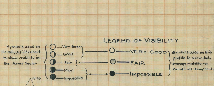
3 charts showing numbers of enemy (Central Powers) aircraft seen on the fronts towards the end of the war. Also includes the quality of visibility for each day. Charts are titled:
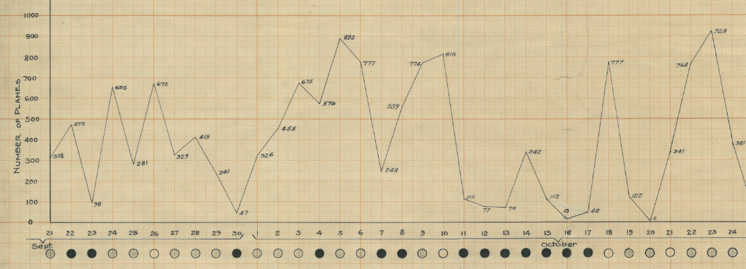
"Total Number of Enemy Aircraft Seen on American and French Fronts From Sept. 21st To Nov. 8th 1918"
"British and Belgian Fronts"
"Total"
Created/Published: 1918
Dimensions (Width x Height): 22.8x28.2
Our printing is archive-quality.
Each map is printed using the finest materials and methods. Your map will be handled with white gloves from start to finish. We use the Giclee printing method on the finest paper, which produces a clear, extremely detailed, durable map that is perfect to be proudly displayed in your home or office.
About our framing:
- Non-glare acrylic to reduce reflection
- Dry mount to ensure your map is smooth and without wrinkles
- 1.5 inch, 4-ply white mat to accentuate your map
- Black, walnut brown, and natural frame color options to match any room
- Wire mounting
- Please note that we cannot refund or return custom framed maps. We can replace a damaged frame. If your frame is damaged, please use the Contact Us or email customercare@battlearchives.com
Digital watermark does not appear on your purchased map
Choose options
