The Ground That Could Not Be Given: Gettysburg, July 2, 1863
The Ground That Could Not Be Given: Gettysburg, July 2, 1863
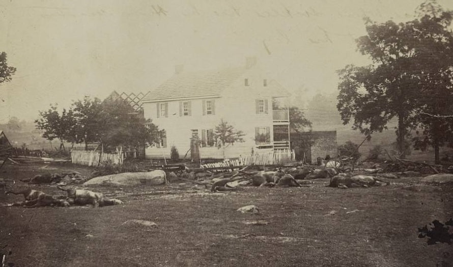
The fighting on July 1 had gone badly for the Union. Federal forces, badly outnumbered, had been driven back through the streets of Gettysburg and up onto Cemetery Hill as the sun went down. By the morning of July 2, General George Meade held an arc of high ground — Cemetery Ridge, Culp's Hill, and the rocky elevation at the southern end known as Little Round Top — and Robert E. Lee intended to take it from him.
The second day of Gettysburg would determine whether he could.
Longstreet's Assault
Lee's plan for July 2 called for a strike against the Union left flank, to be delivered by Lieutenant General James Longstreet's First Corps. The assault did not begin until late afternoon. When it came, it came hard.
What Confederate commanders did not know was that the Union III Corps, under Major General Daniel Sickles, had advanced nearly a mile forward from its assigned position on Cemetery Ridge into a salient anchored on the Peach Orchard, running through the Wheatfield and down into a boulder-strewn depression the men would call Devil's Den. The position could be struck from three sides.
The Confederate assault rolled over the Peach Orchard and drove into the Wheatfield in successive waves. The Wheatfield changed hands across the afternoon — Union brigades fed into the fight, broken, replaced, broken again. Sickles himself lost his leg to artillery fire near the Peach Orchard. The III Corps absorbed severe casualties before the fighting in that sector subsided.
Little Round Top
The most dangerous moment of the day came on the rocky hill at the Union's extreme left flank.
Little Round Top was, for a critical window, nearly unoccupied. If Confederate forces gained the summit, they held commanding ground over the entire Union line on Cemetery Ridge. General Gouverneur Warren, Meade's chief engineer, recognized the crisis from the hilltop and sent riders in every direction for troops.
Colonel Strong Vincent's brigade arrived first, racing up the southern slope. Vincent placed his regiments along the tree line and anchored the extreme left with the 20th Maine Infantry under Colonel Joshua Chamberlain. Chamberlain's position was the farthest point of the entire Army of the Potomac's line. His orders were explicit: hold at all costs.
The Confederate assault — Hood's division, attacking up the boulder-strewn slope — struck the 20th Maine repeatedly. Each was repulsed. When ammunition ran critically low and another advance began, Chamberlain ordered a bayonet charge downhill into the attacking line. Little Round Top held. Vincent was killed in the fighting. Chamberlain was wounded. The hill did not fall.
The Map and the Man Who Drew It

This map of July 2 was drawn by Captain William H. Willcox, aide-de-camp to Major General John F. Reynolds — the commander killed on the morning of July 1, the day before the fighting this map documents. Willcox produced this record of the battle's second day in the immediate aftermath of the engagement, while positions were still known to the men who had held them.
It is a primary source in the fullest sense of the term. Not a reconstruction. Not a cartographer's interpretation assembled from after-action reports. A map produced by a trained staff officer who had been on that ground the day his general was killed, and who understood what these positions cost.
Every regiment, battery, and defensive position is marked across the Union and Confederate lines — Union in blue, Confederate in red. The Wheatfield, Devil's Den, Little Round Top, Cemetery Ridge, all documented at the moment they mattered.
What the Day Cost
By the time the fighting ended on July 2, the Union left had been badly damaged. But the high ground — Cemetery Ridge, Little Round Top — remained in Federal hands.
Lee had not broken the Union line. He would try again on July 3, with a massed infantry assault across open ground against the center of Cemetery Ridge. History would remember that attempt as Pickett's Charge.
Within five months, President Abraham Lincoln would stand on this ground and deliver 272 words attempting to account for what had happened here.
The Map at Battle Archives
The Gettysburg July 2, 1863 Battle Map — drawn by Captain Willcox, reproduced at archival quality on Hahnemühle paper using the giclée process — is available at Battle Archives. It is among the rare battlefield maps drawn by a staff officer present for the engagement it documents. For collectors of Civil War cartography, students of the battle, or anyone with a family connection to the units that fought on this ground, it is a primary source.
Written by Mike Bryant
Visit author's website