Fort Sumter, Charleston Harbor, South Carolina – April 12, 1861 Fortification Blueprint
Fort Sumter, Charleston Harbor, South Carolina – April 12, 1861 Fortification Blueprint
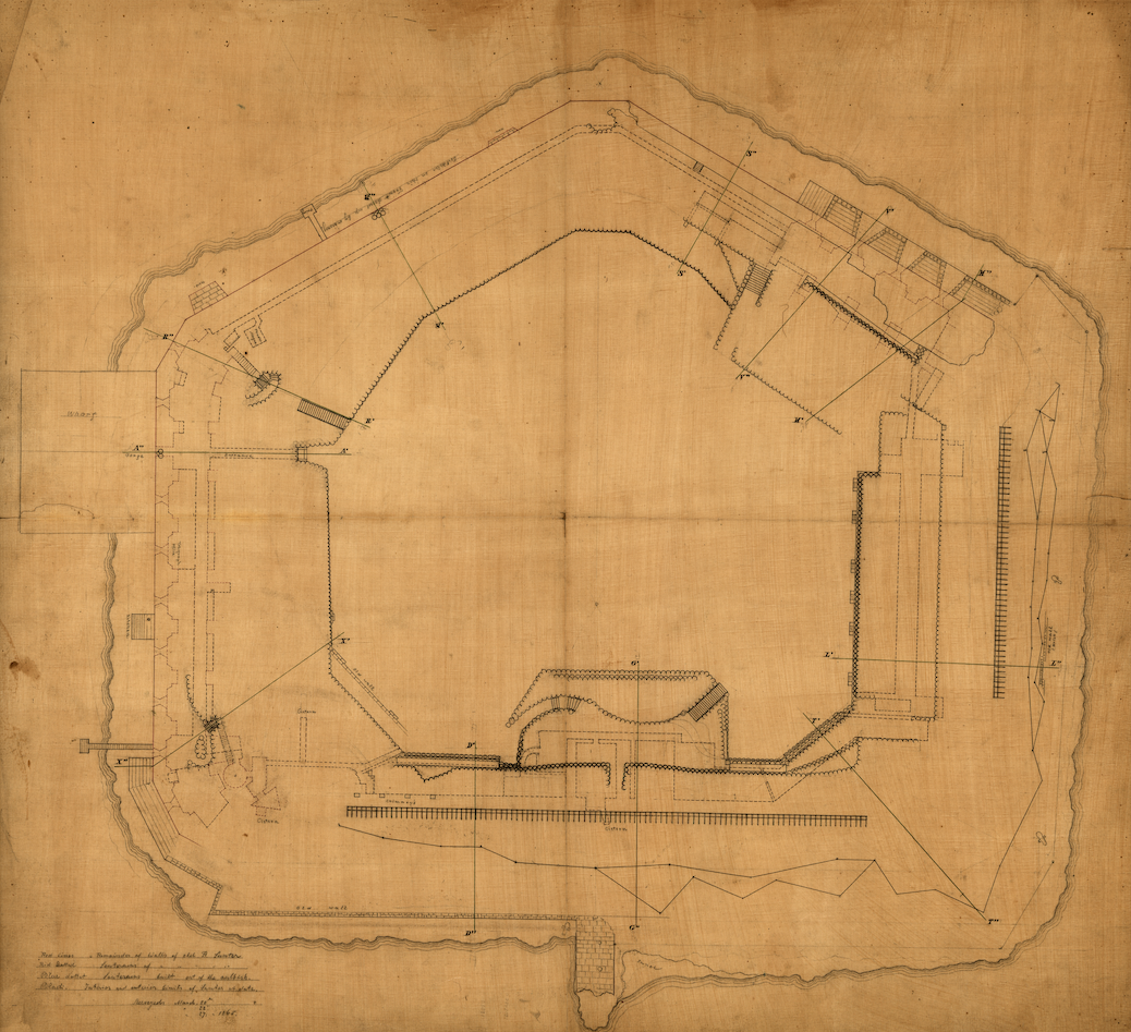
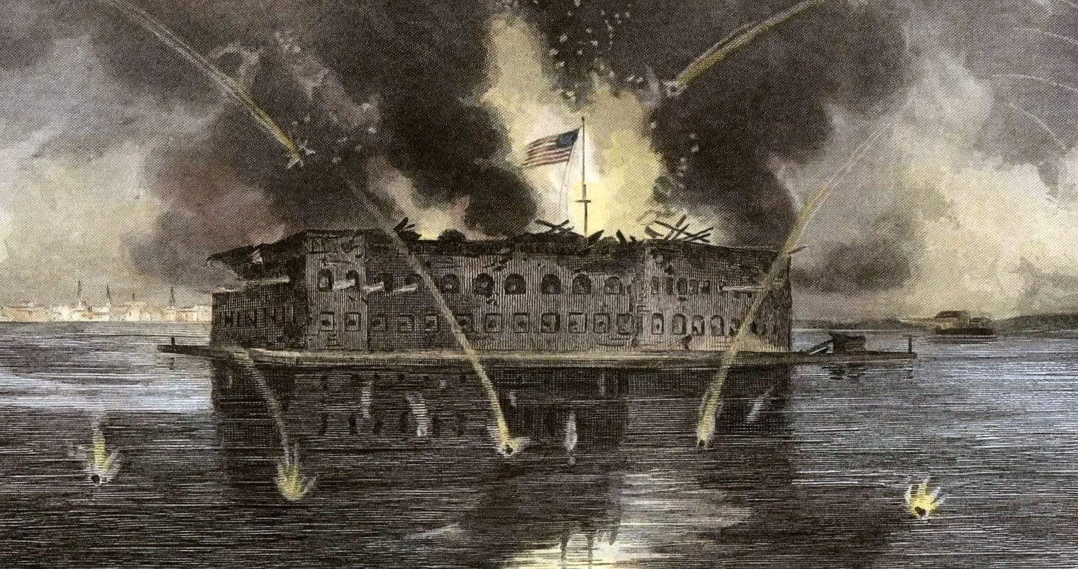
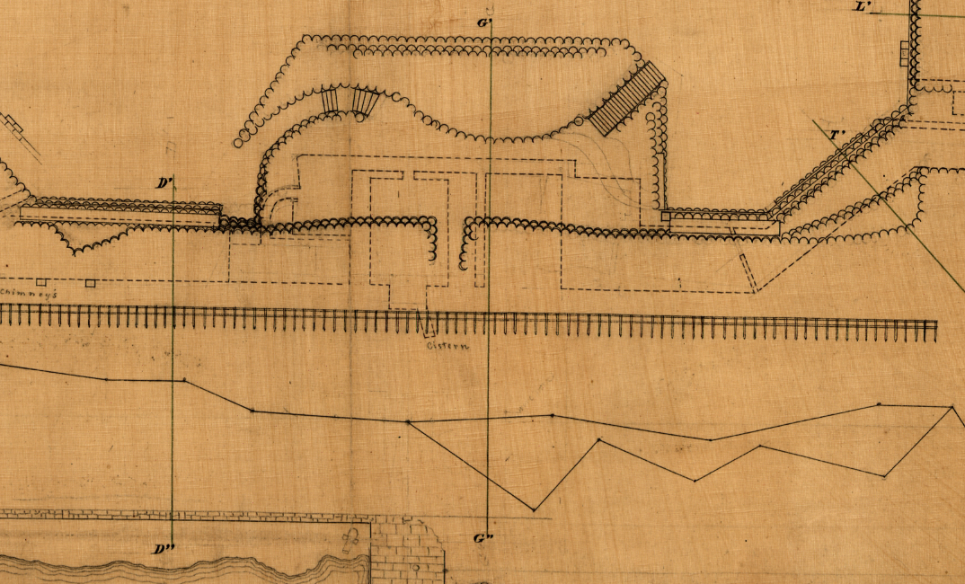
On the morning of April 12, 1861, Confederate batteries surrounding Charleston Harbor opened fire on Fort Sumter, a federal garrison occupying a man-made island at the harbor's mouth, igniting the American Civil War. After a 34-hour bombardment that left the fort's walls breached and its interior in flames, Union Major Robert Anderson lowered the garrison flag and surrendered—the opening act of the bloodiest conflict in American history. Fort Sumter would remain under Confederate control for nearly four years, enduring relentless Union siege operations before finally returning to federal hands in February 1865. This 1865 engineering blueprint captures the fort at the close of that four-year ordeal, documenting its battered structure in precise cartographic detail.
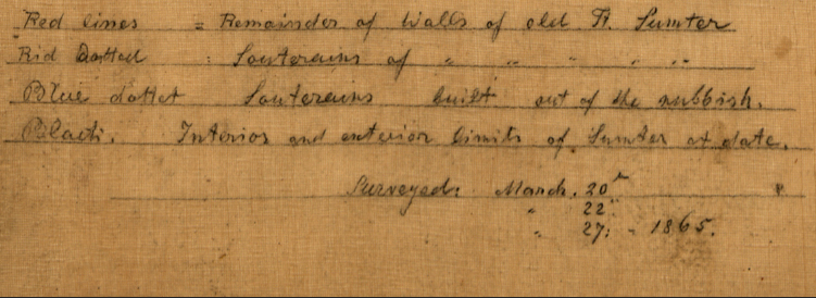
Historical Context Fort Sumter's strategic position at the entrance to Charleston Harbor made it a symbol of Federal authority in a state that had already declared secession. The Confederate bombardment in April 1861 transformed a political standoff into open warfare, compelling President Lincoln to call up 75,000 militia and forcing border states to choose sides. Confederate forces held and fortified the installation through two major Union siege campaigns—most notably the sustained naval and land bombardment of 1863, which reduced much of the fort's masonry to rubble while its garrison refused to yield. By the time this blueprint was drafted in 1865, Fort Sumter had become both a military ruin and a Confederate emblem, its very deterioration proof of the garrison's defiance against years of Federal attrition. The notes inscribed in the lower left corner reference the fort's condition at the time of its return to Union hands, making this document a firsthand accounting of the structure at war's end.
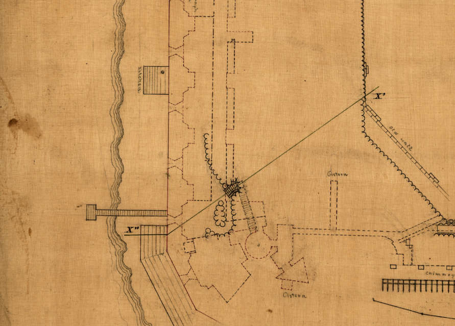
The Map's Features This hand-drawn engineering sketch presents a detailed plan view of Fort Sumter's pentagonal fortification, rendering the full perimeter of the man-made island alongside the fort's surviving defensive works. The drawing delineates the outer scarp walls, interior traverse structures, gun emplacements along the bastions, and the central parade ground, with lettered reference points marking key positions throughout the work. The upper right quadrant reveals intact barracks and casemate structures, while the surrounding wall lines—marked with jagged notation—indicate sections damaged or destroyed during prolonged bombardment. Handwritten field annotations in the lower left margin, dated 1865, record the condition of the walls and interior features, providing the primary documentation that defines this blueprint as a post-siege assessment rather than a pre-war construction plan.
Historical Significance Fort Sumter occupies an irreplaceable position in American military history as the site where the Civil War began and where Confederate resistance in the Deep South symbolically ended. The fort's four-year defense under Confederate command—surviving sustained naval bombardment, amphibious assault attempts, and the eventual collapse of Confederate forces throughout the Carolinas—stands as a testament to the entrenchment of both sides in a conflict that would claim over 600,000 lives. This 1865 blueprint documents the physical consequence of that defiance: a fortification reduced to earthworks and rubble yet never abandoned under fire. For students of military engineering, Civil War history, and American political history, this document is a primary source of the first order.
Museum-Quality Reproduction This is a high-quality reproduction of the original historic map, professionally printed on archival Hahnemühle paper using the Giclée printing process to preserve fine cartographic detail, line clarity, and period authenticity for long-term display.
Perfect For:
- Civil War historians and collectors of primary source military documents
- Students of 19th-century fortification design and military engineering
- Veterans, military families, and those honoring the Union and Confederate heritage
- Offices, studies, libraries, and heritage display collections
- Gifts commemorating the opening chapter of the American Civil War
Specifications:
- Original Publication: 1865
- Style: Hand-drawn military fortification blueprint
- Battle/Conflict: Battle of Fort Sumter / Siege of Fort Sumter (American Civil War)
- Battle Result: Confederate Victory (1861 and 1863)
- Product Type: High-Quality Reproduction Print
Dimensions (Width x Height): 24.6 x 22.5
Each map is printed using the finest materials and methods. Your map will be handled with white gloves from start to finish. We use the Giclée printing method on Hahnemühle paper, which produces a clear, extremely detailed, durable map perfect for proud display in your home or office.
Choose options
