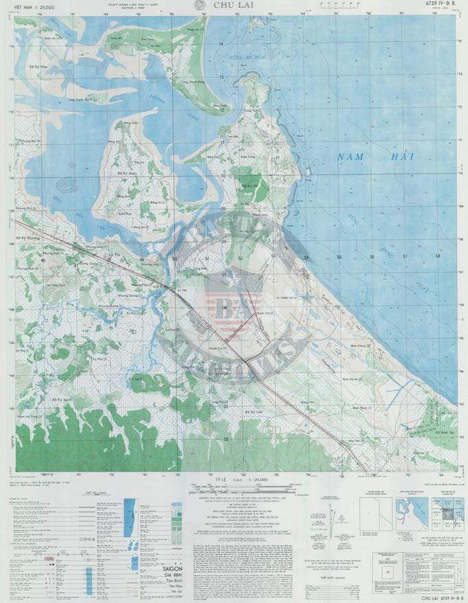


Chu Lai, Vietnam – 1969 Military Topographical Map
Chu Lai, Vietnam – 1969 Military Topographical Map
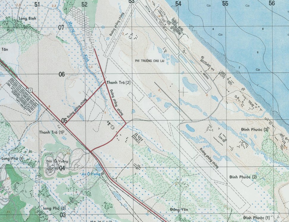
Few installations in the Vietnam War defined American resolve and adaptability like Chu Lai — a combat base carved from the coastal lowlands of Quang Nam Province that grew from a Marine expeditionary airfield into one of the largest military complexes in Southeast Asia. Established in May 1965 as the first Short Airfield for Tactical Support (SATS) in military history, Chu Lai served as a critical hub for air operations, ground combat, and logistical sustainment throughout the war. This 1969 military topographical map documents the terrain, infrastructure, and coastline of the Chu Lai operational area at the height of American involvement — a precise cartographic record of a landscape that shaped the tactics, patrols, and operations of two generations of American servicemen.
Historical Context Chu Lai's strategic position along the South China Sea coast made it both a logistical lifeline and a contested operational zone. When U.S. Marines landed in May 1965 and constructed the airfield in just 12 days, they demonstrated the ingenuity that would define American military engineering in Vietnam. The base was the staging ground for Operation Starlite in August 1965 — the first major conventional ground engagement of the war — in which Marines struck a Viet Cong regimental force operating in the surrounding villages and rice paddies. By 1969, operational control of Chu Lai had transitioned to the Army's Americal Division (23rd Infantry Division), which conducted sustained pacification and combat operations across the surrounding Quang Tin and Quang Nam provinces. The map was produced during this transition period, reflecting the full operational footprint of the base at the moment American strategy was shifting toward Vietnamization.
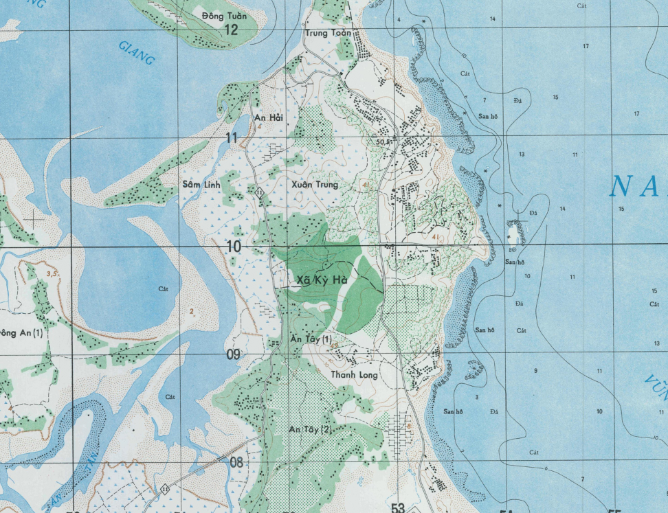
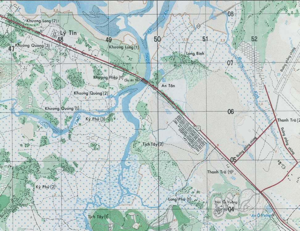
The Map's Features This detailed military topographical map presents the Chu Lai operational area at a scale of 1:25,000, capturing the coastal geography, river systems, rice paddies, and elevated terrain that defined movement and combat in this region of I Corps. The South China Sea coastline (labeled Nam Hải) anchors the eastern edge, while inland terrain features — including lowland plains, hamlets, and elevation contours — provide the operational context used by commanders planning patrols, fire support, and helicopter insertions. Road networks, waterways, and settlement patterns visible on the map reflect the dual nature of the Chu Lai area of operations: a densely populated coastal zone where conventional military operations and counterinsurgency overlapped daily.
Historical Significance Chu Lai occupies a foundational place in the history of American military operations in Vietnam. It was here that the Marine Corps demonstrated the SATS concept, here that the first large-scale American ground offensive of the war was launched, and here that the Americal Division conducted years of sustained operations across one of the war's most complex human and physical terrains. A topographical map of this area produced in 1969 is not merely a geographic document; it is an operational artifact that reflects the intelligence priorities, engineering capabilities, and tactical demands of the American military at a pivotal moment in the conflict. For veterans of I Corps, the Americal Division, or Marine units stationed at Chu Lai, this map is a direct cartographic record of the ground they walked.
Framing Options This map is available unframed or professionally framed and ready to hang. Choose from a classic Black Frame or a warm Walnut Brown Frame, each matted with 4-ply white archival mat board and finished with non-glare acrylic glazing for a clean, museum-style presentation. Framed orders are professionally assembled and shipped directly to your door. Please allow 3–4 weeks for delivery on framed orders.
Museum-Quality Reproduction This is a high-quality reproduction of the original 1969 military topographical map, professionally printed on archival Hahnemühle paper using the Giclée printing process to preserve fine cartographic detail, line clarity, and period authenticity for long-term display.
Perfect For:
- Vietnam War veterans and military families with service connections to I Corps or Chu Lai
- Military history collectors specializing in the Vietnam era
- Students and researchers of American counterinsurgency and Southeast Asian operations
- Home offices, libraries, and veteran memorial displays
- Gifts honoring those who served in Quang Nam and Quang Tin Provinces
Specifications:
- Original Publication: 1969
- Scale: 1:25,000
- Style: Military topographical operational map
- Conflict: Vietnam War
- Product Type: High-Quality Reproduction Print
Dimensions (Width x Height): 23 x 29.4
Each map is printed using the finest materials and methods. Your map will be handled with white gloves from start to finish. We use the Giclée printing method on Hahnemühle paper, which produces a clear, extremely detailed, durable map perfect for proud display in your home or office.
Choose options
