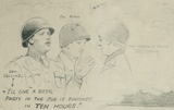
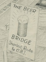
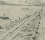


The Beer Bridge (Crossing the Rhine at Bonn) Drawing
$69
View of the southern suburb of Washington, DC during the war.
Created/Published: 1862
Dimensions (Width x Height): 26.1x19.6
Our printing is archive-quality.
Each map is printed using the finest materials and methods. Your map will be handled with white gloves from start to finish. We use the Giclee printing method on the finest paper, which produces a clear, extremely detailed, durable map that is perfect to be proudly displayed in your home or office.
Digital watermark does not appear on your purchased map.


