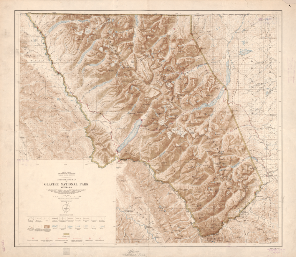
Glacier National Park, Montana – 1915 Administrative Map
Glacier National Park, Montana – 1915 Administrative Map
Explore the rugged grandeur of Glacier National Park through this detailed 1915 administrative and topographic map issued by the United States Department of the Interior. Created at a time when the National Park system was still in its formative years, this map presents Glacier not as a romantic panorama, but as a carefully surveyed and precisely documented landscape of peaks, valleys, lakes, and boundaries.
Historical Context
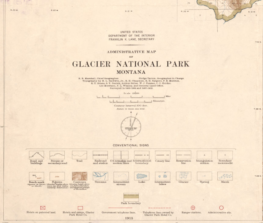
Published in 1915 and engraved and printed by the U.S. Geological Survey, this map reflects Glacier National Park just five years after its establishment in 1910. Based on surveys conducted between 1900–1904 and 1907–1912, it captures the park during the early era of federal conservation—when scientific mapping, infrastructure planning, and administrative oversight were shaping how Americans would experience and protect their national parks.
The Map’s Features
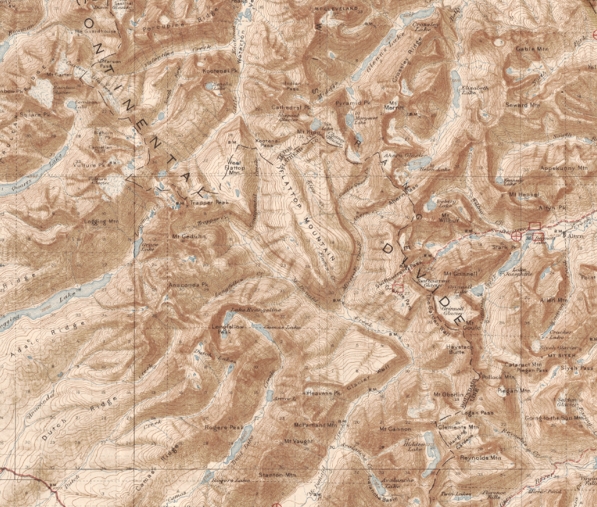
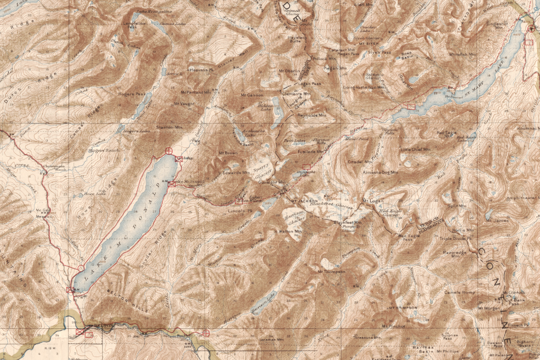
Relief is rendered with contour lines, shading, and spot heights, offering a remarkably clear depiction of the park’s dramatic topography. The map shows park boundaries, U.S. township and section lines, county lines, roads, highways, railroads, and major geographic features. A 100-foot contour interval provides detailed elevation information, and the datum is mean sea level. The inclusion of a township diagram underscores its administrative and survey-focused purpose.
Historical Significance
This map represents the federal government’s early efforts to formally define, manage, and preserve Glacier National Park. It stands as both a scientific document and a conservation milestone—an artifact from the period when America’s wild landscapes were being systematically protected for future generations.
Museum-Quality Reproduction
This is a high-quality reproduction of the original 1915 map, professionally printed on archival Hahnemühle paper using the Giclée printing process to preserve fine contour detail, subtle shading, and period coloration for long-term display.
Perfect For:
• National park enthusiasts and Glacier visitors
• Collectors of early U.S. Geological Survey maps
• Lovers of topographic and contour-based cartography
• Offices, studies, and mountain-inspired interiors
• Gifts celebrating America’s conservation legacy
Specifications:
• Original Publication: 1915
• Cartographer / Issuing Body: United States Department of the Interior
• Engraver / Printer: U.S. Geological Survey
• Map Type: Administrative and topographic map
• Product Type: High-Quality Reproduction Print
Dimensions (Width x Height): 25.8 x 22.4
Each map is printed using the finest materials and methods. Your map will be handled with white gloves from start to finish. We use the Giclée printing method on Hahnemühle paper, which produces a clear, extremely detailed, durable map perfect for proud display in your home or office.
Choose options
